This year was something of a milestone—it was the first year in about 16 that we didn’t do a pre-Christmas backpacking trip with the kids. It was bound to happen sometime soon, since the kids are all grown up now and doing their own things.
Instead, my husband and I had a post-Christmas hike all on our own. Let me say right now that I loved tramping with the kids, but doing the Christmas hike with just my husband was REALLY nice—just like old times … except that we’re a lot older. It was nice hiking at 54-year-old pace (instead of being dragged along by impatient 20-something kids), and we could also go places that appealed to us, without considering if the kids would enjoy it.
So we stayed relatively close to home, but took a route we hadn’t ever explored.
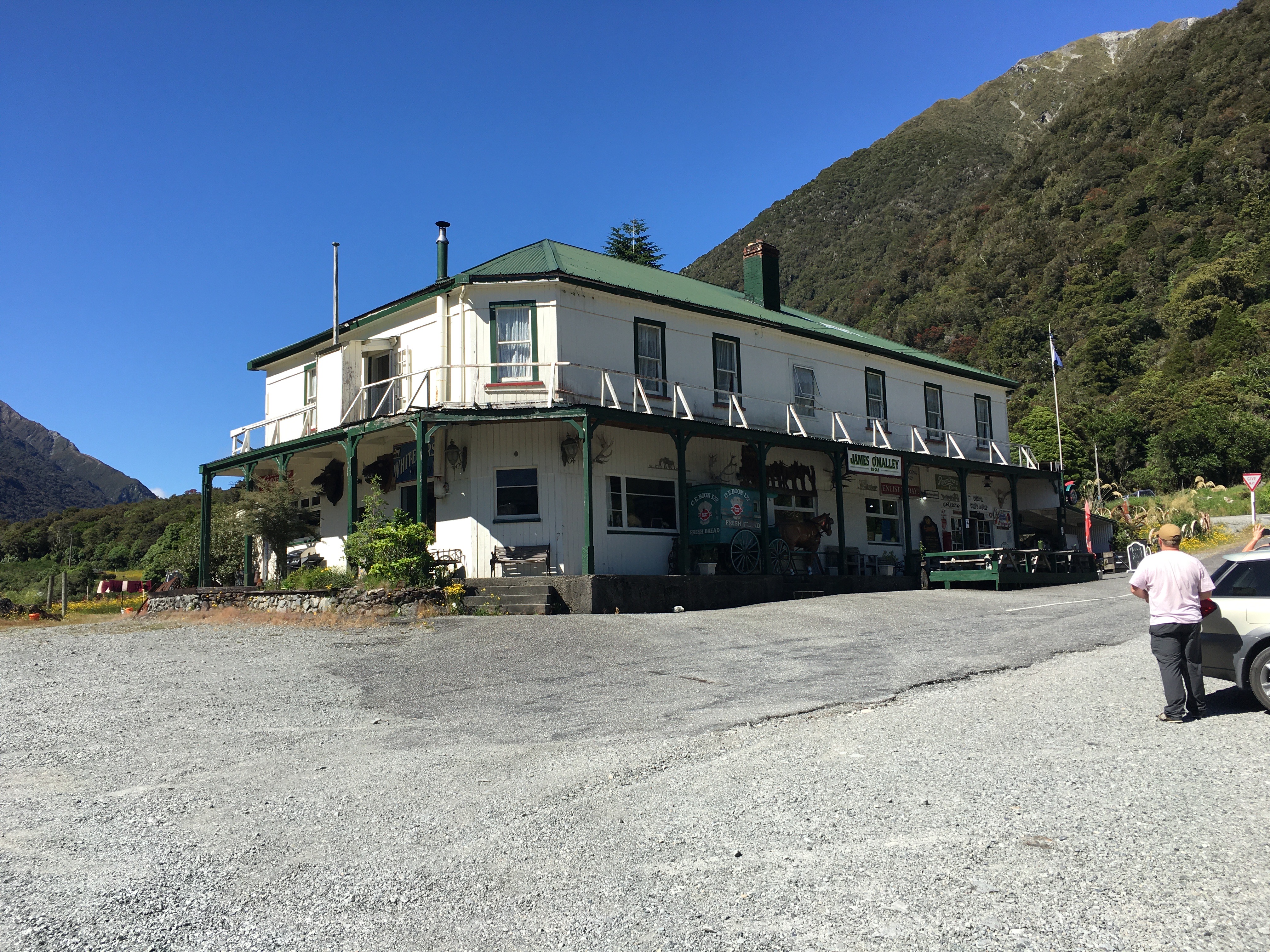
Day one began with dropping a car at the far end of our hike, near Kelly Creek. There was a bit of faffing around to charge the electric car (with the charger in Arthur’s Pass out of order, and the one in Otira busy), but it gave us an excuse to have a coffee at the Otira Hotel, which is an experience of its own.
Then we drove back to the Waimakariri River, parked car number two at Klondyke Corner, and hiked up the Waimakariri to Carrington Hut.
This hike is a bit of a slog and involves crossing the river a couple of times. In fact, the first river crossing comes within the first five minutes of hiking, which was fine—we were going to spend four and a half days walking rivers. There was no way we were going to have dry feet.
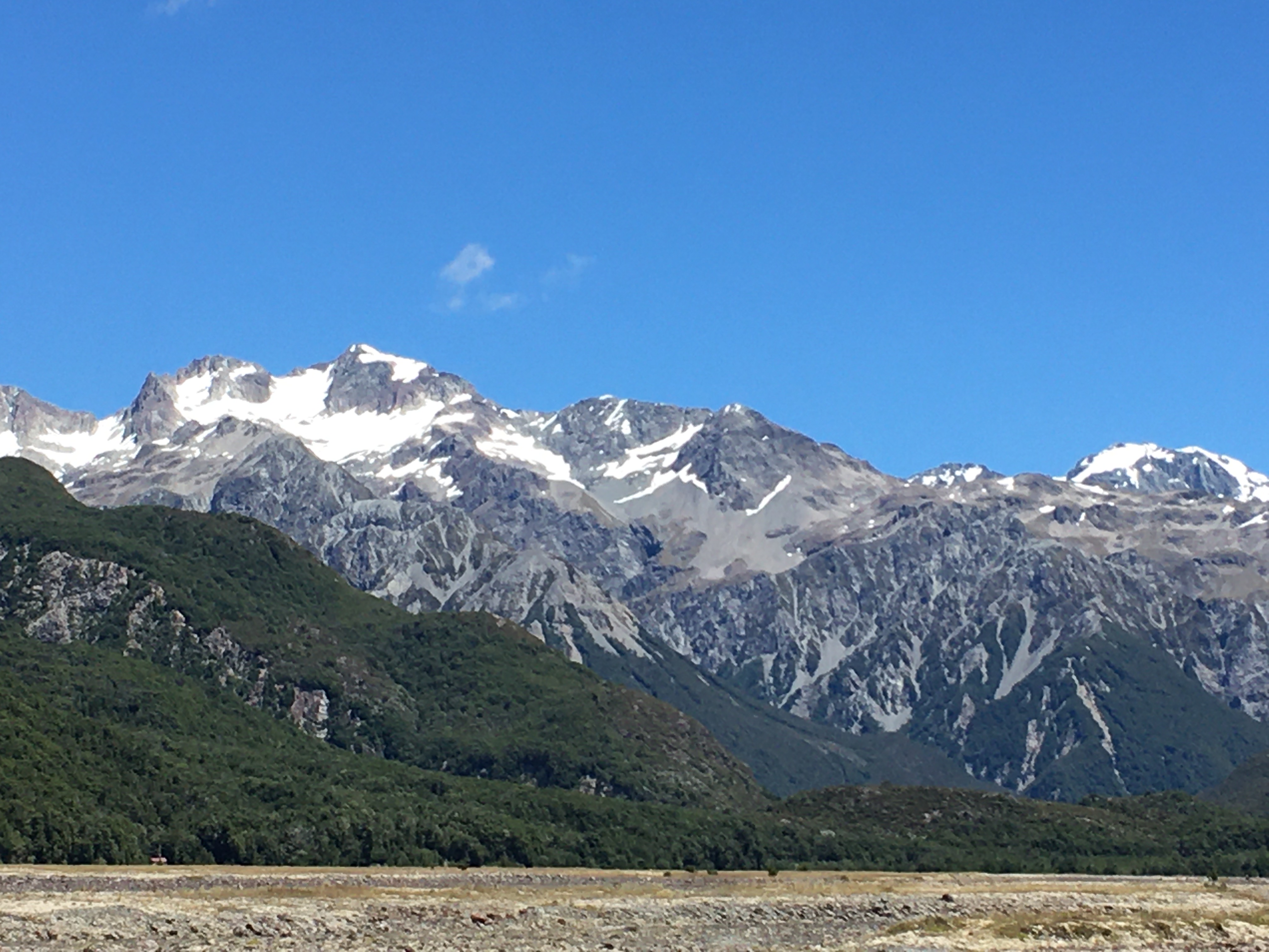
In spite of the dull nature of the actual hiking up to Carrington Hut, the scenery is fabulous, and only improves as you go further up the watershed. We were lucky to have a tern hunting the river alongside of us for a while, and we scared up a pair of banded dotterels, too.

After passing Anti Crow Hut, we left the riverbed to follow a track over a couple of roche moutonnée—rocky mounds left behind by glaciation. A series of tarns on the mounds give them a magical sort of quality, and the short break from river walking is nice.
The last time we were at Carrington Hut, it was incredibly crowded and unpleasant, so we carried a tent this time, just in case. But the 36-bunk hut housed only five of us that night, and we barely saw one another.
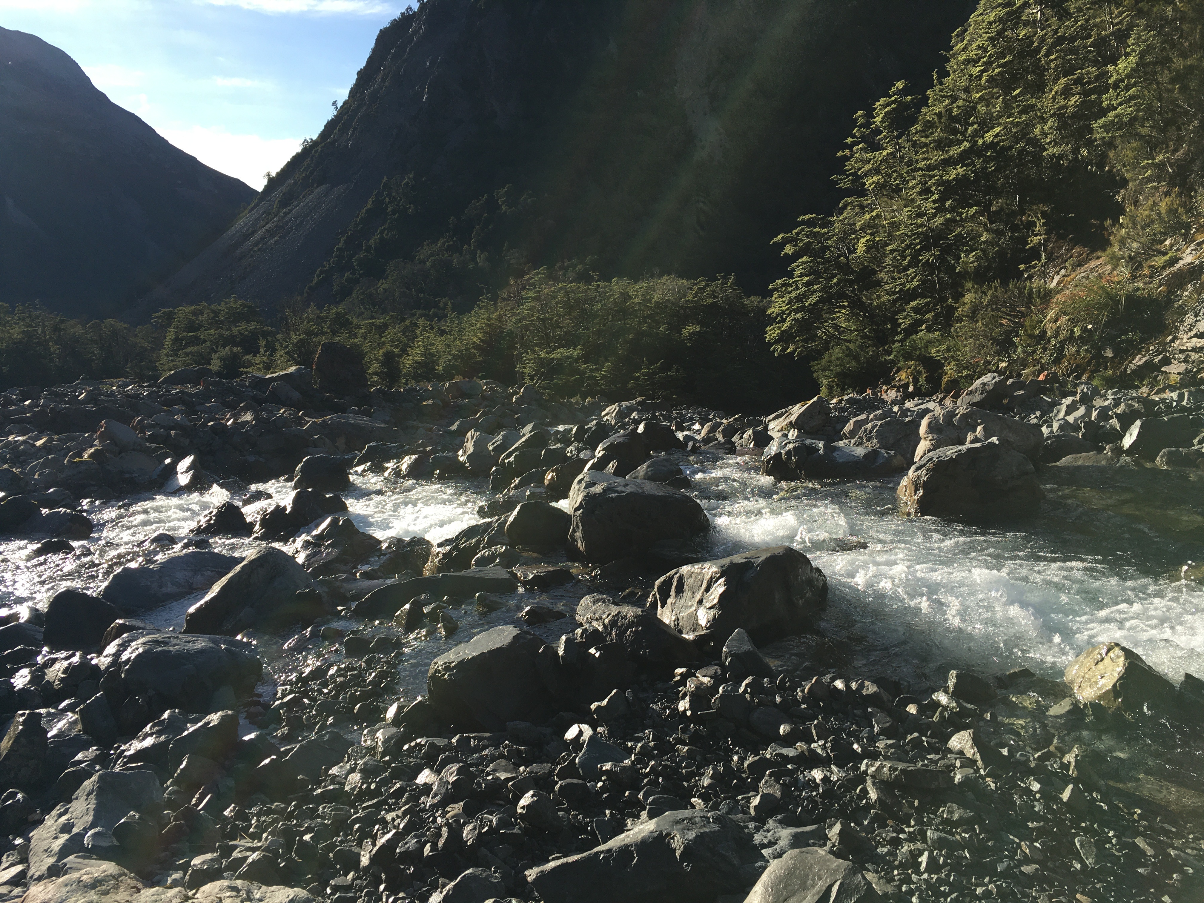
Day 2, we hiked over Harman Pass—up the Taipoiti River (click here for a video), then down Mary Creek. Again, the first act of the day was crossing a river, and then it was river crossings all day, back and forth across the Taipoiti as it rushed through a narrow valley which at times could be more properly called a gorge. It was another fabulous day, weather-wise, and the scenery was spectacular. So were the alpine plants. It seemed like EVERYTHING was in flower, and it was a slow hike up to the pass, because we were photographing all the way.

At the pass, we took a little jaunt up to see some tarns higher up, and then hung out for a while with a curious kea (click here for a video). Kea are an odd mix of highly endangered (there are 1,000-5,000 of them left), and incredibly pesky, thanks to their intelligence, curiosity and a beak shaped like a giant can opener (their peskiness is unfortunately part of the reason they’re endangered). The world’s only alpine parrot, it’s common to encounter them at elevation near Arthur’s Pass, but it never gets old.
Mary Creek was more of the same—river crossings, beautiful scenery, endangered birds. We spent some time watching a pair of whio (blue ducks) having a nap on a rock in the middle of the stream. There are only 3000 whio left and unfortunately the population is skewed strongly to males, because females are vulnerable to introduced predators when sitting on the nest. We were lucky enough to encounter two pairs on our trip.

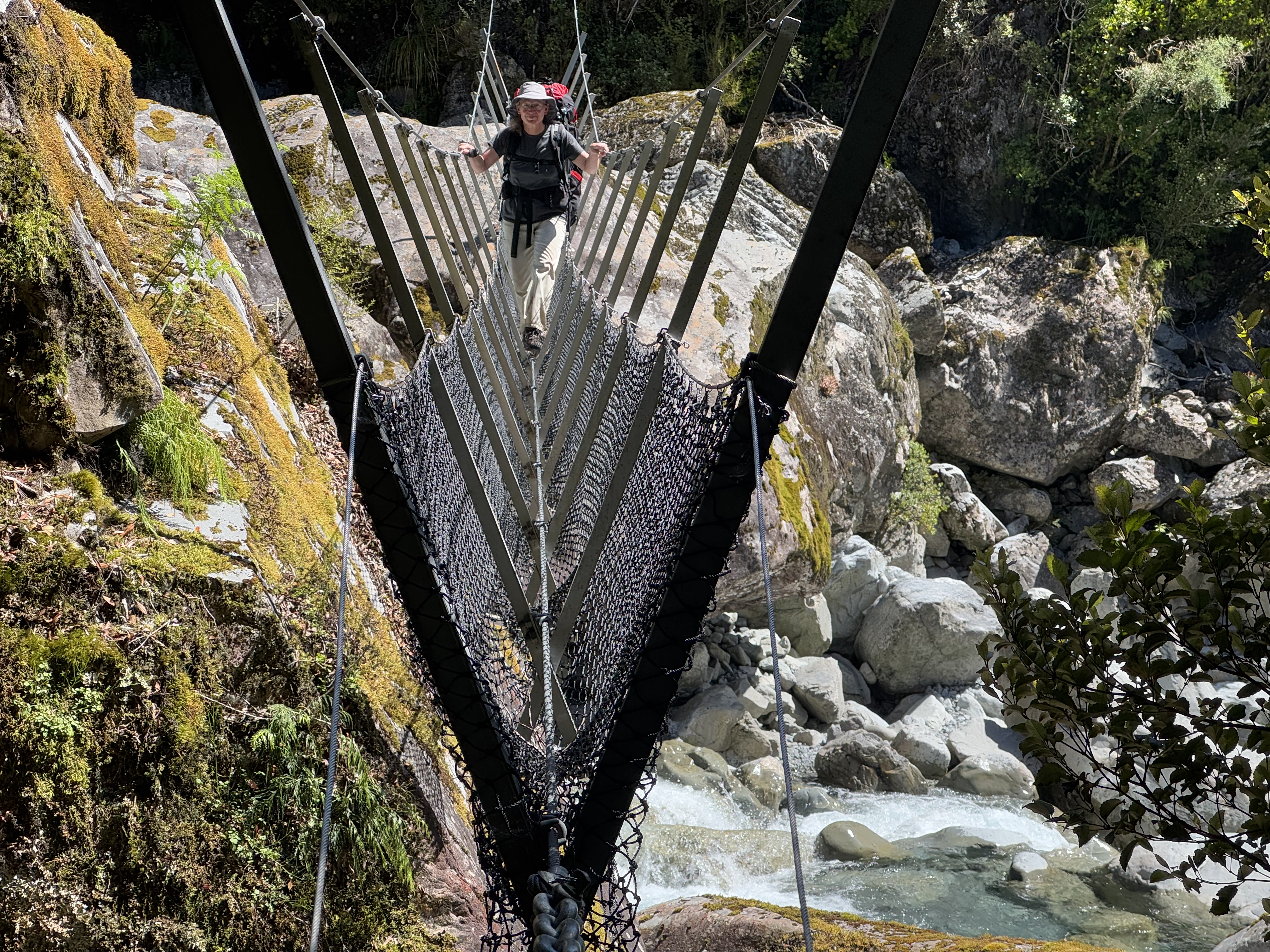
After a 3-wire bridge crossing at the bottom of Mary Creek, we arrived at Julia Hut. The hut is relatively small, and with another couple there already, we decided to tent. After setting up the tent and settling in, we had the rest of the sunny afternoon to explore. A natural hot spring was our destination. Only five minutes walk from the hut, next to the icy, swiftly flowing Julia Creek (click here for a video), the hot pool did not disappoint. It was initially too hot to sit in, and we had to redirect some river water into it to temper the heat.

After a sweaty hike, I have to say I wasn’t all that interested in sitting in a hot pool, but I took a dunk in the river first, and then the hot pool was pretty nice. You couldn’t fault the setting—two days hike from a road, on an absolutely stunning mountain stream in the bush. It beat Hanmer Springs by a mile!
There is clearly a lot of geothermal activity in the area—the smell of sulphur was prevalent all along Julia Creek—and I suspect if you fossicked around, you’d find more hot pools.
Day 3 was a lot of river walking (again), punctuated by a couple more three-wire bridges. We hiked down Julia Creek and the Taipo River to Dillon Hut. Well, we intended to stay at Dillon Hut, but when we arrived we were informed by a very cute four-year-old that there were ‘no more mattresses’ (Dillon hut is only a 2-hour hike from the road, and is clearly a great destination for a short family hike). So we moved on to Dillon Homestead Hut, just 500 metres down the track.
Dillon Homestead Hut is just that—an old homestead. Built of hand-hewn timber and clad in whatever the original owners could scrounge, it is quite the historical experience to spend the night there. It’s clearly beloved by local four-wheel drivers and dirt bikers, but is in sore need of some upkeep. Still, it was shelter when the skies opened up and dumped rain all night, and if it had been cold, there was a big open fireplace surrounded by three tatty, 1950s-era armchairs. And once you brushed the rat droppings off the sleeping platforms, tables and chairs, it had everything you needed to spend the night.
Fortunately the rats weren’t as active inside the hut as I had feared, and we spent a reasonably comfortable night (if a bit smelly) in the hut. In the morning, however, I trudged out to the long drop through soaking wet, waist-high grass. The loo is as old as the hut, and was stocked with three mouldy, rat-poo-festooned rolls of toilet paper. I didn’t stop to investigate the myriad spider webs (there may have been some interesting native spiders), but in retrospect I should have inspected my surroundings a bit more. Leaving the door open for light and ventilation, I dropped my pants to do my business.
A scuttling overhead was all the warning I got before a rat leapt out of the rafters and landed on my head. I may have sworn. But the four-letter word had barely left my lips before the rat was off again, leaping for the toilet seat and then the floor before racing off into the bush.
So, a warning to you—the Dillon Homestead Hut loo is guarded by an attack rat.
After that exciting start, the rest of Day four was a hard climb. From Dillon Homestead Hut, we followed Seven Mile Creek briefly to a track that climbs steeply through dense west coast forest up to the Kelly Range. It was dark and humid in the forest. At one point, the track passed through a narrow gorge that was almost tunnel-like. It felt like we were crawling uphill, and often it was literally true, as it took both hands and feet. Pīwakawaka kept flitting around us, taunting us with their darting flight and chittering voices—what was so difficult about this slope, they seemed to ask.
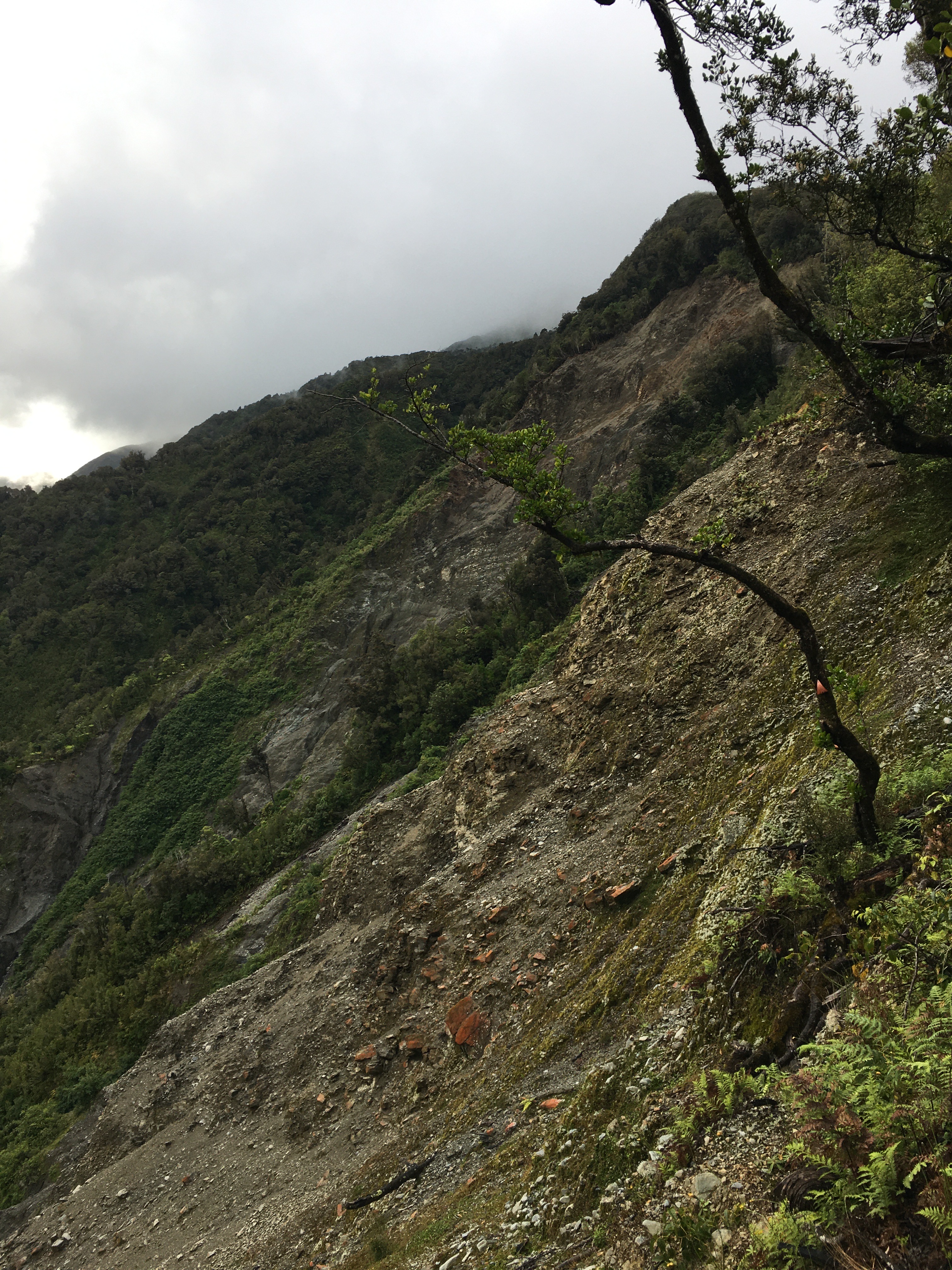
At one point, the track met a huge slip hundreds of metres across and hundreds of metres tall. A blaze remained on a lone tree suspended at the top of the slip. The rerouted track scrambled precariously around the top of the slip, and I breathed easier once we were past it.
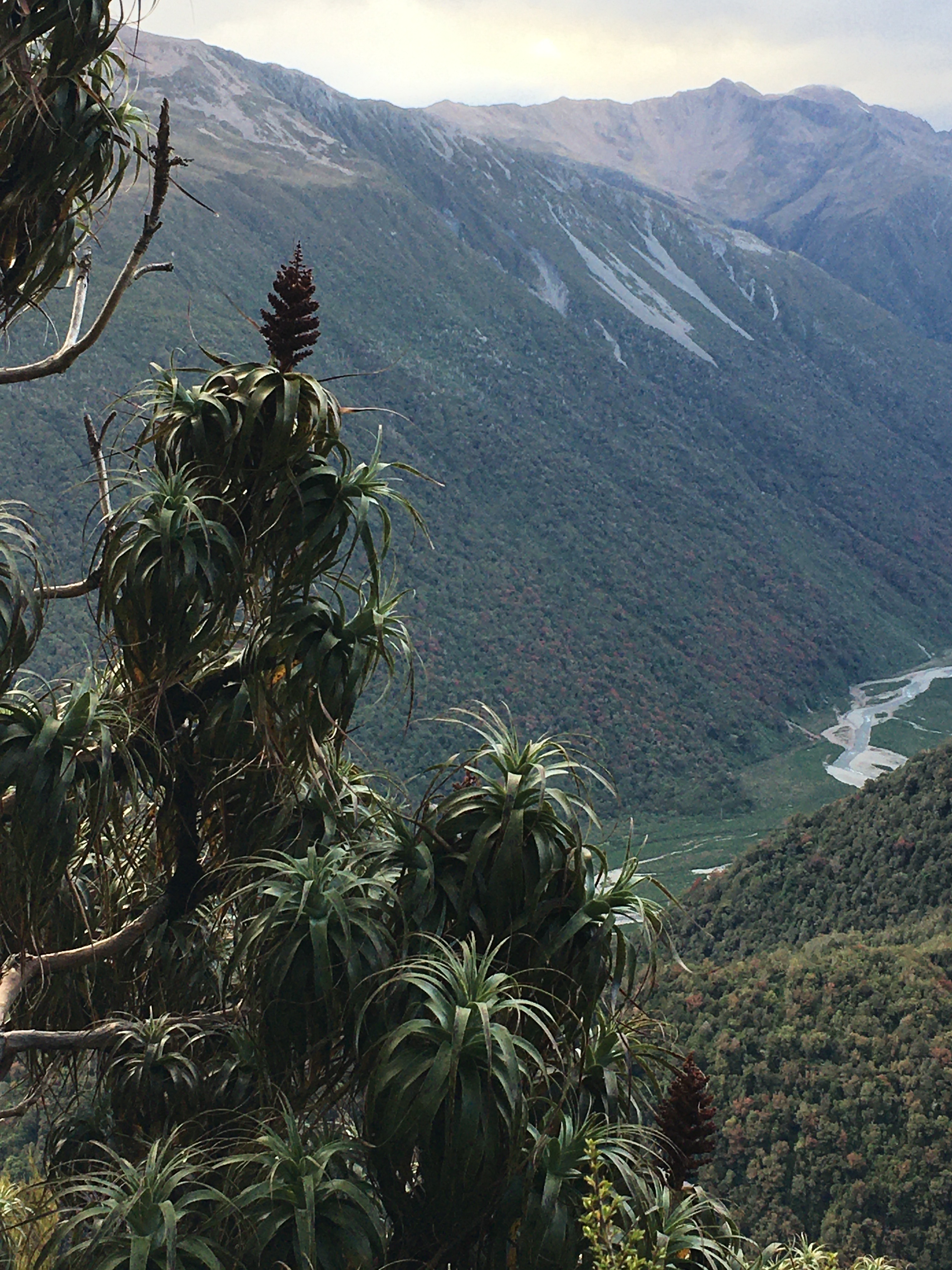
After 700 metres of elevation gain, we reached tree line and got a view back down to where we’d come from that morning—it was a long way down, and we still had more climbing to do.
The tops were dotted with tarns, and even where there wasn’t standing water, it was wet. We walked through fields of sundew plants, and took our breaks amid alpine orchids and daisies.

Clouds prevented us from having great views, but turned the views we did have into a dramatic, ever-changing landscape. By the time we’d reached the top of our climb—a thousand metres above Dillon Homestead Hut—the clouds were swirling around us.
A relatively short descent brought us to Caroll Hut just as the first raindrops began to fall. We had a late lunch of soup and peanut butter crackers as the wind picked up and the rain lashed the hut.
We shared Caroll Hut with a UK expat who lives in Wellington, a pair from Whanganui, and a fellow from Adelaide. It was a great mix, and we had a nice afternoon and evening chatting with them all. The best of hut life.
All night the wind howled, and I was thankful for the steel cables tethering the hut in place. Although the rain ended before dark, the wind continued through to morning, so it was a cold and windy start to Day 5. An early morning treat at the hut was a family of weka with fluffy chicks fossicking around the hut.
Day 5 was a short (hour and a half) jaunt out to the road from Caroll Hut. The ‘jaunt’ involved a good 800 metre elevation change, steeply downhill, but not bad going, with some nice views from time to time. And just when we thought we were done with wet boots, there was a stream crossing in the last 20 metres.
We were home by lunchtime, wet and tired, but having had an excellent five days. It was a fabulous way to spend the Christmas-New Year gap.
Discover more from Robinne Weiss
Subscribe to get the latest posts sent to your email.
