Last weekend, my husband and I spent a day on the Banks Peninsula doing three short walks we hadn’t done before.
Hay Reserve
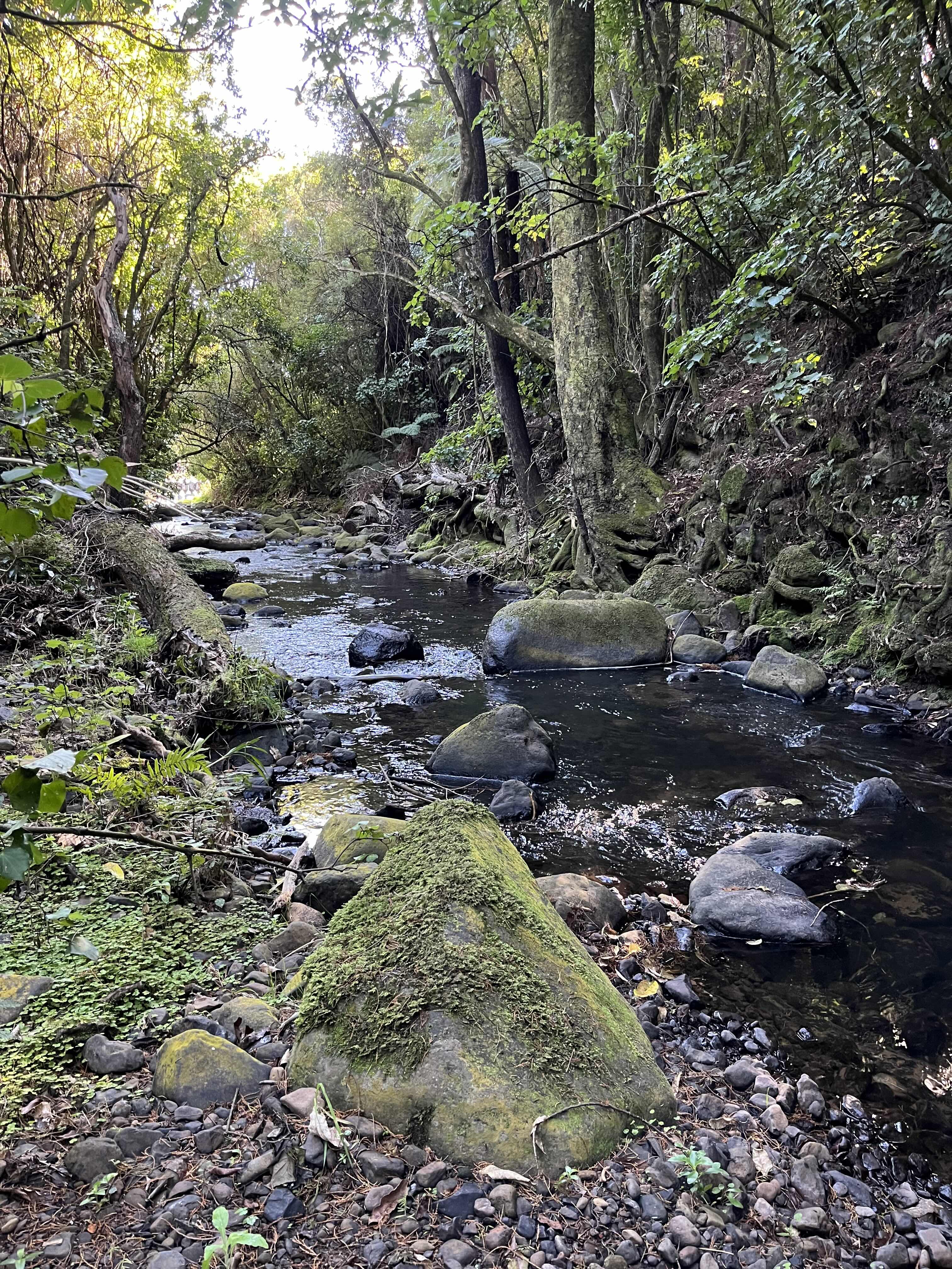
Our first stop was Hay Reserve in Pigeon Bay. This short, family-friendly track circles through lowland old growth podocarp forest. It’s a slice of what the whole peninsula would have been like before human colonisation. Huge kahikatea and tōtara, supplejack looping through the branches, cabbage trees and ferns—so dense at spots, I almost wanted a head torch despite the bright sky overhead. If you’re a fan of big trees, Hay Reserve is a fantastic stroll.
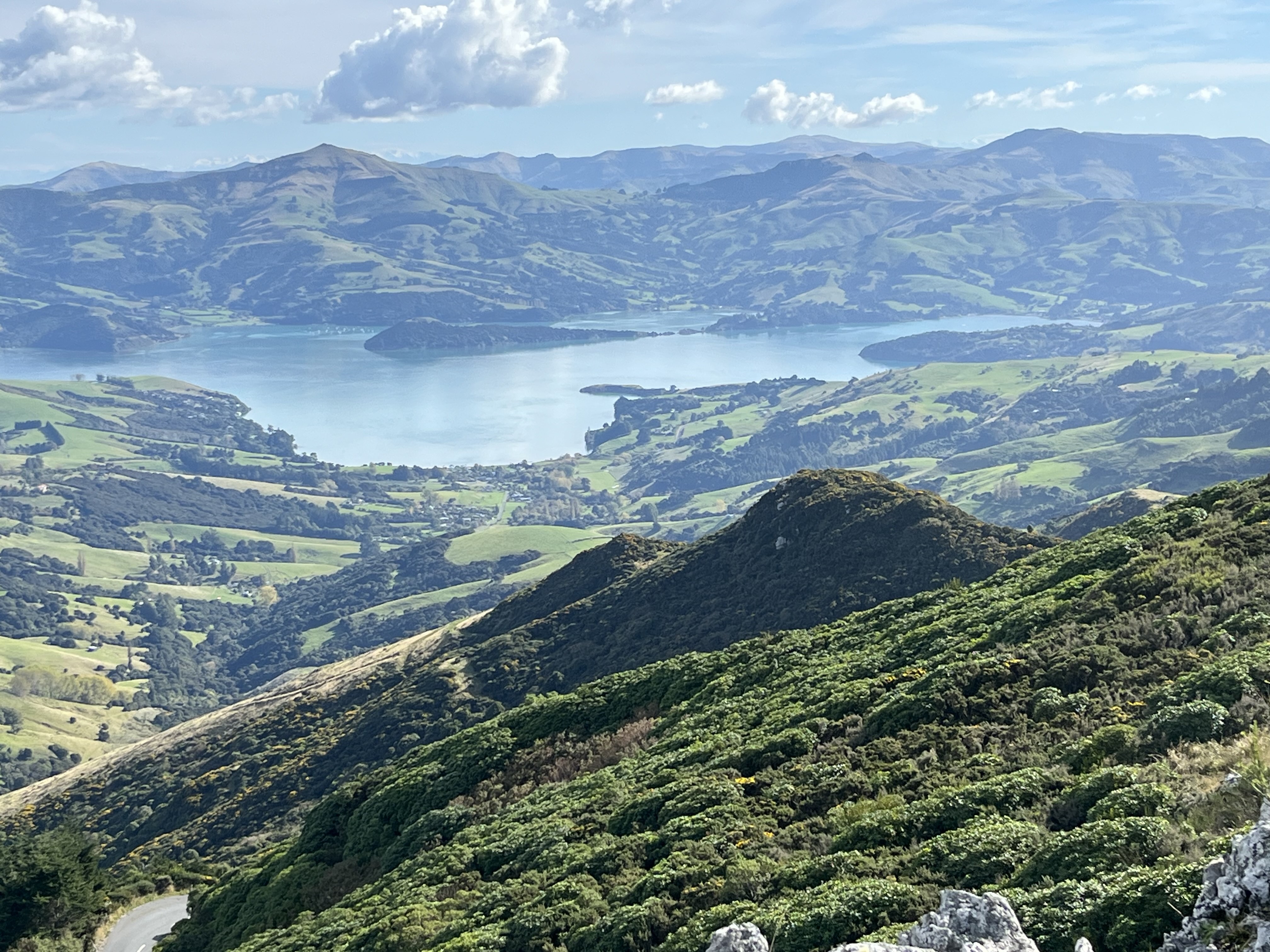
Our next stop was Ellangowan Scenic Reserve, on Hickory Bay Road. Though poorly signed, it’s not difficult to find the track. It follows a two-track to a rocky ridge, with a fabulous 360-degree view of the peninsula, then drops back down through a beautiful patch of bush that includes some very old, though dwarfed native trees. Lower down, massive red beeches punctuate the forest. Just 2.4 km long, the track has it all—forest, views, rock scrambling. Definitely worth a visit if you’re out that way.
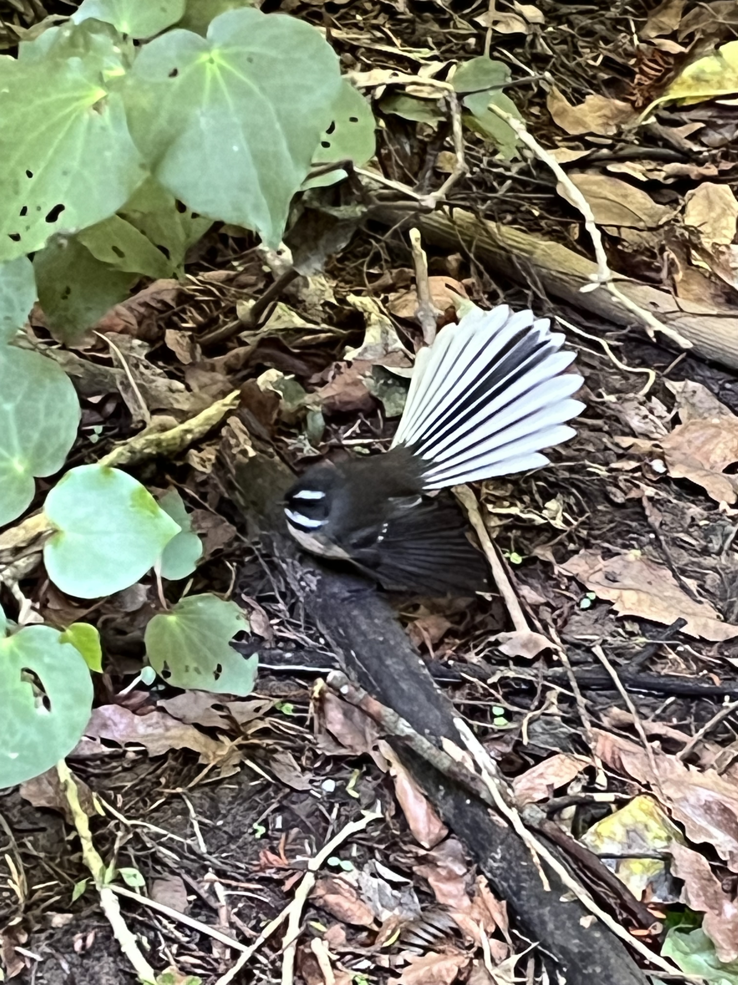
Pīwakawaka in Hay Reserve
Finally, we popped over to Akaroa, where we walked the Children’s Bay Walkway (with a detour to the creek waterfall). I can’t believe we’ve never done this walk (it would have been great when the kids were younger). The out-and-back, well-maintained track winds through a patchwork of farmland and forest. The creek waterfall was minimalist on the day we visited, but magical nonetheless. The really special thing about the walkway isn’t the landscape, though, but the fabulous sculptures along the way. No spoilers, but there are surprising creatures all the way to the end.
All three of these walks are relatively short and easy (though the Ellangowan Reserve track requires a bit of confidence on the ridge), and the three together made for a fun day, which naturally ended with a beer and chips in Akaroa.
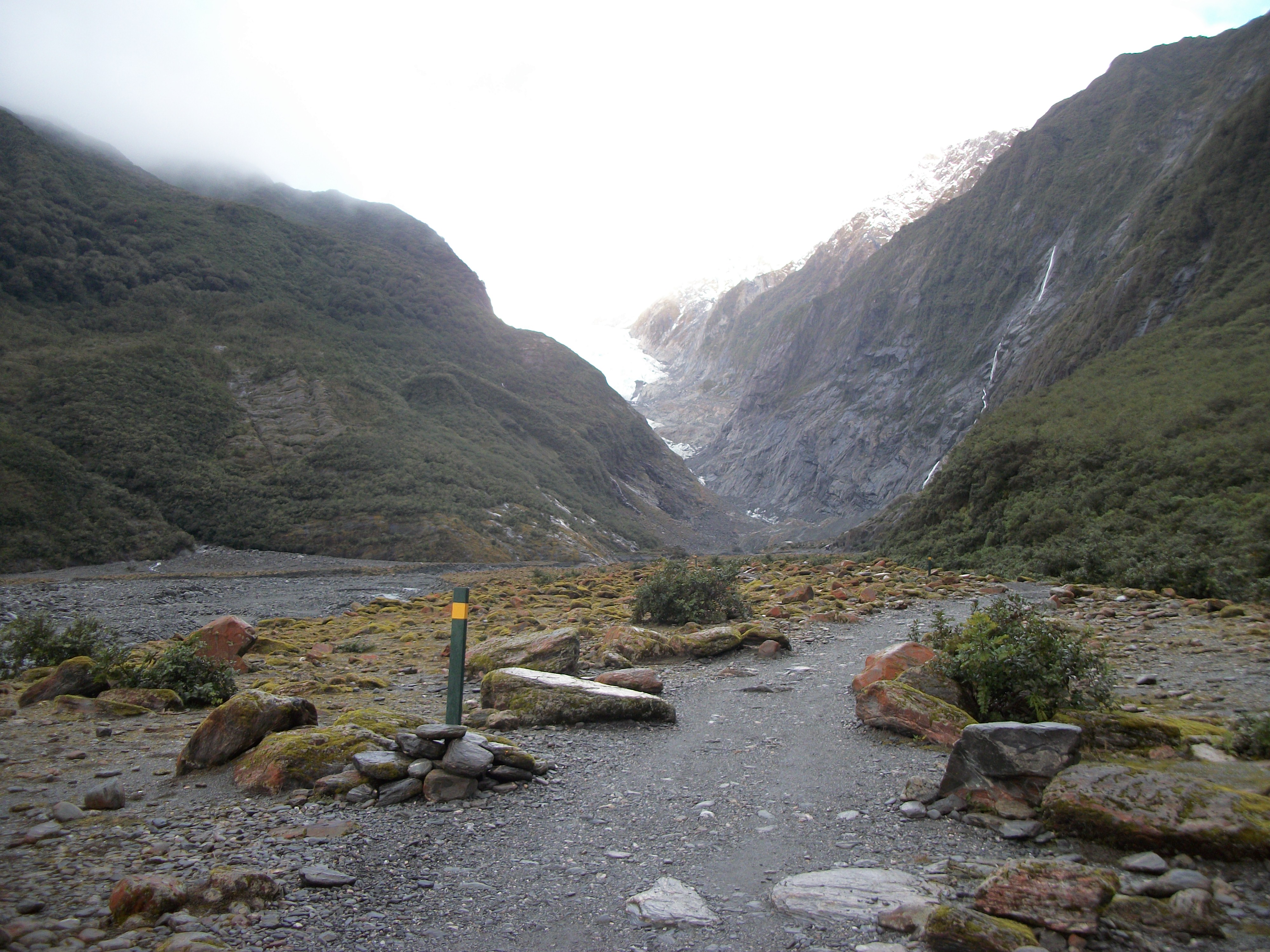
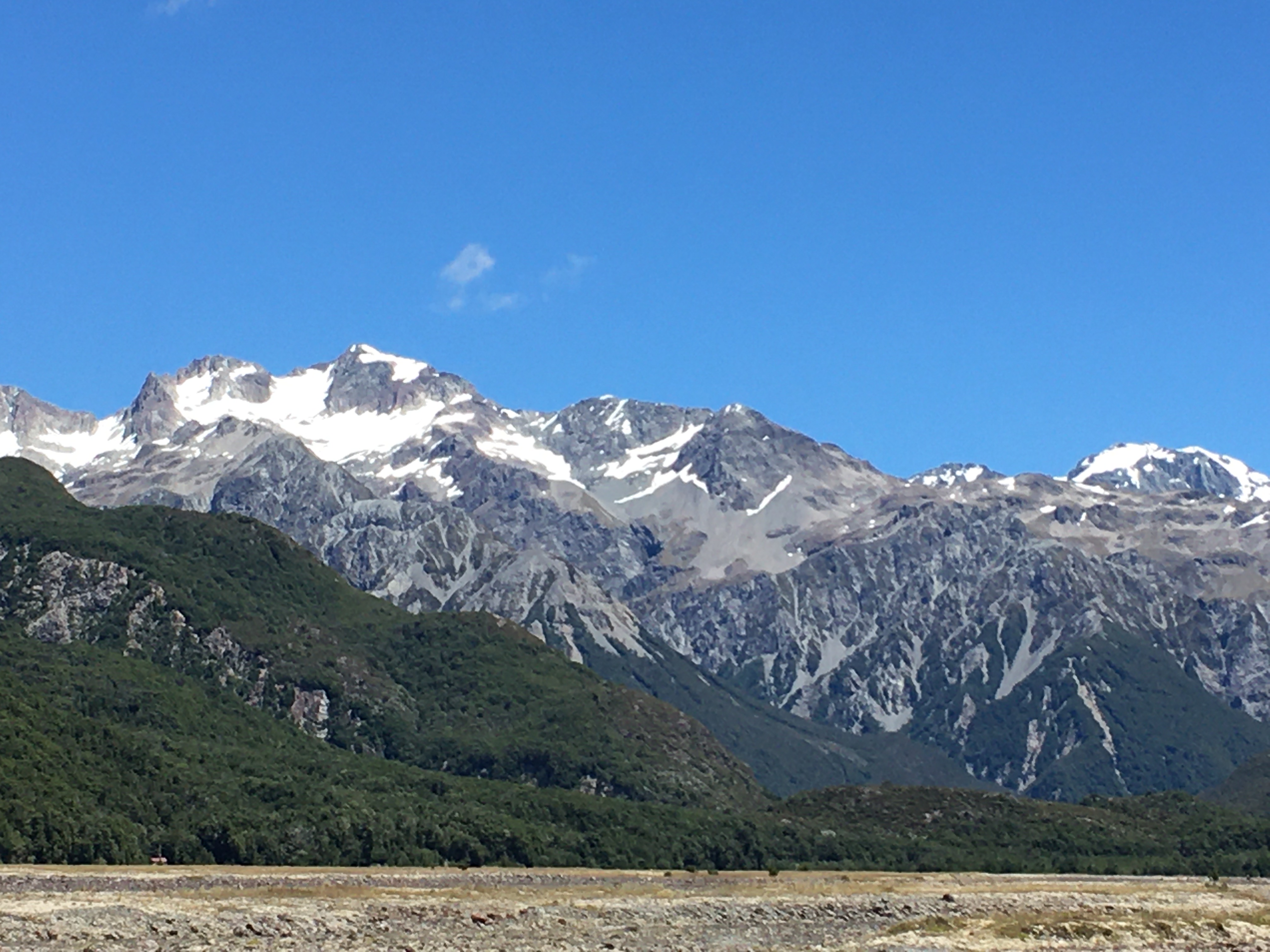
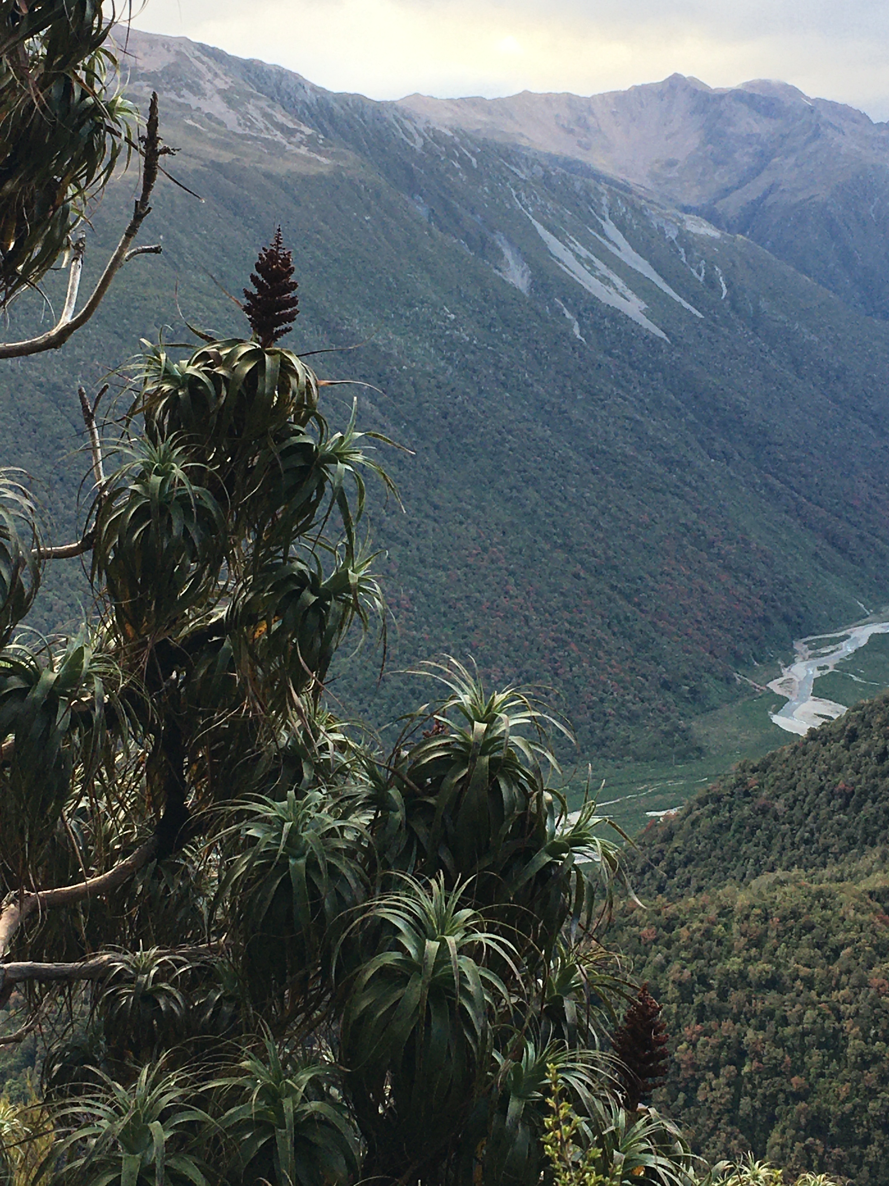
My husband and I spent Canterbury weekend on the West Coast. We stayed in Hokitika, because I had a market there on Sunday, but on Saturday, we drove down to Franz Josef Glacier.
Franz Josef Glacier in 2009.
We hiked up to Alex Knob. This 17 km hike is a steady, occasionally steep climb of about 1000 metres. It’s not technically difficult, but it’s a good hike. It’s rated as 8 hours return, but we did it in about 5 1/2—it’s easy to speed on the way down. On our way up, we got glimpses of the glacier. Unfortunately, by the time we reached the top, where the view should have been spectacular, the whole top of the knob was in cloud, and a fierce wind was driving snow into our faces. Despite the wind, snow and cold, we tucked ourselves behind a tussock and had a snack, enjoying the sheer wildness of the weather, before driving hail hurried us down.
It’s been ten years since I’ve been to the glacier. What I saw on this visit was heartbreaking.
Sixteen years ago, I did some interpretation work for the Department of Conservation, researching and writing text for interpretive panels at Franz Josef Glacier and Fox Glacier. I also did some research around visitor behaviour at the glaciers and the effectiveness of various warning messages. At the time, the glaciers were easily accessible on foot. They were advancing and dropping deadly chunks of ice on visitors who ignored warning signs and crossed barrier ropes to get up close.
Franz Josef Glacier in 2015
Today, Franz Josef Glacier has retreated so far, it is not possible to walk to it. Ironically, the only way to visit the glacier these days is by helicopter—further spewing the greenhouse gases that are killing the glaciers.
There were thousands of tourists in Franz Josef Township last weekend, and the glacier carpark and tracks were crowded. Many of these tourists were here for the lure of New Zealand’s spectacular glacial landscape. New Zealand used to be the only place on earth where you could see glaciers reaching down into temperate rainforest. Today the glaciers come nowhere close to the forest, and soon there will be no glaciers left at all.
Franz Josef Glacier in 2025
There are many other wonders on the West Coast—the rainforest, the mountains, wildlife and beaches—but the loss of the glaciers is tragic, not just because of their natural beauty, but also because of their role in water storage and release. Their loss will have long term consequences for all of New Zealand.
It may be another decade before I go to Franz Josef Glacier. I hope there is still a glacier to see when I get there.
I love hiking at any time of the year, but there’s something particularly enjoyable about winter hikes.
Part of that enjoyment for me is that it’s the only chance here in Aotearoa New Zealand to walk in snow, because it rarely snows at lower elevations. To get to snow, you’ve got to hike to it. (Yes, you can hike to snow even in summer, but it’s easier to do so in winter, and there’s more of it.)
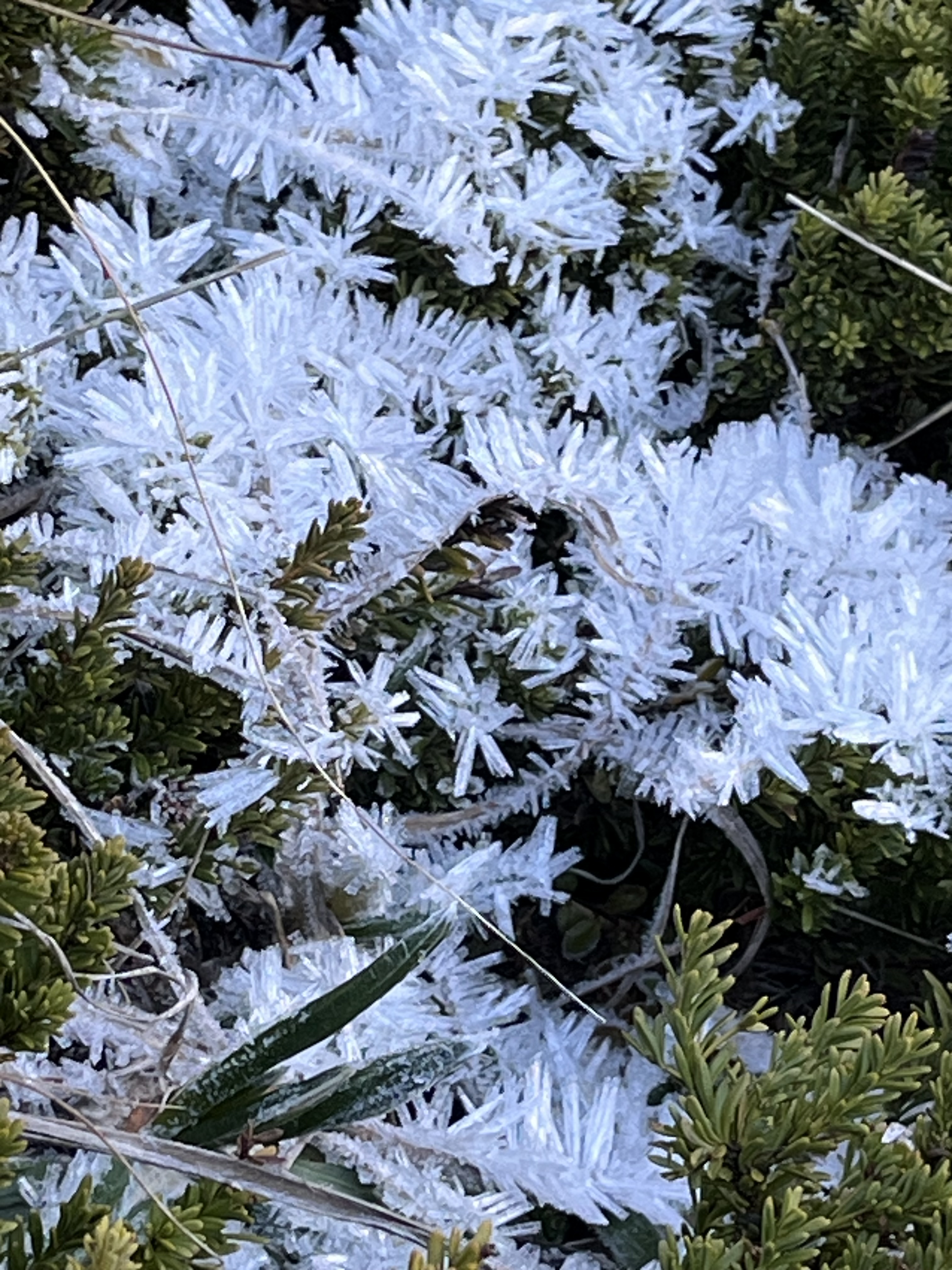
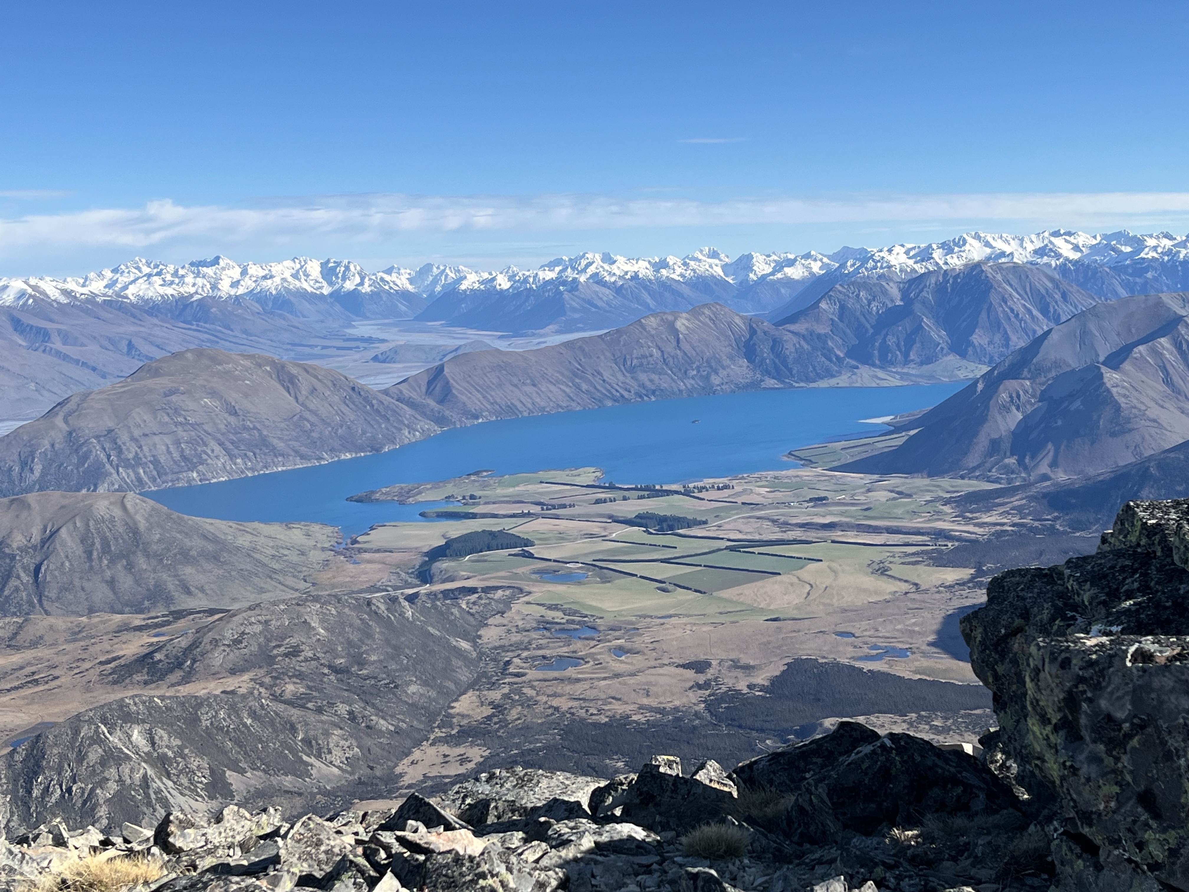
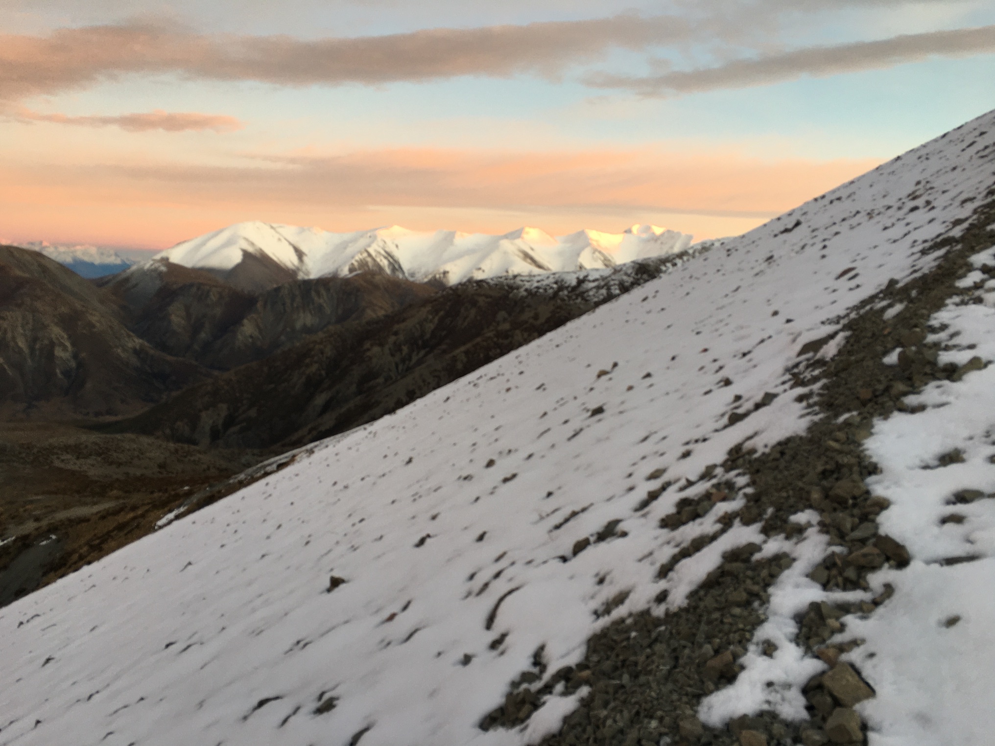
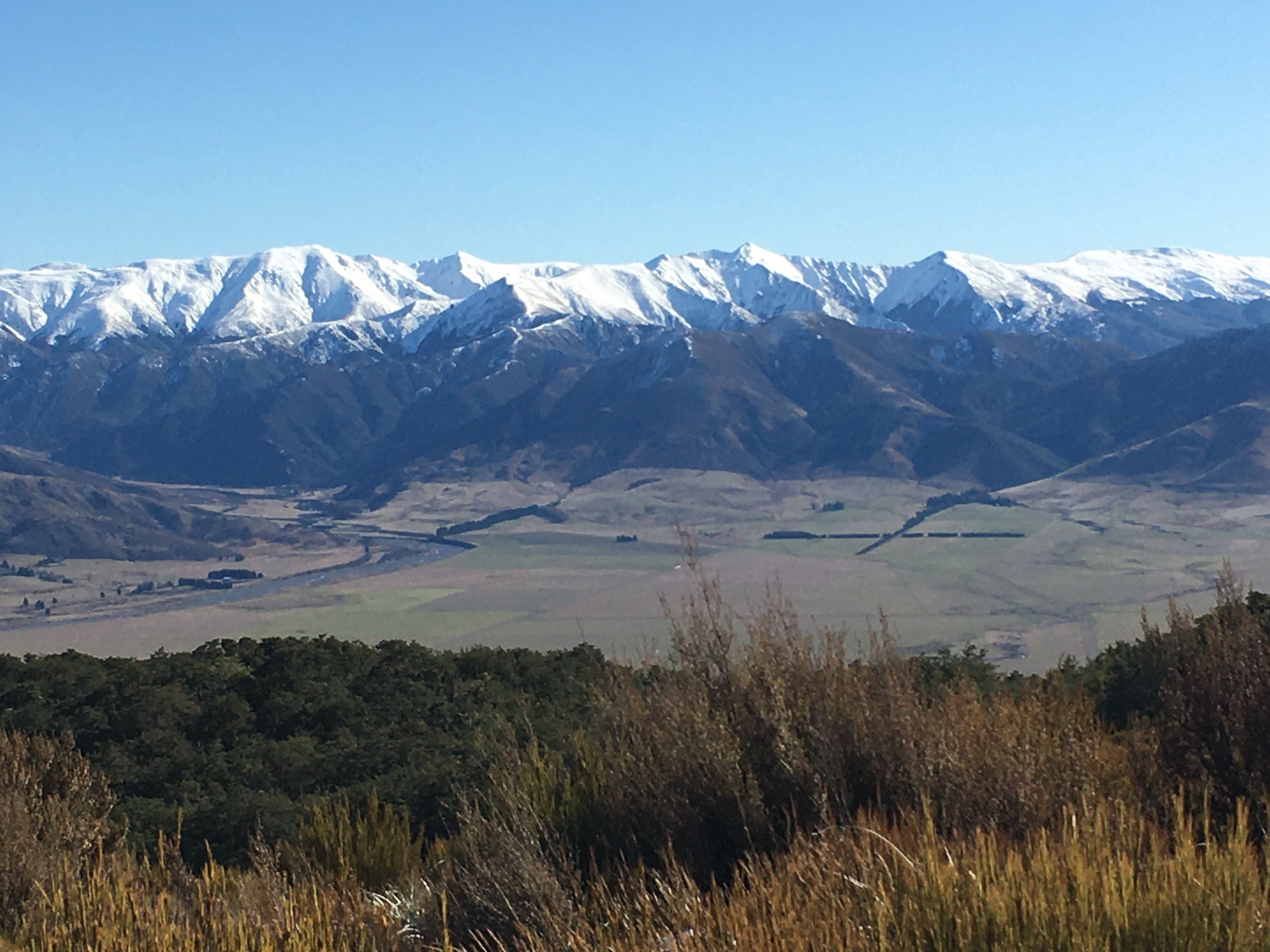
Last weekend, my husband, daughter and I headed to Red Hill, which sits between Lake Lyndon and Lake Coleridge. At 1640 metres, Red Hill is higher than nearby Porters Skifield, but lacks the snow making machines. So the snow was patchy, even at the top.
Still, winter hiking was in its full glory. On the way up, we hiked across crunchy frozen mud, pushed up by countless ice needles. We teetered on icy tussock mounds as we crossed a wetland. As we gained altitude, the wind increased and the temperature fell. We passed pockets of spectacular frost, with ice crystals so long, it looked like leaves. Snow in the shady hollows was wind sculpted and hard, more ice than snow.
By the time we hit the open tussock and scree-covered tops, the freezing wind was burning my cheeks, and I was thankful for my snood, which I pulled over my face to block the worst of the wind.
The view from the top was definitely worth the windburn. Winter mountains—covered in snow—stretched across the skyline. Down below us, the water of Lake Coleridge glistened blue in the sun.
The only bad part about winter hiking is that it’s often not pleasant to sit on the top for lunch, and last weekend was absolutely not a weekend to hang out on top of any mountain. After a quick look around and some photos, we hightailed it back down.
But one of the cool things about winter hiking is that, on a sunny day, you can start the hike in winter conditions, and end in spring or summer-like conditions.
Having donned all our warm layers at the top of Red Hill, we began shucking them as we descended. We went from thermals, jacket, hat and gloves to just t-shirts by the time we were back to the car. It was a balmy 17℃. Warm enough for a swim … according to our daughter. (We decided not to swim that day, but she did take a swim the following day after a hike with a friend.)
As someone with mediocre circulation, I struggle with overheating when I hike. I can be sweating, but still have numb fingers and toes, because my body doesn’t push the heat to my extremities. It turns summer hiking into a sweat-fest. But hiking during winter is much more pleasant. I can shuck my jacket to cool my core, but keep hat and gloves on to warm my extremities. It makes for a much more pleasant experience.
We’ve enjoyed some memorable winter hikes: Cragieburn under a freshly fallen 15 centimetres of fluff, a trek to Woolshed Creek Hut in fresh calf-deep snow, followed by barefoot wading in the stream at the top, a winter wonderland of wind-sculpted ice atop Mount Isobel … Winter landscapes are spectacular.
Hopefully, we’ll get out for a few more hikes before the end of winter. Gotta enjoy the snow while it’s there!
Our daughter wanted to go to the west coast for professional reasons (to photograph mosses for a project she’s doing), so my husband and I happily agreed to accompany her for a weekend getaway.
We left Friday evening, stopping at Lake Pearson (Moana Rua) for a lovely picnic dinner, and then carrying on over the mountains to camp at Goldsborough Campsite near Kumara. We pulled into the campsite around eight o’clock and set up camp. With the light already fading, we decided to wander up one of the tracks that followed old gold mining tracks through the bush.
Old mining water race tunnelling through the hillside
We started up German Gully Track, thinking we’d just go up a little ways, then return. The track passed an old mining water race that looked like a cathedral-shaped tunnel as it snaked steadily up the hill. Soon we were close enough to the end of the track that, of course, we had to finish.
We popped out onto a broad, modern gold mining road. The sign at the road indicated that we could either return to the track the way we came (30 minutes, according to the sign), or return via Goff’s Track (65 minutes). It was 8.55 pm. To take Goff’s Track would, theoretically, have us arriving back at the campsite at 10 pm. After ascertaining we all had our head torches with us, we powered up the road towards Goff’s Track.
German Gully track–an old mining road
The west coast was unusually dry, for which I was glad as we picked our way down Goff’s Track in the gloom—while most of the track was easy going, the steeper sections would have been slick and no fun in low light.
Knowing we were racing the light, we kept the pace up, and didn’t even need to use our torches, arriving back at the campsite around 9.30. A nice little evening hike!
The following day, we got an early start and hiked up Mount French, near Lake Brunner. None of the track descriptions have much to say, except that the hike is a steady climb of over 1000 vertical metres. Telling, however, are the listed track length and times: 7 km return, 8 hours return. That’s a walking speed of only 875 metres per hour.
View from the top of Mount French towards the Tasman Sea
We did slightly better, making the 3.5 kilometre trip to the summit in 3 hours forty-five minutes, for a walking speed of 933 metres per hour. Most of the hike up is through dense west coast rainforest, so other than the forest itself, there’s not much to see. When we hit the alpine vegetation near the top, the views opened up and it was spectacular. At first we were a little worried we’d struggle to find our way across the multiple false peaks to the actual summit, because clouds obscured the tops. In hindsight, I’m glad the cloud was there, because when it did clear and we finally got a view of the summit, I was disappointed at how far away it still was. LOL! Though the elevational change from the bottom to the top is officially a bit over 1000 metres, there are several significant dips along the ridge, so I suspect the actual amount of climbing you do to reach the summit is more like 1200 metres.
Looking back down the ridge from the summit of Mount French
But we made it, and by the time we were on the summit the clouds had cleared entirely. We had stunning views to the Tasman Sea on one side, and to the mountains on the other. Lake Brunner glittered in the sun far below us.
We had lunch on the peak and spent a good bit of time enjoying the view and exploring the plants and insects at the top before tackling the descent.
Lake Brunner seen from the summit of Mount French
Going down was faster than going up, and we reached the car shortly after 3 pm, hot and sweaty and ready for a swim. After a quick dip in Lake Brunner, and a change of clothes, we headed to Hokitika for dinner and a short stroll on the beach.
All of us were in bed and asleep early Saturday night.
Sunday, we packed up camp and headed to Lake Kaniere to hike the Lake Kaniere walkway. We’ve done part of this walk several times. It’s a mostly flat, well maintained track that follows the entire western edge of the lake. There are multiple stony beaches to stop at along the way, and amazing lowland rainforest vegetation.
A reflective early morning Lake Kaniere
On Sunday, it was also really hot (28 degrees by early afternoon). And even on the flat, we were sweating. My husband turned back about a third of the way into the hike, in order to drive the car to the end of the one-way track. My daughter and I continued on, stopping for a quick skinny dip at Lawyer’s Delight beach, before meeting my husband walking back towards us from the far end, about a kilometre from the end of the track.
Carové’s giant dragonfly at Dorothy Falls
We had lunch, a stop a Dorothy Falls, and another swim in Lake Kaniere, then headed home.
The entire weekend on the west coast was hot and sunny, so it was a bit of a shock to hit Porter’s Pass and drive into drizzle and 12 degrees. It was a chilly 15 at home under overcast skies. Poor Canterbury—this summer has been anything but summery here. It’s no wonder the west coast was absolutely packed with vacationing families.
And now I have one week left before returning to the day job. My summer to-do list is getting shorter, but I will definitely not accomplish everything on it. But it’s been a good summer for getting out and hiking, so I can’t complain. Now I just need to knuckle down and get some writing in while I can.
This year was something of a milestone—it was the first year in about 16 that we didn’t do a pre-Christmas backpacking trip with the kids. It was bound to happen sometime soon, since the kids are all grown up now and doing their own things.
Instead, my husband and I had a post-Christmas hike all on our own. Let me say right now that I loved tramping with the kids, but doing the Christmas hike with just my husband was REALLY nice—just like old times … except that we’re a lot older. It was nice hiking at 54-year-old pace (instead of being dragged along by impatient 20-something kids), and we could also go places that appealed to us, without considering if the kids would enjoy it.
So we stayed relatively close to home, but took a route we hadn’t ever explored.
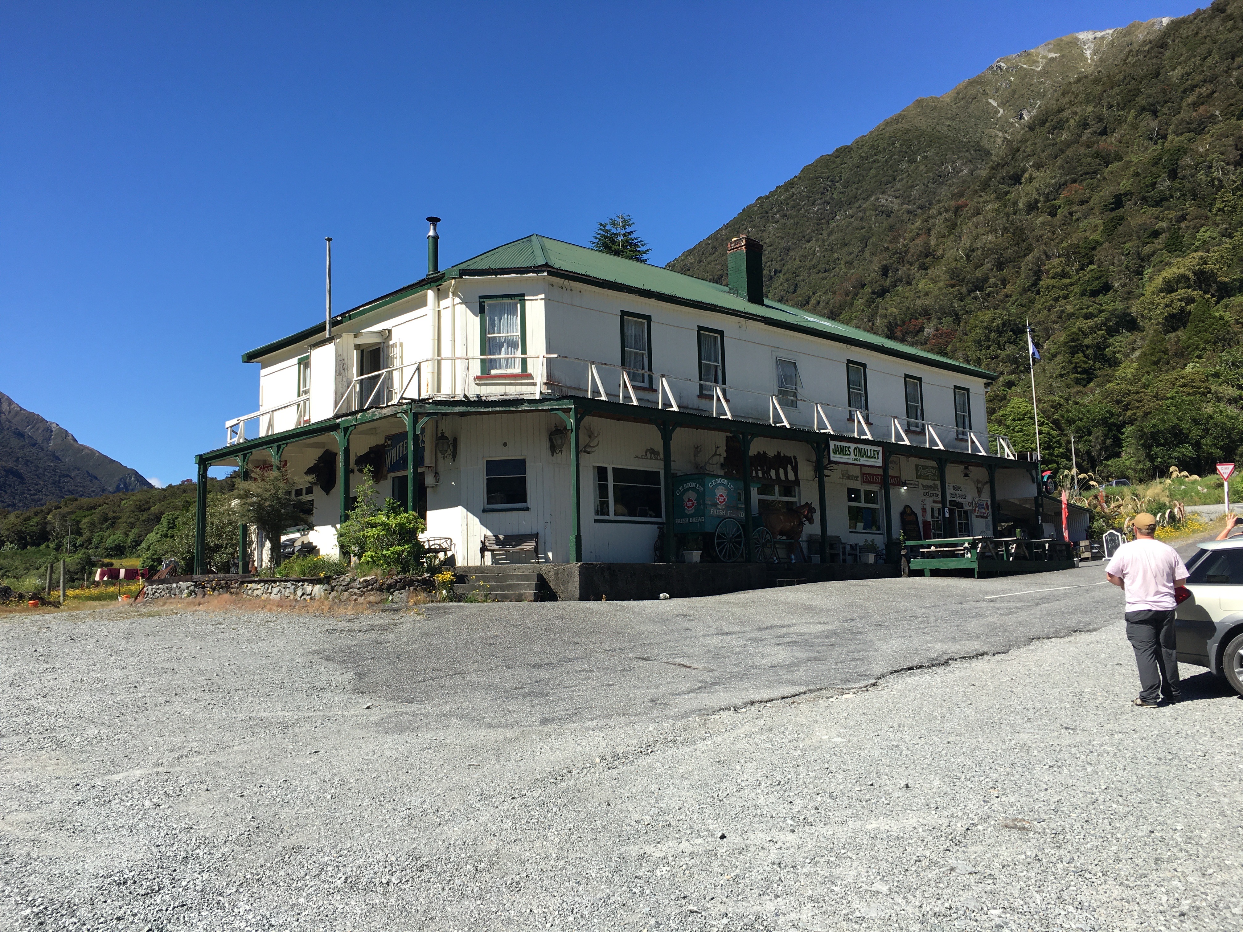
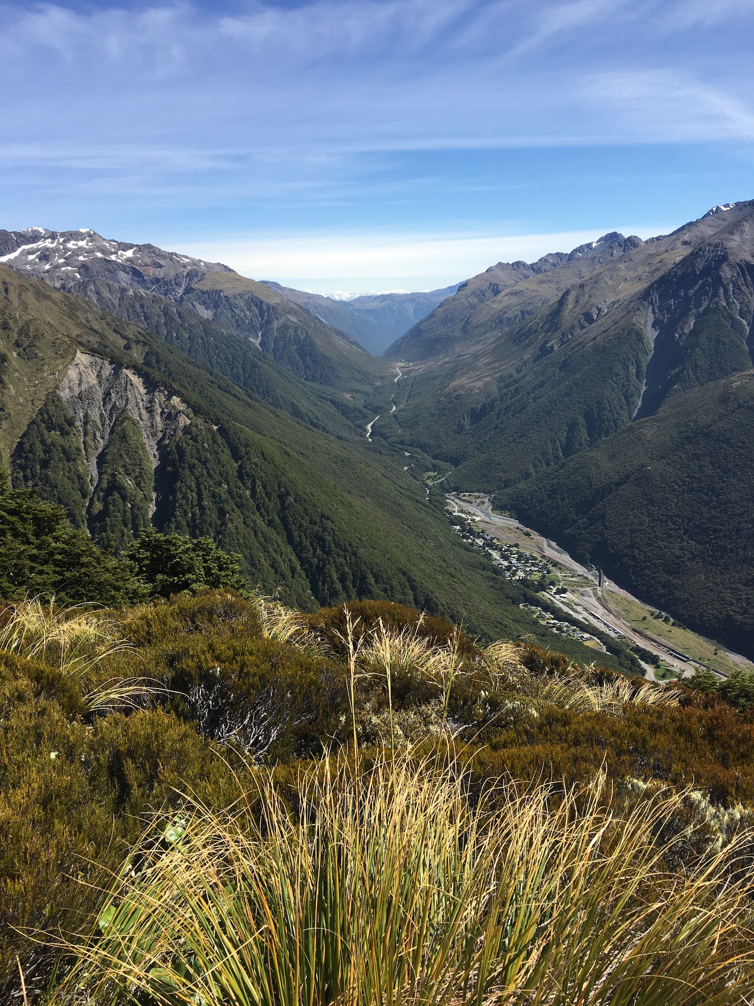
Day one began with dropping a car at the far end of our hike, near Kelly Creek. There was a bit of faffing around to charge the electric car (with the charger in Arthur’s Pass out of order, and the one in Otira busy), but it gave us an excuse to have a coffee at the Otira Hotel, which is an experience of its own.
Then we drove back to the Waimakariri River, parked car number two at Klondyke Corner, and hiked up the Waimakariri to Carrington Hut.
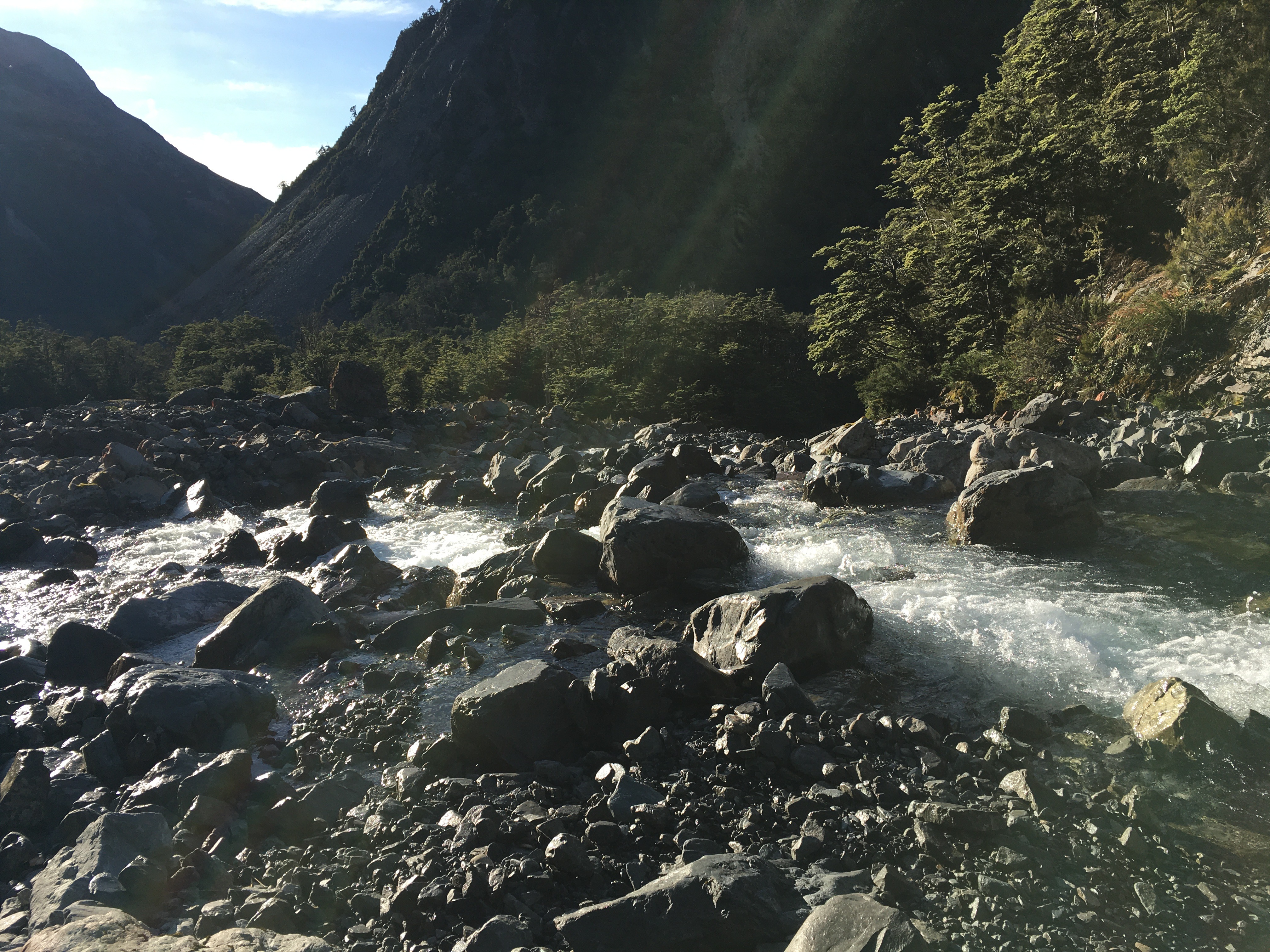
This hike is a bit of a slog and involves crossing the river a couple of times. In fact, the first river crossing comes within the first five minutes of hiking, which was fine—we were going to spend four and a half days walking rivers. There was no way we were going to have dry feet.
In spite of the dull nature of the actual hiking up to Carrington Hut, the scenery is fabulous, and only improves as you go further up the watershed. We were lucky to have a tern hunting the river alongside of us for a while, and we scared up a pair of banded dotterels, too.
After passing Anti Crow Hut, we left the riverbed to follow a track over a couple of roche moutonnée—rocky mounds left behind by glaciation. A series of tarns on the mounds give them a magical sort of quality, and the short break from river walking is nice.
The last time we were at Carrington Hut, it was incredibly crowded and unpleasant, so we carried a tent this time, just in case. But the 36-bunk hut housed only five of us that night, and we barely saw one another.
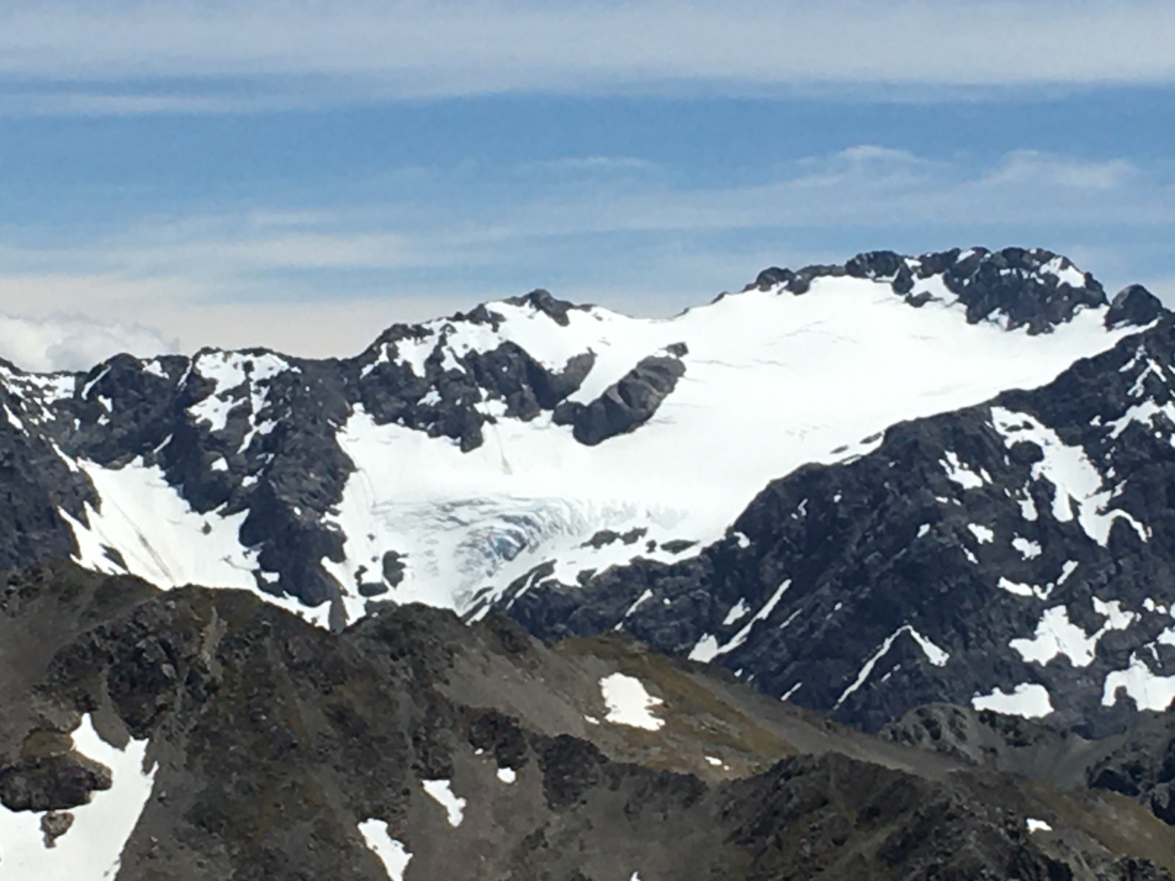
Day 2, we hiked over Harman Pass—up the Taipoiti River (click here for a video), then down Mary Creek. Again, the first act of the day was crossing a river, and then it was river crossings all day, back and forth across the Taipoiti as it rushed through a narrow valley which at times could be more properly called a gorge. It was another fabulous day, weather-wise, and the scenery was spectacular. So were the alpine plants. It seemed like EVERYTHING was in flower, and it was a slow hike up to the pass, because we were photographing all the way.
At the pass, we took a little jaunt up to see some tarns higher up, and then hung out for a while with a curious kea (click here for a video). Kea are an odd mix of highly endangered (there are 1,000-5,000 of them left), and incredibly pesky, thanks to their intelligence, curiosity and a beak shaped like a giant can opener (their peskiness is unfortunately part of the reason they’re endangered). The world’s only alpine parrot, it’s common to encounter them at elevation near Arthur’s Pass, but it never gets old.
Mary Creek was more of the same—river crossings, beautiful scenery, endangered birds. We spent some time watching a pair of whio (blue ducks) having a nap on a rock in the middle of the stream. There are only 3000 whio left and unfortunately the population is skewed strongly to males, because females are vulnerable to introduced predators when sitting on the nest. We were lucky enough to encounter two pairs on our trip.
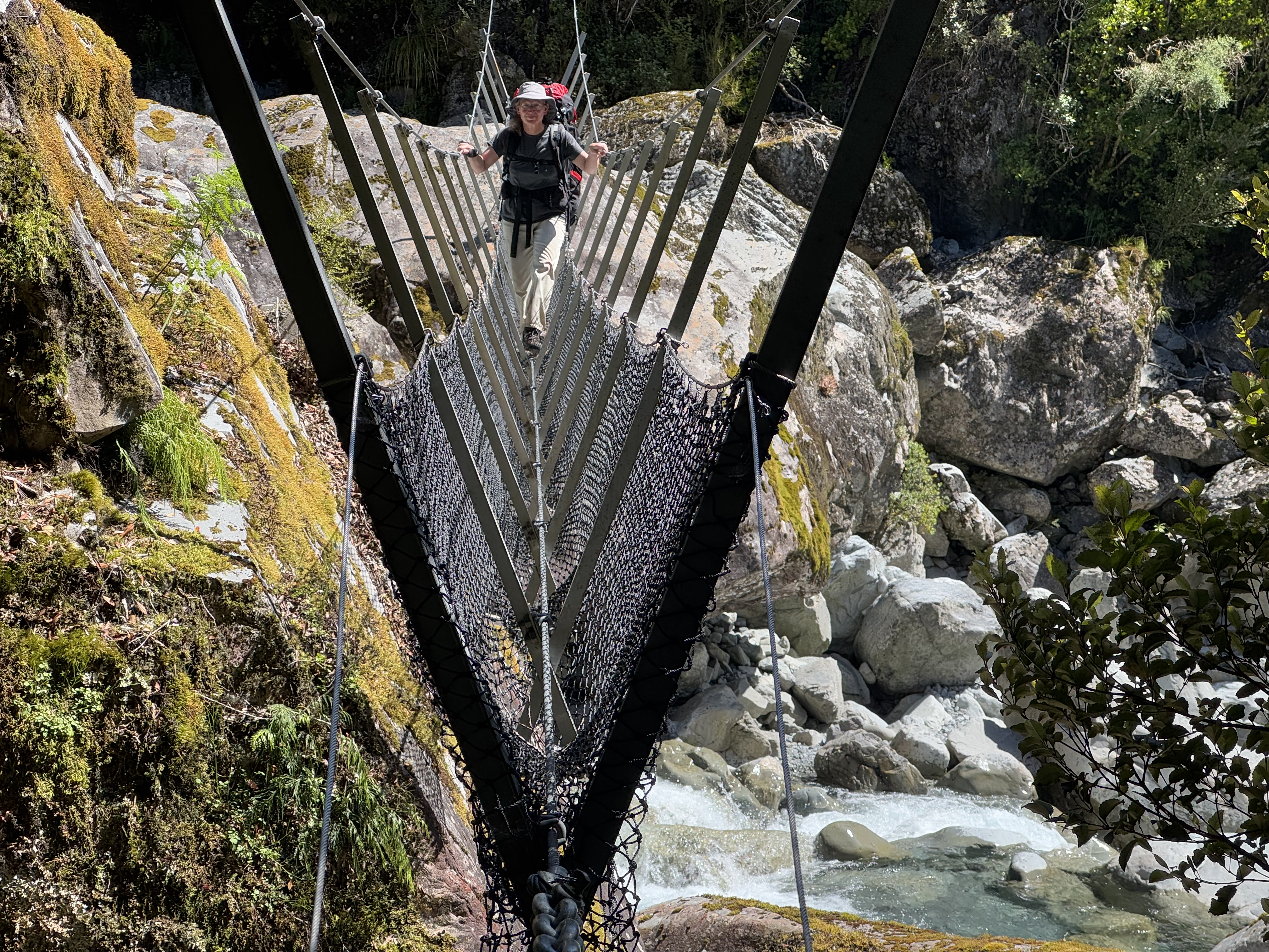
After a 3-wire bridge crossing at the bottom of Mary Creek, we arrived at Julia Hut. The hut is relatively small, and with another couple there already, we decided to tent. After setting up the tent and settling in, we had the rest of the sunny afternoon to explore. A natural hot spring was our destination. Only five minutes walk from the hut, next to the icy, swiftly flowing Julia Creek (click here for a video), the hot pool did not disappoint. It was initially too hot to sit in, and we had to redirect some river water into it to temper the heat.
After a sweaty hike, I have to say I wasn’t all that interested in sitting in a hot pool, but I took a dunk in the river first, and then the hot pool was pretty nice. You couldn’t fault the setting—two days hike from a road, on an absolutely stunning mountain stream in the bush. It beat Hanmer Springs by a mile!
There is clearly a lot of geothermal activity in the area—the smell of sulphur was prevalent all along Julia Creek—and I suspect if you fossicked around, you’d find more hot pools.
Day 3 was a lot of river walking (again), punctuated by a couple more three-wire bridges. We hiked down Julia Creek and the Taipo River to Dillon Hut. Well, we intended to stay at Dillon Hut, but when we arrived we were informed by a very cute four-year-old that there were ‘no more mattresses’ (Dillon hut is only a 2-hour hike from the road, and is clearly a great destination for a short family hike). So we moved on to Dillon Homestead Hut, just 500 metres down the track.
Dillon Homestead Hut is just that—an old homestead. Built of hand-hewn timber and clad in whatever the original owners could scrounge, it is quite the historical experience to spend the night there. It’s clearly beloved by local four-wheel drivers and dirt bikers, but is in sore need of some upkeep. Still, it was shelter when the skies opened up and dumped rain all night, and if it had been cold, there was a big open fireplace surrounded by three tatty, 1950s-era armchairs. And once you brushed the rat droppings off the sleeping platforms, tables and chairs, it had everything you needed to spend the night.
Fortunately the rats weren’t as active inside the hut as I had feared, and we spent a reasonably comfortable night (if a bit smelly) in the hut. In the morning, however, I trudged out to the long drop through soaking wet, waist-high grass. The loo is as old as the hut, and was stocked with three mouldy, rat-poo-festooned rolls of toilet paper. I didn’t stop to investigate the myriad spider webs (there may have been some interesting native spiders), but in retrospect I should have inspected my surroundings a bit more. Leaving the door open for light and ventilation, I dropped my pants to do my business.
A scuttling overhead was all the warning I got before a rat leapt out of the rafters and landed on my head. I may have sworn. But the four-letter word had barely left my lips before the rat was off again, leaping for the toilet seat and then the floor before racing off into the bush.
So, a warning to you—the Dillon Homestead Hut loo is guarded by an attack rat.
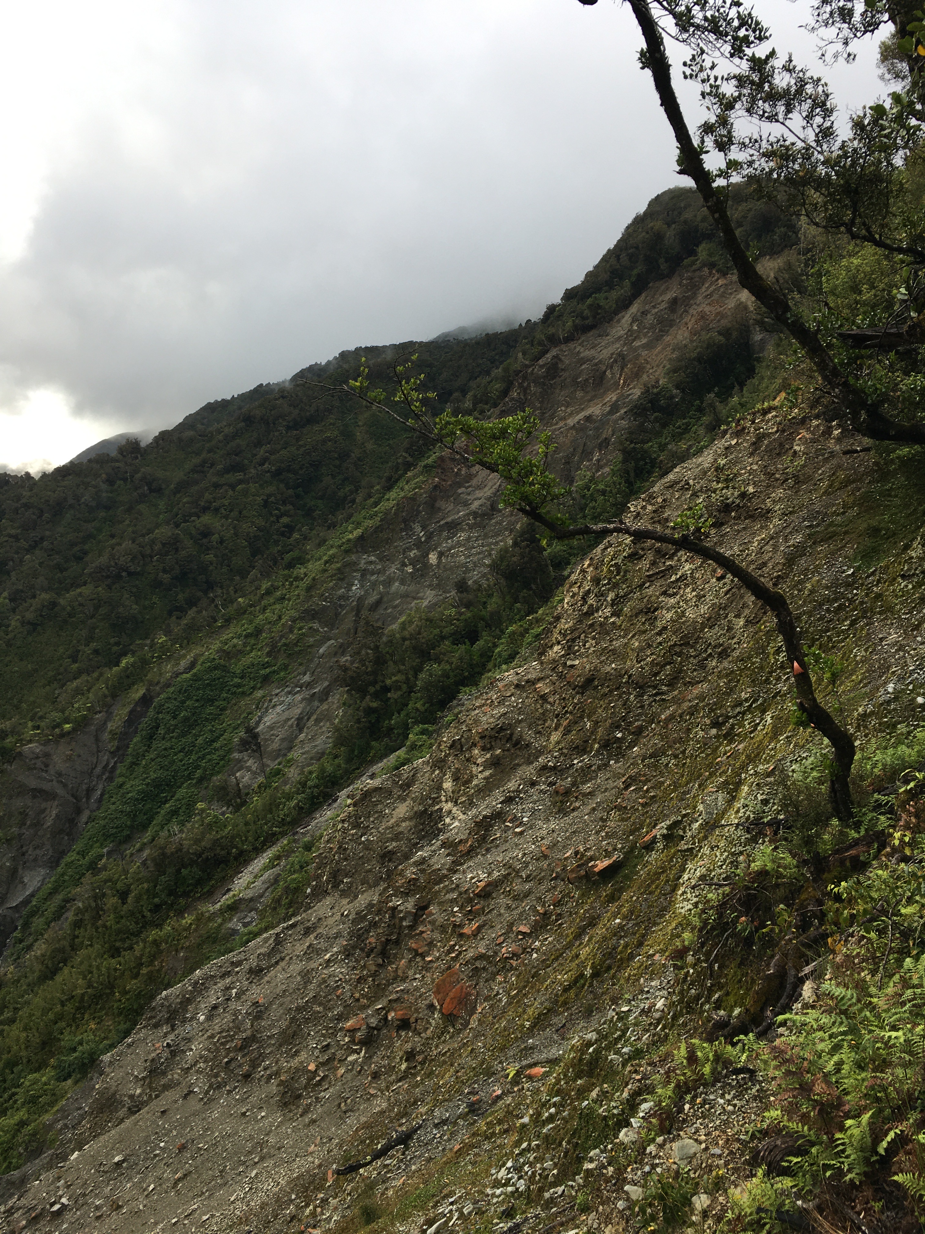
After that exciting start, the rest of Day four was a hard climb. From Dillon Homestead Hut, we followed Seven Mile Creek briefly to a track that climbs steeply through dense west coast forest up to the Kelly Range. It was dark and humid in the forest. At one point, the track passed through a narrow gorge that was almost tunnel-like. It felt like we were crawling uphill, and often it was literally true, as it took both hands and feet. Pīwakawaka kept flitting around us, taunting us with their darting flight and chittering voices—what was so difficult about this slope, they seemed to ask.
At one point, the track met a huge slip hundreds of metres across and hundreds of metres tall. A blaze remained on a lone tree suspended at the top of the slip. The rerouted track scrambled precariously around the top of the slip, and I breathed easier once we were past it.
After 700 metres of elevation gain, we reached tree line and got a view back down to where we’d come from that morning—it was a long way down, and we still had more climbing to do.
The tops were dotted with tarns, and even where there wasn’t standing water, it was wet. We walked through fields of sundew plants, and took our breaks amid alpine orchids and daisies.
Clouds prevented us from having great views, but turned the views we did have into a dramatic, ever-changing landscape. By the time we’d reached the top of our climb—a thousand metres above Dillon Homestead Hut—the clouds were swirling around us.
A relatively short descent brought us to Caroll Hut just as the first raindrops began to fall. We had a late lunch of soup and peanut butter crackers as the wind picked up and the rain lashed the hut.
We shared Caroll Hut with a UK expat who lives in Wellington, a pair from Whanganui, and a fellow from Adelaide. It was a great mix, and we had a nice afternoon and evening chatting with them all. The best of hut life.
All night the wind howled, and I was thankful for the steel cables tethering the hut in place. Although the rain ended before dark, the wind continued through to morning, so it was a cold and windy start to Day 5. An early morning treat at the hut was a family of weka with fluffy chicks fossicking around the hut.
Day 5 was a short (hour and a half) jaunt out to the road from Caroll Hut. The ‘jaunt’ involved a good 800 metre elevation change, steeply downhill, but not bad going, with some nice views from time to time. And just when we thought we were done with wet boots, there was a stream crossing in the last 20 metres.
We were home by lunchtime, wet and tired, but having had an excellent five days. It was a fabulous way to spend the Christmas-New Year gap.
I enjoy winter hiking—I enjoy the crisp air, the opportunity to hike without sweating too much, the snow on the peaks.
One of my favourite winter phenomena is frost heave. This is when moisture in the soil freezes. Since water expands when it freezes, the ice crystals push soil and rocks upward. We get frost heave at home, but in the mountains, where there is both more water and colder temperatures, the phenomenon can be spectacular.
On a cold Matariki morning a few weeks ago, I snapped a photo of five-centimetre-long ice needles near Foggy Peak. Each needle was topped by gravel—the whole top centimetre or more of the sloping surface lifted. As the sun rose and melted the ice, every rock fell a few centimetres downhill from where it started. I imagine this process happening daily all through winter—a slow-motion conveyor belt shifting the mountain downhill.
Meanwhile, higher up on the mountain, water seeping into the cracks in rocks and then freezing shatters them day by day into smaller fragments to be added to the icy conveyor belt.
It is such a small thing, frost heave. But its slow action has a big effect.
The Southern Alps are rising at a rate of 10 to 20 millimetres per year—some of the fastest rising mountains in the world. If no erosion had ever occurred, the mountains would currently stand over 20 kilometres tall. Our tallest mountain, Aoraki Mount Cook, is 3754 metres tall.
Of course, when we think of erosion, we think of the big events like landslides and rock avalanches. These events can be spectacular.
On 14 December 1991, a rock avalanche on Aoraki lowered the summit by 10 metres over the course of a few hours. Fourteen million cubic metres of rock and ice tumbled down the mountain at speeds of up to 300 kilometres per hour. The shock waves from the landslide were recorded on seismographs as far as 58 kilometres away.
But without frost heave, the 1991 Aoraki rock avalanche might never have happened. Frost heave slowly weakened the rocks, slowly snapped them into smaller and smaller pieces, slowly shifted their weight. Centimetre by centimetre, those little ice needles brought the mountainside down.
I like to think of frost heave as a metaphor. Each of those tiny ice crystals, by itself, can move a pebble, and together they bring down mountains.
Today is Matariki, and like new year celebrations all around the world, it’s a day for assessing the past and planning the future. It’s a day to spend with family and friends. It’s a day to remember and honour our connections with other people, the seasons, and the land.
Spending time with whānau wasn’t an option for me today, so I thought I’d celebrate my connections to the seasons and the Earth instead. Before dawn I drove to Porter’s Pass and hiked up towards Foggy Peak. It was dark when I began the ascent, with just a hint of light to the east. I hiked the first 40 minutes or so with my head torch, before it was light enough to see the track.
Being midwinter, I expected it to be cold. It was actually surprisingly warm to start—the air temperature was above freezing. But the wind was stiff, and the temperature was still falling. Thankfully, there was no problem staying warm on the uphill.
But the wind grew more fierce the further up I went. I stopped frequently to enjoy the beauty of dawn in the mountains, to gaze back at the bright smudges of towns dotting the plains, the pinpricks of light from the cars crawling up the mountain to Porters Pass. I never stopped for long, though.
I’d hoped to catch the sunrise from the summit of Foggy Peak, but as the scree gave way to icy snow, my progress slowed, and I wished for crampons. I watched sun strike the snowy peaks of the Craigieburn Range and decided that that would have to be good enough—I could push on to Foggy Peak, but I wasn’t going to sit there with a cup of tea and watch the sun rise as I’d hoped. Even if I’d been in time, it was too windy and cold.
So I had my tea in a sheltered spot lower down, where I could sit and enjoy the view. It wasn’t the summit, but it was a beautiful way to start the new year.
Injuries and weather have conspired to keep me out of the mountains for months, but my husband and I finally made it to the hills a few weekends ago.
It wasn’t a big trip—just a little jaunt to the top of Mt Richardson, one of the foothills around Oxford.
At only 1047 metres tall, Mt Richardson doesn’t get above tree line, but a clearing at the top provides a great view of the ‘real’ mountains beyond.
The day we went was sunny and nearly windless. There was snow on the ground, but we ate lunch at the top in our t-shirts, enjoying the stunning panorama spread out around us.
I would say that the only things that diminished the perfection were the mud, the slip that took out a section of track (necessitating a bit of bushwhacking) and the washed-out bridge that meant wading through an icy stream, but those things only added to the fun.
I look forward to better weather and more outdoor adventures as we head into spring.
A few days ago, my husband, son and I went for a hike up Mount Bealey. This was my husband and my second trip up, but the first was a hastily planned late-autumn post-lockdown get-us-the-f@*k-out-of-the-shed hike, and we ran out of daylight to make it to the summit. This time, we had plenty of time to reach the peak.
The day was absolutely perfect, with early low cloud burning off before we reached the tree line, and just enough breeze at the top to cool off.
The climb up is fairly steep in places—the track more of a ladder than a trail. But that’s to be expected around Arthur’s Pass, and I prefer an interesting scramble over a steady upward slog anytime. The beech forest is lovely, with tantalising peeks down to the ever-receding village of Arthur’s Pass.
Breaking out above tree line makes the scramble worthwhile, with views of multiple 100-metre-tall waterfalls in the valley below, and the snow-covered peaks above.
We had lunch on the summit and spent a long time simply enjoying the 360-degree landscape of jagged peaks and vertiginous valleys. We had the summit (and in fact most of the track) to ourselves. Not even a kea came to visit us on the peak—no doubt they were hanging out with the hoards of people on top of the more popular Avalanche Peak.
One of the best things about being on the summit was the chance to see other places we’ve hiked and put them all into a cohesive understanding of the landscape. There is satisfaction in that intimate knowledge of a place—to know the chill of the icy river below as well as having the bird’s-eye perspective of the river’s braided channel from the mountain above.
The trip took us a bit under seven hours, with the long lunch break on top, and we reached the car by 4pm. An ice cream at Arthur’s Pass was the perfect end to a perfect hike.
Looking down to Arthur’s Pass village from just above tree lineAlpine vegetation, looking east toward Porter’s PassCrow Glacier flowing down from Mount RollestonLooking down to the confluence of the Crow and Waimakariri RiversPanorama of the view to the west from the summit
This year’s pre-Christmas tramp took us to the Lewis Pass area for four days of forests, mountains, and lots of water.
Day 1 was up the Nina Valley Track through beautiful beech forest. We bypassed Nina Hut, planning to camp below Devil’s Den Bivvy. Unfortunately, recent rain had rendered the area below Devil’s Den Biv into a swamp. There was no place to pitch a tent, so we carried on to the biv. Then we had to figure out how to bunk four people in a two-person hut. With three in the biv and one in a tent blocking access to the loo, we managed. It was … cosy.
Day 2, we left the biv in dense fog, hiking down to the Doubtful River on a track that has clearly seen no maintenance for a decade. At times it felt like bush bashing, and there was lots of windfall to clamber over, under and around.
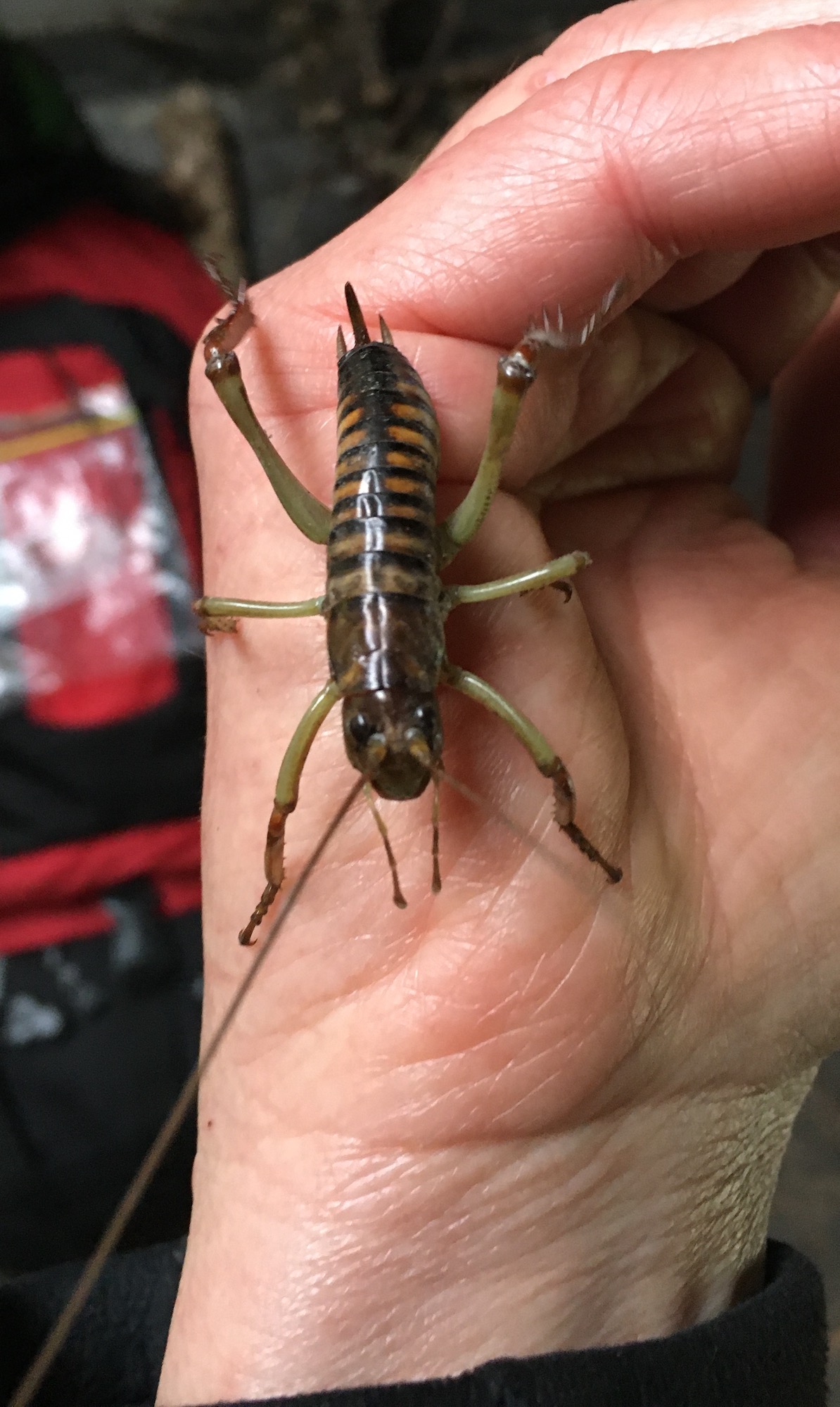
Once at the Doubtful River, a cruisy 40-minute hike took us up to the confluence with the Doubtless River, and shortly thereafter, to the Doubtless Hut, where we had a spacious six bunks to ourselves. Well, almost to ourselves. As we were packing up to leave, we found a beautiful young female Wellington tree wētā in the hut.
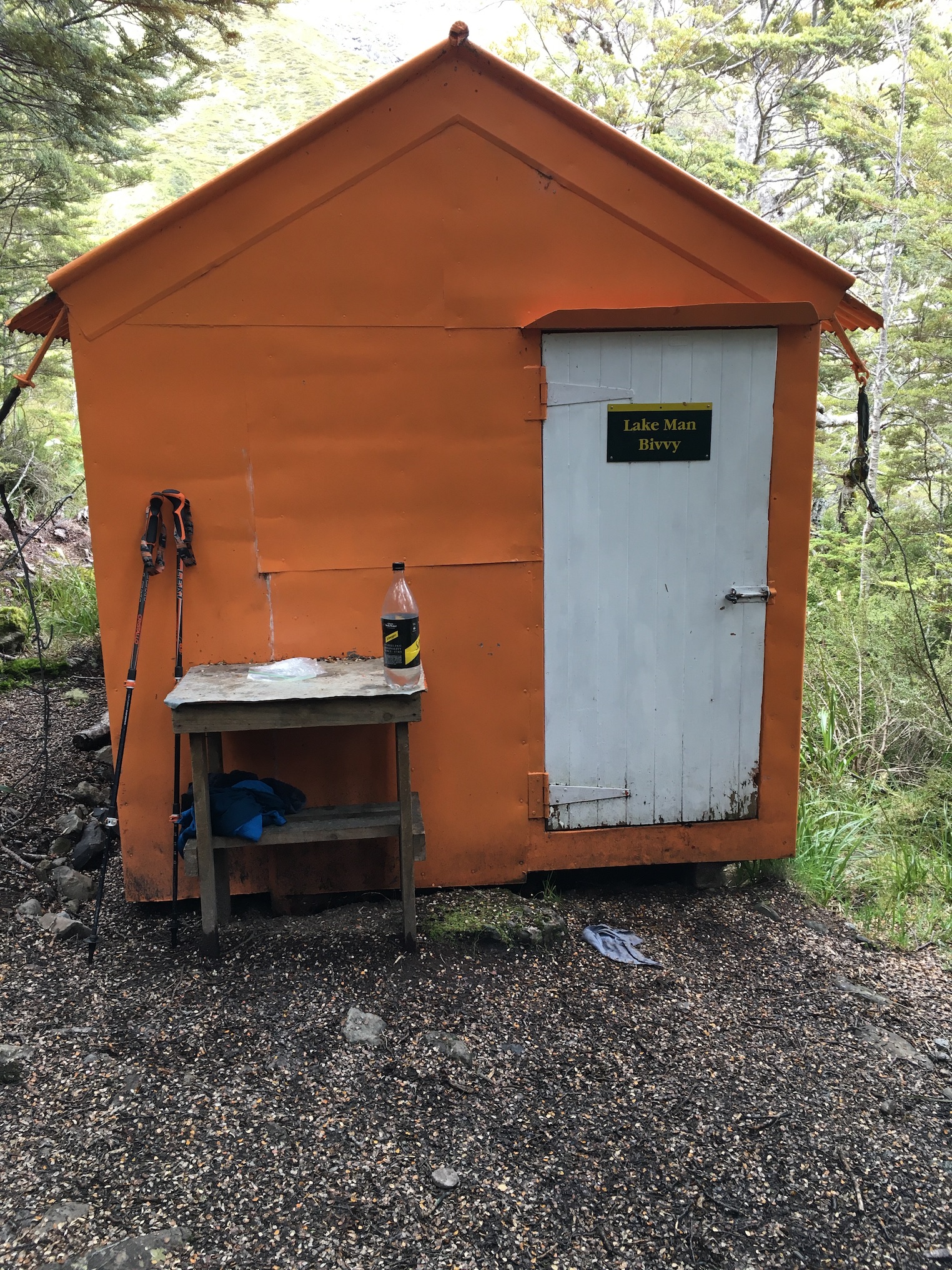
On day 3 we climbed up to Lake Man Biv—another 2-person hut, thankfully with a little more camping space nearby. Lake Man Biv is hobbit-sized. The door is about three-quarters height, and the bunks were so short, even 160-centimetre (5-foot, two-inch) me couldn’t stretch out on them. But in spite of its size, the biv is perfectly appointed, with a small table for cooking (complete with a drawer full of cooking and cleaning supplies) a set of tiny shelves, a fold-down bench, and an empty ammo box for additional seating and mouse-proof storage. Cords along the ceiling provide clothes drying space, and there are even clothes pegs fashioned from beech tree branches. The overall effect is a tidy, fully-functional space, in spite of its size.
After dropping our gear at Lake Man Biv, we hiked up to Lake Man, an alpine lake where we found our summer solstice snow and had a lovely lunch in the sun, surrounded by awesome alpine vegetation and some cool bugs.
After a cosy night in Lake Man Biv, we hiked out via the Doubtful River. The hike ended with a couple of crossings of the thigh-deep Boyle River and a long river-valley slog—easy hiking, but not terribly exciting.
The trip wasn’t our most strenuous ever, but after having spent the better part of the last six weeks sick, first with Covid, then with a nasty, lingering not-Covid, I was seriously out of shape and thankful for the relatively easy hike.