One of the first things we did when we bought our new property, even before we built the house, was to establish native plantings. Those plantings have grown spectacularly well, and many of the trees are four metres tall already.
Invertebrate life on the property has increased with the growth of our gardens. Our lush akeake attract katydids, the herb garden is alive with butterflies, native bees, and hover flies. Preying mantids stalk the flowers, snatching up prey. Jumping spiders of several species prowl among the foliage and rocks. And web-building spiders festoon the branches of nearly every plant.
But there are some notable absences. Species that aren’t good at dispersal.
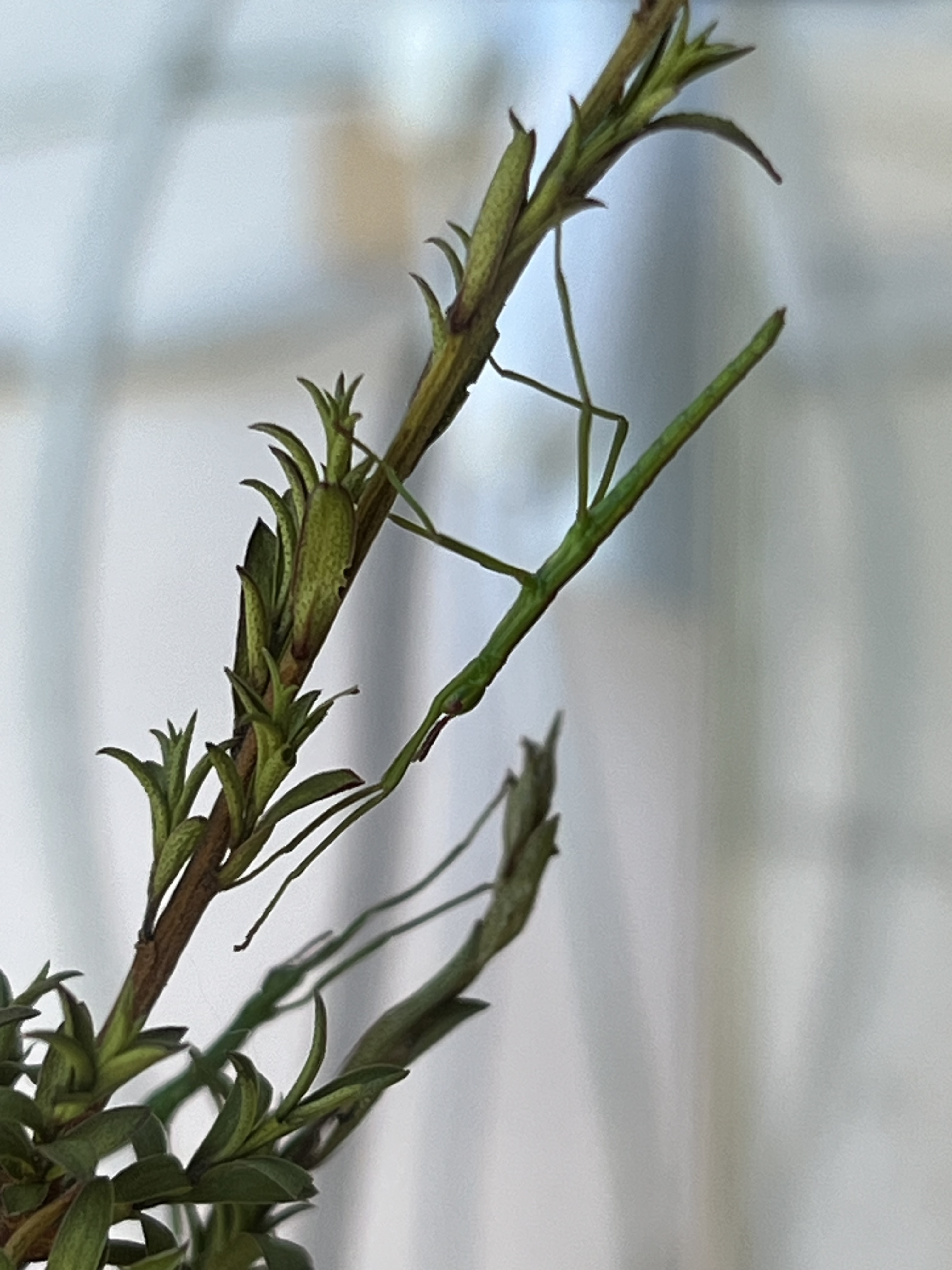
One of those absences is stick insects. Our common native species here in Canterbury are particularly fond of kānuka and mānuka. The kānuka we planted in our gardens has grown beautifully, but is completely devoid of stick insects.
But not for long …
I was recently gifted some stick insect eggs from a researcher who is studying them. I set them up in an aquarium with some kānuka branches and eagerly awaited their hatching. The researcher warned the eggs were a bit old and might not hatch, but over the course of a few days, seven successfully emerged (a few more died in hatching).
The seven stick babies are now happily munching kānuka in captivity. I’ll release them into our garden when they’re a little older and I’m more confident they’ll survive. For now, I’m enjoying watching them in their tank on my desk.
Stick insects are some of my favourite bugs. I love their improbable shape. I love their crypsis-enhancing behaviours—sitting with their forelegs stretched out in front to make them look even more stick-like, and swaying in the ‘wind’ when disturbed.
I also love the fact that many species are parthenogenic—the females can lay fertile eggs without mating with a male. In fact, there are some species of stick insect for which we’ve never found males.
This parthenogenesis is the result of a strange relationship many insects have with the reproductive parasite Wolbachia. Wolbachia is a genus of bacteria that is passed from female insects to their offspring. Because Wolbachia’s spread is only through the females of its host species, it’s in the bacterium’s best interest to eliminate males. It does this by a variety of methods, depending upon the strain of bacteria and the host species. The result is insects in which males are rare or nonexistent and females can reproduce parthenogenically. Its a cool and complex relationship that I find fascinating.
I look forward to establishing stick insects on our native trees. Hopefully my seven lovely babies will grow into a thriving population.
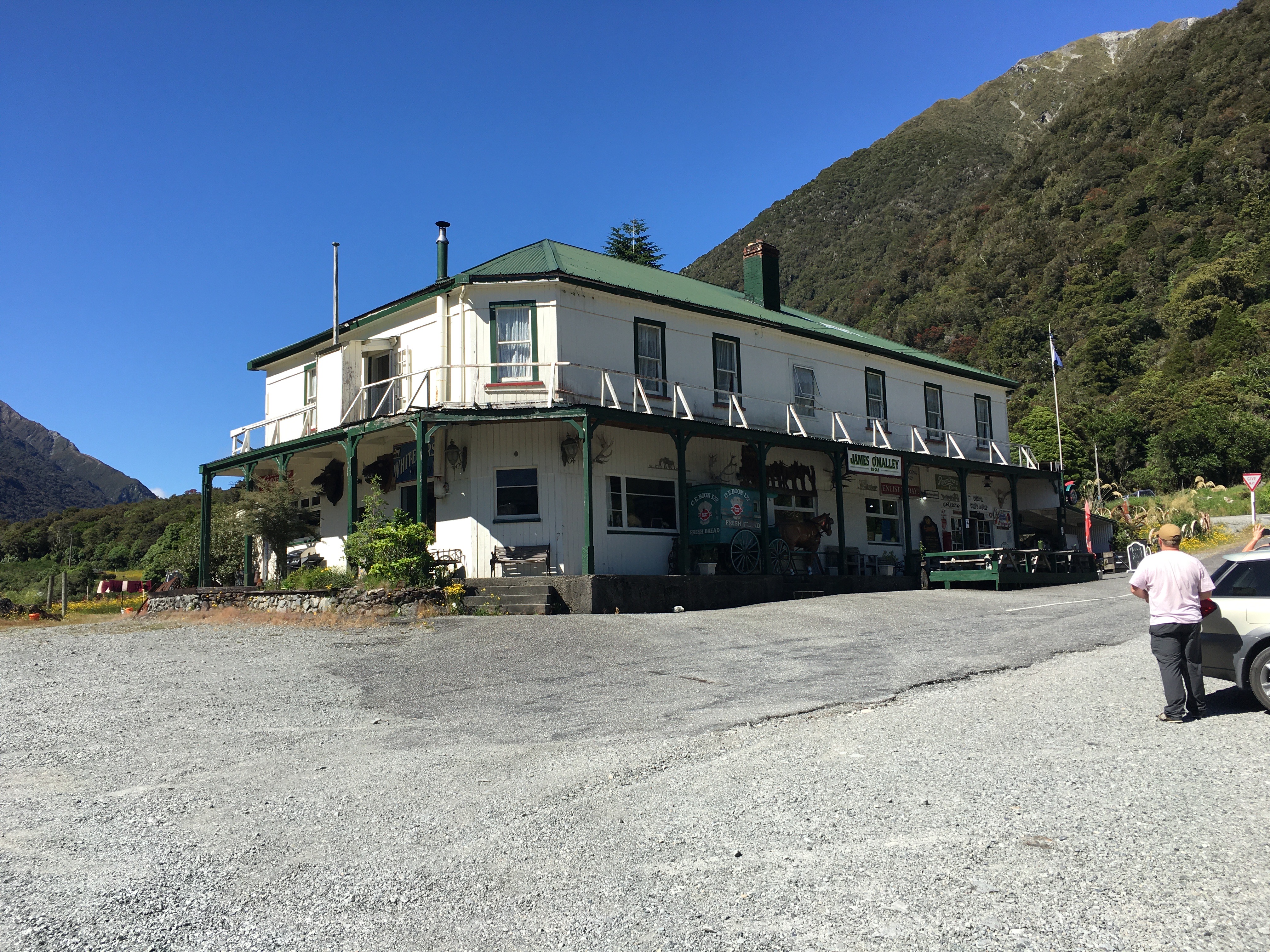
My husband and I spent Canterbury weekend on the West Coast. We stayed in Hokitika, because I had a market there on Sunday, but on Saturday, we drove down to Franz Josef Glacier.
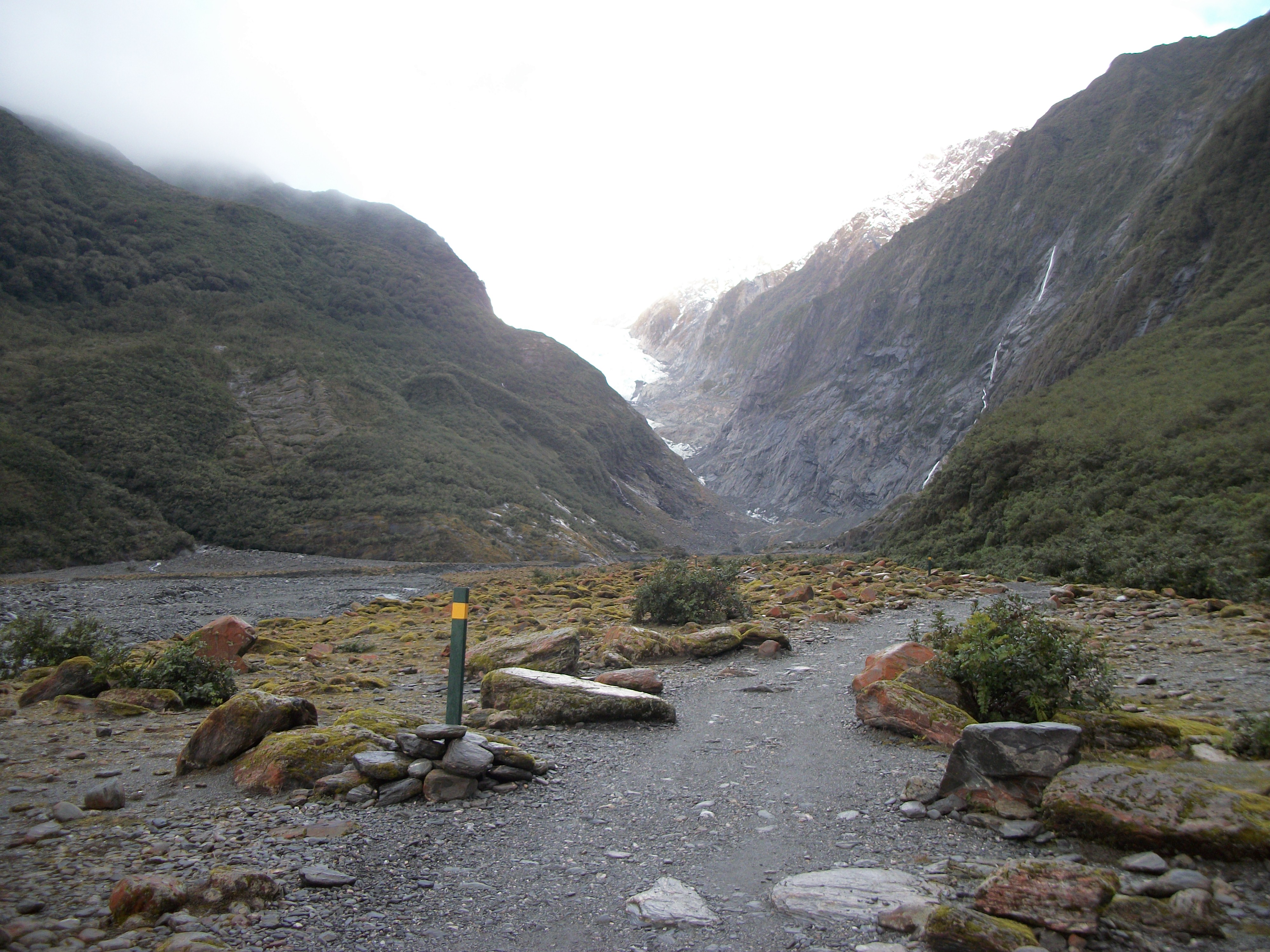
Franz Josef Glacier in 2009.
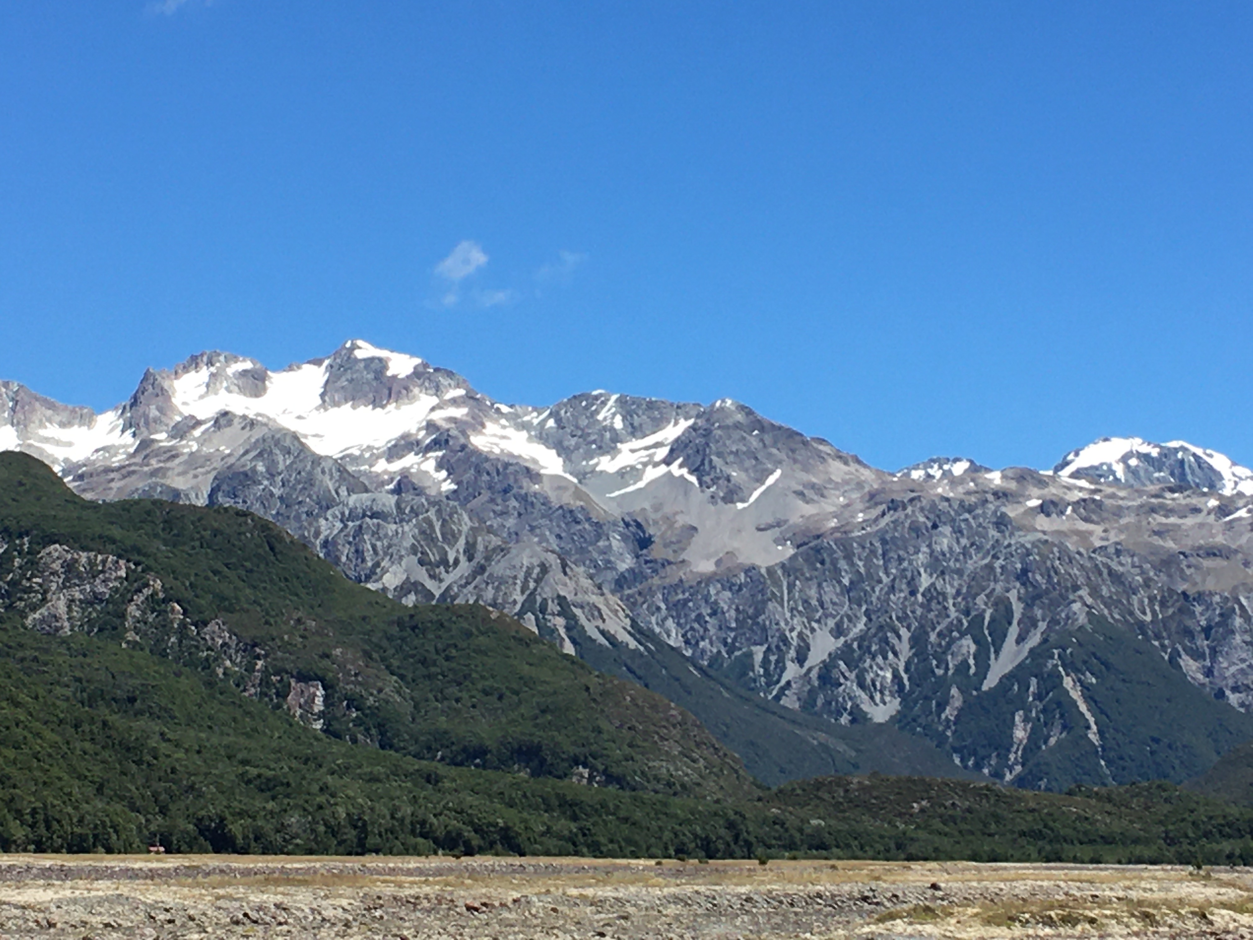
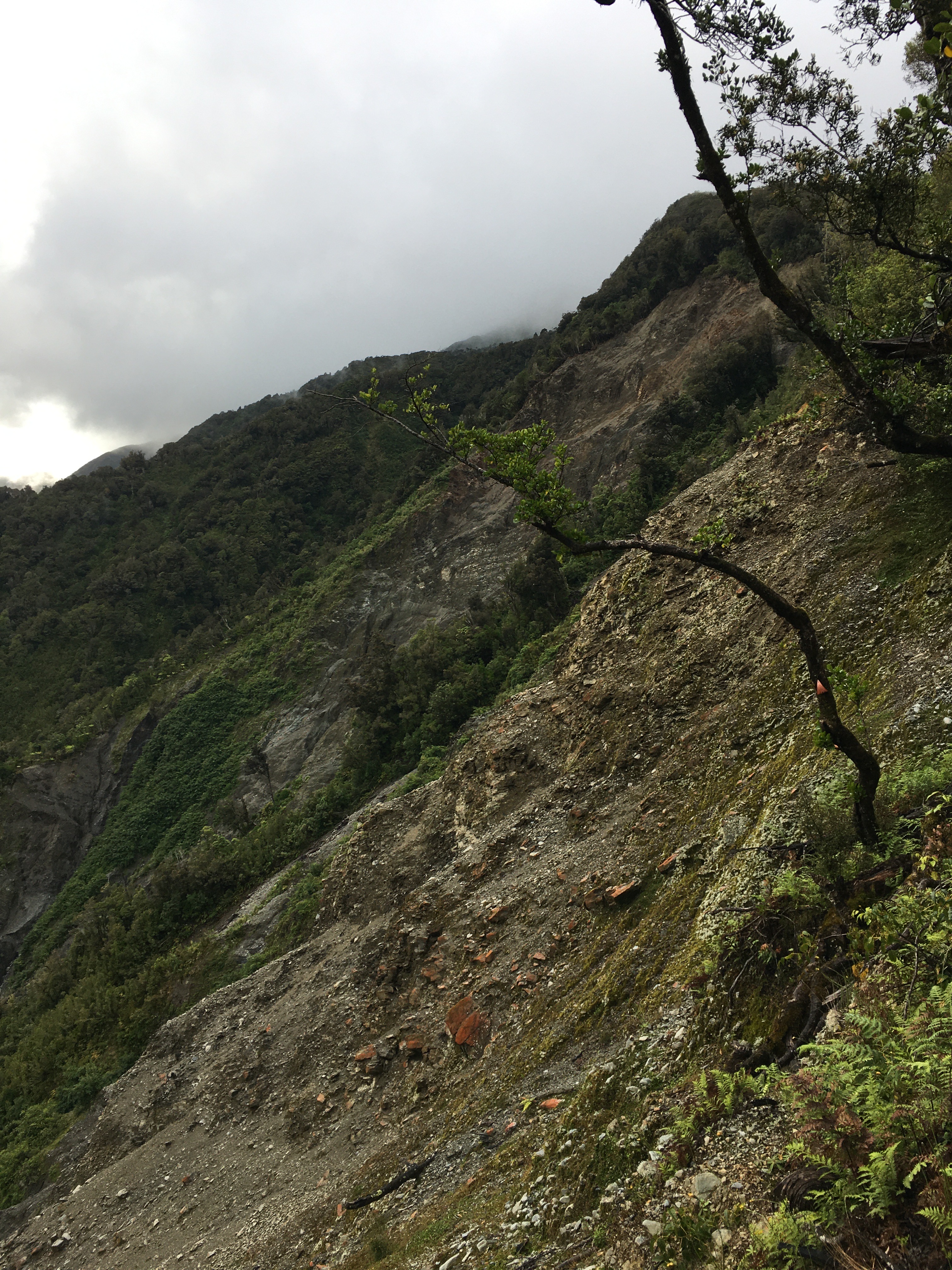
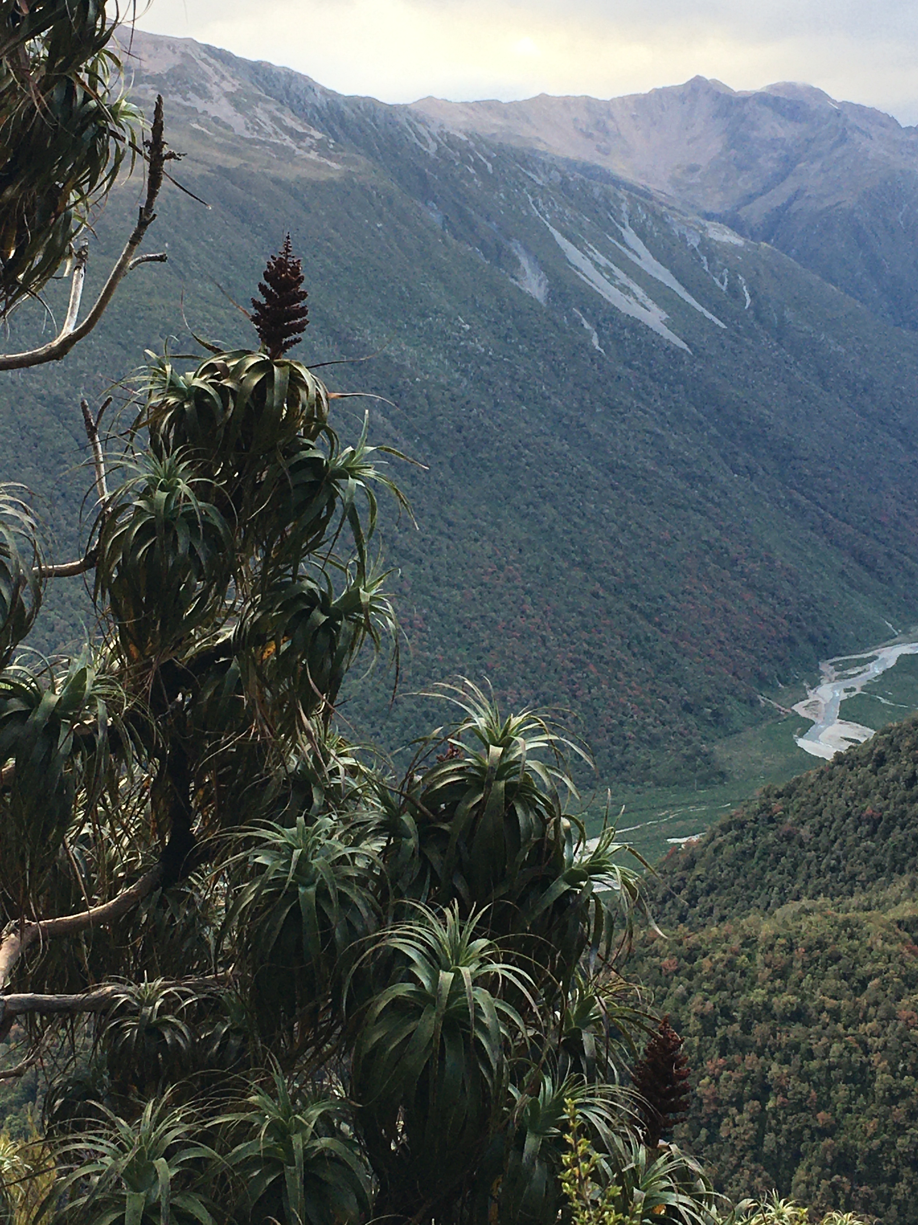
We hiked up to Alex Knob. This 17 km hike is a steady, occasionally steep climb of about 1000 metres. It’s not technically difficult, but it’s a good hike. It’s rated as 8 hours return, but we did it in about 5 1/2—it’s easy to speed on the way down. On our way up, we got glimpses of the glacier. Unfortunately, by the time we reached the top, where the view should have been spectacular, the whole top of the knob was in cloud, and a fierce wind was driving snow into our faces. Despite the wind, snow and cold, we tucked ourselves behind a tussock and had a snack, enjoying the sheer wildness of the weather, before driving hail hurried us down.
It’s been ten years since I’ve been to the glacier. What I saw on this visit was heartbreaking.
Sixteen years ago, I did some interpretation work for the Department of Conservation, researching and writing text for interpretive panels at Franz Josef Glacier and Fox Glacier. I also did some research around visitor behaviour at the glaciers and the effectiveness of various warning messages. At the time, the glaciers were easily accessible on foot. They were advancing and dropping deadly chunks of ice on visitors who ignored warning signs and crossed barrier ropes to get up close.
Franz Josef Glacier in 2015
Today, Franz Josef Glacier has retreated so far, it is not possible to walk to it. Ironically, the only way to visit the glacier these days is by helicopter—further spewing the greenhouse gases that are killing the glaciers.
There were thousands of tourists in Franz Josef Township last weekend, and the glacier carpark and tracks were crowded. Many of these tourists were here for the lure of New Zealand’s spectacular glacial landscape. New Zealand used to be the only place on earth where you could see glaciers reaching down into temperate rainforest. Today the glaciers come nowhere close to the forest, and soon there will be no glaciers left at all.
Franz Josef Glacier in 2025
There are many other wonders on the West Coast—the rainforest, the mountains, wildlife and beaches—but the loss of the glaciers is tragic, not just because of their natural beauty, but also because of their role in water storage and release. Their loss will have long term consequences for all of New Zealand.
It may be another decade before I go to Franz Josef Glacier. I hope there is still a glacier to see when I get there.
Anyone who knows me knows how much I love spiders. One of my favourite story books as a child was Be Nice to Spiders by Margaret Bloy Graham (never mind the subtle misogyny in this 1967 publication). Growing up, we called the big hairy jumping spiders in the basement “friend ‘pider”.
When I was bitten as a teen by a large wolf spider who’d taken up residence in one of my sneakers, my main concerns were: was the spider okay? (Yes, she appeared unharmed by me squishing my foot into ‘her’ shoe), and was wolf spider venom strong enough to do anything to humans? I was fascinated to find that, yes, my pinky toe, near the site of the bite, was paralysed for about fifteen minutes. Cool, right?
Having lived in Panama, a place with spectacular spiders, the relatively small and harmless New Zealand spider fauna was initially disappointing. But Aotearoa has some fun and quirky spiders. And though none of them rival the tarantulas and golden silk spiders in Panama, New Zealand wins the prize for the sheer volume of spiders. They seem to inhabit every nook and cranny here.
I’ve recently started a wee project to document the spiders on our property. Last Friday, I spent my morning tea break photographing a few.
One of the more common spiders I found on my stroll was the sooty orbweaver (Salsa fuliginata). Despite the name, these dainty arachnids are beautiful creatures, and quite variable in appearance. The three individuals in these photos were hanging out within 50 centimetres of one another—one brown, one rosy, and one yellow-hued. I always find them among the broad beans, capitalising on the heavy insect traffic around the aromatic blossoms.
The sooty orbweaver is native to Australia, and likely arrived in New Zealand from there around 2000.
Yesterday marked 15 years since the M7.3 earthquake here in Canterbury. I doubt there’s been a single day since then that I haven’t, at some point in the day, thought about earthquakes. I even sleep under a quilt inspired by the 2010 quake.
Working on the quake quilt. Wow! Look how little grey hair I had back then!
Earlier this year, I took a friend, who was visiting from overseas, to Quake City, the museum dedicated to our earthquakes in 2010-2011, which devastated Christchurch. I thought I would be okay visiting the museum, since the quakes were so long ago. But facing that exhibition, everything about those days, weeks, and months came rushing back. At one point, my friend turned to me and said, “You talk like this happened yesterday.”
It felt like it had happened yesterday.
The quakes changed me, changed everyone who was here at the time.
The quakes made me a New Zealander. In the aftermath, when communities were rallying together to help everyone, I realised that this was the place I wanted to be. When the world came crashing down, I wanted to be in a place where university students mobilised a massive volunteer force to dig liquefaction from people’s houses, where farmers airlifted food into the city, where ordinary people organised the collection and distribution of blankets and other homewares for people who had lost everything, where spaces left empty in the city by demolished buildings were turned into temporary parks and places of joy.
The Famous Grouse in Lincoln, post quake.
This week I got the beta reader comments back from my next book, Draconic Search and Rescue, in which the Alpine Fault ruptures, so earthquakes have been on my mind a lot. None of my beta readers experienced the Canterbury quakes—most of them hadn’t even been born yet. Writing the book, I worried that I would frighten my readers (8-13 year-olds are my target market) with a book about the Alpine Fault rupture. When it happens (and it will), the consequences for the whole country will be huge, and some towns are likely to be entirely destroyed. Researching for this book kept me awake at night, inspired me to be even more particular about my own earthquake preparedness, and reminded me that I’m not entirely crazy to ensure that, wherever I go, I’m prepared to walk home (hi vis vest and water bottle in the car, check, comfortable shoes, check, jersey, check).
But my beta readers wanted more danger, more fear. For them, it isn’t real. The rumble of a large truck doesn’t have them pausing to listen, make sure it’s just a truck. They don’t look for the emergency exits every time they enter a room. They don’t mentally assess the construction date of every building and consider whether it will collapse in the next quake.
So this week, I’m ratcheting up the danger in my book. Shoving my characters closer the destruction, maybe breaking a limb or two. And if I’m a bit jumpy for the next week or so, you’ll know why.
As though they know What I need When winter returns On the eve of bud burst, Magpies warble On fence posts In the dark.
Spring comes! Spring comes!
Ten years ago I posted a blog titled, It Ain’t Over ’Til the Magpie Sings. The post was prompted by the first morning that a magpie warbled for an hour before dawn. At the old house, where the windows weren’t double glazed, the magpies were my alarm clock in spring and summer, warbling an hour or so before sunrise, urging me up to do the milking and make the most of the day. It’s harder to hear them in our new house, where the double glazed windows deaden outdoor sounds, but I’ve been tuning into the magpies for years.
And I’ve discovered that the magpies are remarkably predictable. Ten years ago, I heard the first pre-dawn magpie song on August 8th. Today (the 8th of August) I heard the first pre-dawn magpie song of the year.
And just like that day a decade ago, the first magpie song was followed by a winter lashing reminding us that, while spring was on its way, winter was still in charge. Today’s weather forecast shows the temperature dropping from a 4 am high (a balmy 12.3℃) all day, to 3℃. We can expect rain and icy wind for the next couple of days.
I love hiking at any time of the year, but there’s something particularly enjoyable about winter hikes.
Part of that enjoyment for me is that it’s the only chance here in Aotearoa New Zealand to walk in snow, because it rarely snows at lower elevations. To get to snow, you’ve got to hike to it. (Yes, you can hike to snow even in summer, but it’s easier to do so in winter, and there’s more of it.)
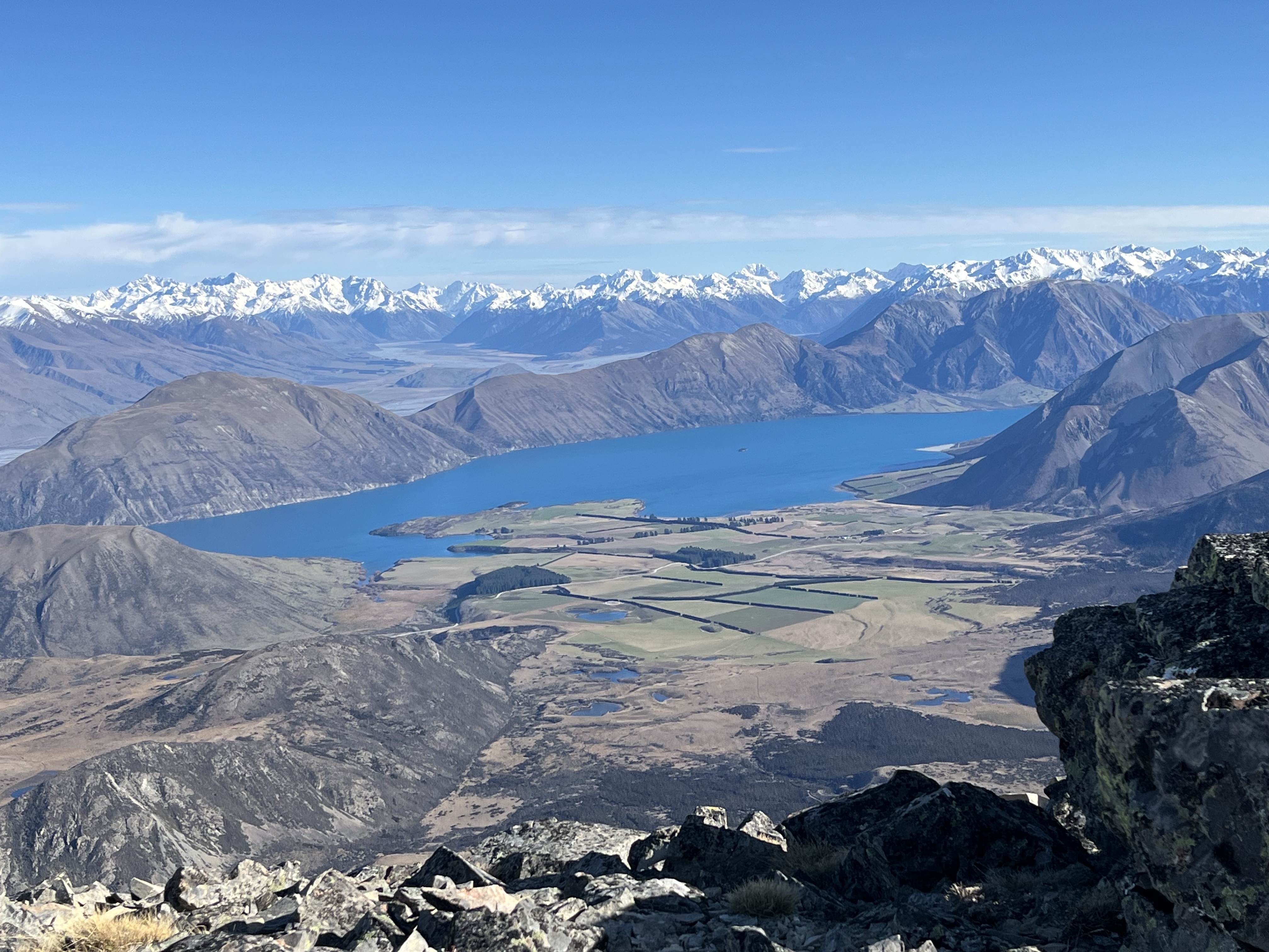
Last weekend, my husband, daughter and I headed to Red Hill, which sits between Lake Lyndon and Lake Coleridge. At 1640 metres, Red Hill is higher than nearby Porters Skifield, but lacks the snow making machines. So the snow was patchy, even at the top.
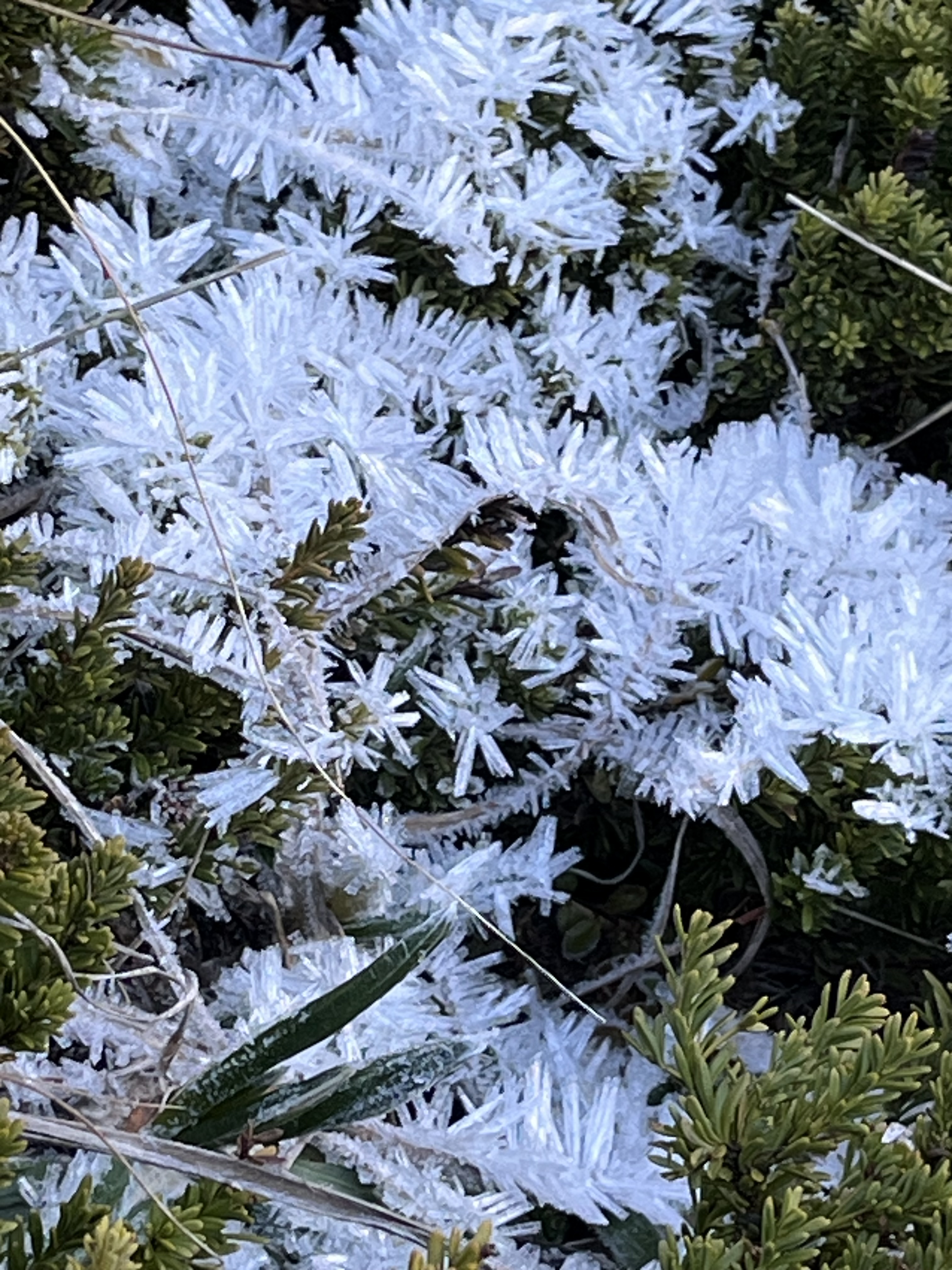
Still, winter hiking was in its full glory. On the way up, we hiked across crunchy frozen mud, pushed up by countless ice needles. We teetered on icy tussock mounds as we crossed a wetland. As we gained altitude, the wind increased and the temperature fell. We passed pockets of spectacular frost, with ice crystals so long, it looked like leaves. Snow in the shady hollows was wind sculpted and hard, more ice than snow.
By the time we hit the open tussock and scree-covered tops, the freezing wind was burning my cheeks, and I was thankful for my snood, which I pulled over my face to block the worst of the wind.
The view from the top was definitely worth the windburn. Winter mountains—covered in snow—stretched across the skyline. Down below us, the water of Lake Coleridge glistened blue in the sun.
The only bad part about winter hiking is that it’s often not pleasant to sit on the top for lunch, and last weekend was absolutely not a weekend to hang out on top of any mountain. After a quick look around and some photos, we hightailed it back down.
But one of the cool things about winter hiking is that, on a sunny day, you can start the hike in winter conditions, and end in spring or summer-like conditions.
Having donned all our warm layers at the top of Red Hill, we began shucking them as we descended. We went from thermals, jacket, hat and gloves to just t-shirts by the time we were back to the car. It was a balmy 17℃. Warm enough for a swim … according to our daughter. (We decided not to swim that day, but she did take a swim the following day after a hike with a friend.)
As someone with mediocre circulation, I struggle with overheating when I hike. I can be sweating, but still have numb fingers and toes, because my body doesn’t push the heat to my extremities. It turns summer hiking into a sweat-fest. But hiking during winter is much more pleasant. I can shuck my jacket to cool my core, but keep hat and gloves on to warm my extremities. It makes for a much more pleasant experience.
We’ve enjoyed some memorable winter hikes: Cragieburn under a freshly fallen 15 centimetres of fluff, a trek to Woolshed Creek Hut in fresh calf-deep snow, followed by barefoot wading in the stream at the top, a winter wonderland of wind-sculpted ice atop Mount Isobel … Winter landscapes are spectacular.
Hopefully, we’ll get out for a few more hikes before the end of winter. Gotta enjoy the snow while it’s there!
Four weeks from the Tamariki Book Festival, and my life has been taken over by festival preparations. We’re thrilled to have 14 authors and illustrators attending the festival this year, writing everything from picture books to young adult novels.
This year’s theme is Books Take Flight, and we’ve collaborated with the Air Force Museum of NZ to bring festival goers all sorts of fun flight-themed activities and prizes.
With so many participating authors and fun activities, we’ve nearly outgrown our space in Tūranga. So this year, we’re running our workshops on Saturday 12 July, and the festival on Sunday 13 July.
If you’re in Canterbury, with kids ages 3 to 17, I highly recommend checking out the festival and festival workshops!
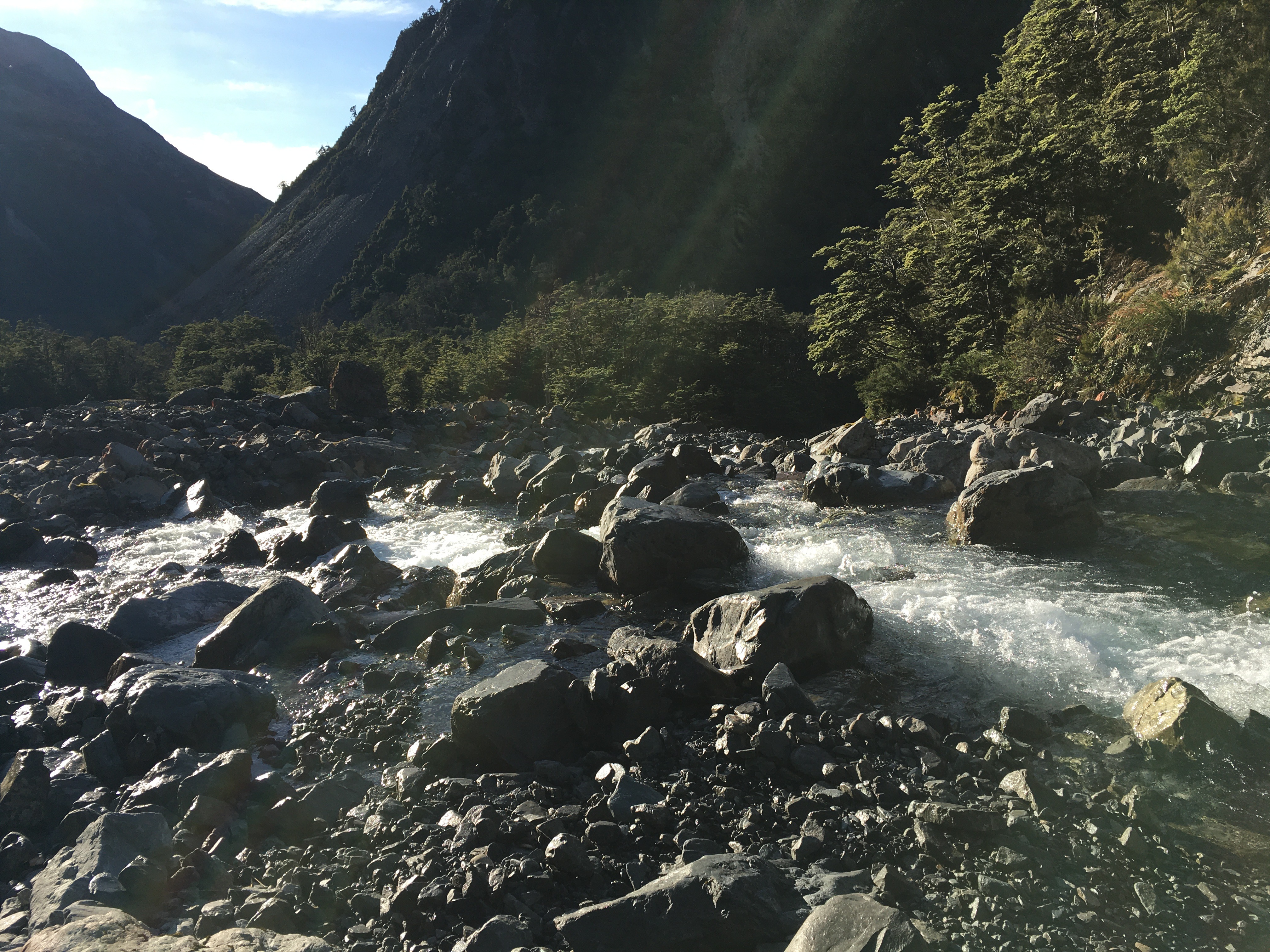
Last weekend, my husband and I got out for a tramping trip in the Two Thumb Range, in Te Kahui Kaupeka Conservation Park. We parked on Rangitata Gorge Road at Forest Stream, then slogged two hours up the road to Bush Stream—not a very exciting start, but better then than at the end of the tramp. We followed Bush Stream Track up the stream to Crooked Spur Hut. The stream flows through some pretty spectacular scenery, and you ‘get’ to cross the stream quite a few times before a steep climb to the hut.
Crooked Spur Hut is one of several historic musterer’s huts in the area. It’s old and the walls are full of holes and rats. We opted to sleep in the tent, but we hung out in the hut, since we had it all to ourselves.
Kea on a cold tin roof.
On the approach to the hut, a kea came to investigate, watching us climb the hill. It must have invited its friends later, because shortly after dark, while I was reading in the tent, I heard the thump-thump-thump of a couple of kea bouncing around outside. I shooed them away, knowing their penchant for mischief, and eventually they got the hint and left.
But by morning the kea had mustered reinforcements. They started about 4 am, thumping around outside the tent, plucking at the tent strings, and calling loudly right by our heads. By 5 am, we were up out of a sense of self-preservation, retreating to the hut to start our day.
When I stepped out of the hut a few minutes later, there were three kea, each one working on pulling out a tent stake, and more calling in the darkness beyond. We quickly took down the tent in the dark, before the kea tore it to shreds.
We got the billy boiling to the sound of kea on the tin roof. They seemed to have multiplied. The noise was deafening, and grew louder as dawn approached. Our trips out to the loo were accompanied by no less than three kea, who then sat on the loo roof, peering in through the skylight to watch the show.
Returning from the loo, I counted fifteen kea, most of them on the hut roof, picking at the roofing nails (which thankfully had been replaced with non-leaded ones, because the old lead nails kill kea), and sliding down the tin. It was the most kea I’d ever seen at once. And as obnoxious as the cheeky buggers are, it was the highlight of the trip.
Leaving the kea behind, on day two, we hiked up from the hut through frosty tussocks to a scree-covered saddle where we were treated to some new spectacular scenery—tussock, scree and craggy peaks all around. At Swamps Stream we scared up a herd of 28 tahr—a non-native pest, but cool to see nonetheless. We arrived at Stone Hut at lunchtime, and had a lovely meal next to the stream before carrying on to Royal Hut.
Interior of Royal Hut.
Royal Hut is similar in age and condition to all the old musterer’s huts, but has the distinction of having been visited by royalty. The accounts I’ve found differ in the details—it was either in the 1960s or in 1970, and the royals involved were either Prince Charles and Princess Anne, or Prince Charles and Princess Diana (Diana being highly unlikely, given the date range suggested for the event).
In any case, it is said the royals zipped in by helicopter for a ‘brief’ visit. I doubt they spent the night. With mice scrabbling over our packs within 15 minutes of our arrival at the hut, we opted for the tent again.
Frost heave on the track, with 4 cm-long ice needles.
The morning of day three was fine and frosty (with frost inside the tent!). The DOC signage indicated we had an 11-hour hike to the road, and with daylight only being 11 hours or so long at this time of year, we made an early start, as soon as it was light enough to see the track.
We warmed up quickly, with the first leg of the day being a climb to Bullock Bow Saddle.
By the time we reached the saddle, I knew I’d pushed too hard over the previous couple of days—my left knee was stuffed, and hurt with every step.
It was a loooong 14 or 15 km from there to the road—the first few kilometres steeply downhill, then a long slog down the Forest Creek riverbed.
Still, we made it to the car well before dusk, and enjoyed more spectacular scenery (and a few more river crossings) along the way.
Overall, a fun long weekend! Spectacular views, awesome wildlife, and some real character huts. And the weather couldn’t have been better.
Our daughter wanted to go to the west coast for professional reasons (to photograph mosses for a project she’s doing), so my husband and I happily agreed to accompany her for a weekend getaway.
We left Friday evening, stopping at Lake Pearson (Moana Rua) for a lovely picnic dinner, and then carrying on over the mountains to camp at Goldsborough Campsite near Kumara. We pulled into the campsite around eight o’clock and set up camp. With the light already fading, we decided to wander up one of the tracks that followed old gold mining tracks through the bush.
Old mining water race tunnelling through the hillside
We started up German Gully Track, thinking we’d just go up a little ways, then return. The track passed an old mining water race that looked like a cathedral-shaped tunnel as it snaked steadily up the hill. Soon we were close enough to the end of the track that, of course, we had to finish.
We popped out onto a broad, modern gold mining road. The sign at the road indicated that we could either return to the track the way we came (30 minutes, according to the sign), or return via Goff’s Track (65 minutes). It was 8.55 pm. To take Goff’s Track would, theoretically, have us arriving back at the campsite at 10 pm. After ascertaining we all had our head torches with us, we powered up the road towards Goff’s Track.
German Gully track–an old mining road
The west coast was unusually dry, for which I was glad as we picked our way down Goff’s Track in the gloom—while most of the track was easy going, the steeper sections would have been slick and no fun in low light.
Knowing we were racing the light, we kept the pace up, and didn’t even need to use our torches, arriving back at the campsite around 9.30. A nice little evening hike!
The following day, we got an early start and hiked up Mount French, near Lake Brunner. None of the track descriptions have much to say, except that the hike is a steady climb of over 1000 vertical metres. Telling, however, are the listed track length and times: 7 km return, 8 hours return. That’s a walking speed of only 875 metres per hour.
View from the top of Mount French towards the Tasman Sea
We did slightly better, making the 3.5 kilometre trip to the summit in 3 hours forty-five minutes, for a walking speed of 933 metres per hour. Most of the hike up is through dense west coast rainforest, so other than the forest itself, there’s not much to see. When we hit the alpine vegetation near the top, the views opened up and it was spectacular. At first we were a little worried we’d struggle to find our way across the multiple false peaks to the actual summit, because clouds obscured the tops. In hindsight, I’m glad the cloud was there, because when it did clear and we finally got a view of the summit, I was disappointed at how far away it still was. LOL! Though the elevational change from the bottom to the top is officially a bit over 1000 metres, there are several significant dips along the ridge, so I suspect the actual amount of climbing you do to reach the summit is more like 1200 metres.
Looking back down the ridge from the summit of Mount French
But we made it, and by the time we were on the summit the clouds had cleared entirely. We had stunning views to the Tasman Sea on one side, and to the mountains on the other. Lake Brunner glittered in the sun far below us.
We had lunch on the peak and spent a good bit of time enjoying the view and exploring the plants and insects at the top before tackling the descent.
Lake Brunner seen from the summit of Mount French
Going down was faster than going up, and we reached the car shortly after 3 pm, hot and sweaty and ready for a swim. After a quick dip in Lake Brunner, and a change of clothes, we headed to Hokitika for dinner and a short stroll on the beach.
All of us were in bed and asleep early Saturday night.
Sunday, we packed up camp and headed to Lake Kaniere to hike the Lake Kaniere walkway. We’ve done part of this walk several times. It’s a mostly flat, well maintained track that follows the entire western edge of the lake. There are multiple stony beaches to stop at along the way, and amazing lowland rainforest vegetation.
A reflective early morning Lake Kaniere
On Sunday, it was also really hot (28 degrees by early afternoon). And even on the flat, we were sweating. My husband turned back about a third of the way into the hike, in order to drive the car to the end of the one-way track. My daughter and I continued on, stopping for a quick skinny dip at Lawyer’s Delight beach, before meeting my husband walking back towards us from the far end, about a kilometre from the end of the track.
Carové’s giant dragonfly at Dorothy Falls
We had lunch, a stop a Dorothy Falls, and another swim in Lake Kaniere, then headed home.
The entire weekend on the west coast was hot and sunny, so it was a bit of a shock to hit Porter’s Pass and drive into drizzle and 12 degrees. It was a chilly 15 at home under overcast skies. Poor Canterbury—this summer has been anything but summery here. It’s no wonder the west coast was absolutely packed with vacationing families.
And now I have one week left before returning to the day job. My summer to-do list is getting shorter, but I will definitely not accomplish everything on it. But it’s been a good summer for getting out and hiking, so I can’t complain. Now I just need to knuckle down and get some writing in while I can.
This year was something of a milestone—it was the first year in about 16 that we didn’t do a pre-Christmas backpacking trip with the kids. It was bound to happen sometime soon, since the kids are all grown up now and doing their own things.
Instead, my husband and I had a post-Christmas hike all on our own. Let me say right now that I loved tramping with the kids, but doing the Christmas hike with just my husband was REALLY nice—just like old times … except that we’re a lot older. It was nice hiking at 54-year-old pace (instead of being dragged along by impatient 20-something kids), and we could also go places that appealed to us, without considering if the kids would enjoy it.
So we stayed relatively close to home, but took a route we hadn’t ever explored.
Day one began with dropping a car at the far end of our hike, near Kelly Creek. There was a bit of faffing around to charge the electric car (with the charger in Arthur’s Pass out of order, and the one in Otira busy), but it gave us an excuse to have a coffee at the Otira Hotel, which is an experience of its own.
Then we drove back to the Waimakariri River, parked car number two at Klondyke Corner, and hiked up the Waimakariri to Carrington Hut.
This hike is a bit of a slog and involves crossing the river a couple of times. In fact, the first river crossing comes within the first five minutes of hiking, which was fine—we were going to spend four and a half days walking rivers. There was no way we were going to have dry feet.
In spite of the dull nature of the actual hiking up to Carrington Hut, the scenery is fabulous, and only improves as you go further up the watershed. We were lucky to have a tern hunting the river alongside of us for a while, and we scared up a pair of banded dotterels, too.
After passing Anti Crow Hut, we left the riverbed to follow a track over a couple of roche moutonnée—rocky mounds left behind by glaciation. A series of tarns on the mounds give them a magical sort of quality, and the short break from river walking is nice.
The last time we were at Carrington Hut, it was incredibly crowded and unpleasant, so we carried a tent this time, just in case. But the 36-bunk hut housed only five of us that night, and we barely saw one another.
Day 2, we hiked over Harman Pass—up the Taipoiti River (click here for a video), then down Mary Creek. Again, the first act of the day was crossing a river, and then it was river crossings all day, back and forth across the Taipoiti as it rushed through a narrow valley which at times could be more properly called a gorge. It was another fabulous day, weather-wise, and the scenery was spectacular. So were the alpine plants. It seemed like EVERYTHING was in flower, and it was a slow hike up to the pass, because we were photographing all the way.
At the pass, we took a little jaunt up to see some tarns higher up, and then hung out for a while with a curious kea (click here for a video). Kea are an odd mix of highly endangered (there are 1,000-5,000 of them left), and incredibly pesky, thanks to their intelligence, curiosity and a beak shaped like a giant can opener (their peskiness is unfortunately part of the reason they’re endangered). The world’s only alpine parrot, it’s common to encounter them at elevation near Arthur’s Pass, but it never gets old.
Mary Creek was more of the same—river crossings, beautiful scenery, endangered birds. We spent some time watching a pair of whio (blue ducks) having a nap on a rock in the middle of the stream. There are only 3000 whio left and unfortunately the population is skewed strongly to males, because females are vulnerable to introduced predators when sitting on the nest. We were lucky enough to encounter two pairs on our trip.
After a 3-wire bridge crossing at the bottom of Mary Creek, we arrived at Julia Hut. The hut is relatively small, and with another couple there already, we decided to tent. After setting up the tent and settling in, we had the rest of the sunny afternoon to explore. A natural hot spring was our destination. Only five minutes walk from the hut, next to the icy, swiftly flowing Julia Creek (click here for a video), the hot pool did not disappoint. It was initially too hot to sit in, and we had to redirect some river water into it to temper the heat.
After a sweaty hike, I have to say I wasn’t all that interested in sitting in a hot pool, but I took a dunk in the river first, and then the hot pool was pretty nice. You couldn’t fault the setting—two days hike from a road, on an absolutely stunning mountain stream in the bush. It beat Hanmer Springs by a mile!
There is clearly a lot of geothermal activity in the area—the smell of sulphur was prevalent all along Julia Creek—and I suspect if you fossicked around, you’d find more hot pools.
Day 3 was a lot of river walking (again), punctuated by a couple more three-wire bridges. We hiked down Julia Creek and the Taipo River to Dillon Hut. Well, we intended to stay at Dillon Hut, but when we arrived we were informed by a very cute four-year-old that there were ‘no more mattresses’ (Dillon hut is only a 2-hour hike from the road, and is clearly a great destination for a short family hike). So we moved on to Dillon Homestead Hut, just 500 metres down the track.
Dillon Homestead Hut is just that—an old homestead. Built of hand-hewn timber and clad in whatever the original owners could scrounge, it is quite the historical experience to spend the night there. It’s clearly beloved by local four-wheel drivers and dirt bikers, but is in sore need of some upkeep. Still, it was shelter when the skies opened up and dumped rain all night, and if it had been cold, there was a big open fireplace surrounded by three tatty, 1950s-era armchairs. And once you brushed the rat droppings off the sleeping platforms, tables and chairs, it had everything you needed to spend the night.
Fortunately the rats weren’t as active inside the hut as I had feared, and we spent a reasonably comfortable night (if a bit smelly) in the hut. In the morning, however, I trudged out to the long drop through soaking wet, waist-high grass. The loo is as old as the hut, and was stocked with three mouldy, rat-poo-festooned rolls of toilet paper. I didn’t stop to investigate the myriad spider webs (there may have been some interesting native spiders), but in retrospect I should have inspected my surroundings a bit more. Leaving the door open for light and ventilation, I dropped my pants to do my business.
A scuttling overhead was all the warning I got before a rat leapt out of the rafters and landed on my head. I may have sworn. But the four-letter word had barely left my lips before the rat was off again, leaping for the toilet seat and then the floor before racing off into the bush.
So, a warning to you—the Dillon Homestead Hut loo is guarded by an attack rat.
After that exciting start, the rest of Day four was a hard climb. From Dillon Homestead Hut, we followed Seven Mile Creek briefly to a track that climbs steeply through dense west coast forest up to the Kelly Range. It was dark and humid in the forest. At one point, the track passed through a narrow gorge that was almost tunnel-like. It felt like we were crawling uphill, and often it was literally true, as it took both hands and feet. Pīwakawaka kept flitting around us, taunting us with their darting flight and chittering voices—what was so difficult about this slope, they seemed to ask.
At one point, the track met a huge slip hundreds of metres across and hundreds of metres tall. A blaze remained on a lone tree suspended at the top of the slip. The rerouted track scrambled precariously around the top of the slip, and I breathed easier once we were past it.
After 700 metres of elevation gain, we reached tree line and got a view back down to where we’d come from that morning—it was a long way down, and we still had more climbing to do.
The tops were dotted with tarns, and even where there wasn’t standing water, it was wet. We walked through fields of sundew plants, and took our breaks amid alpine orchids and daisies.
Clouds prevented us from having great views, but turned the views we did have into a dramatic, ever-changing landscape. By the time we’d reached the top of our climb—a thousand metres above Dillon Homestead Hut—the clouds were swirling around us.
A relatively short descent brought us to Caroll Hut just as the first raindrops began to fall. We had a late lunch of soup and peanut butter crackers as the wind picked up and the rain lashed the hut.
We shared Caroll Hut with a UK expat who lives in Wellington, a pair from Whanganui, and a fellow from Adelaide. It was a great mix, and we had a nice afternoon and evening chatting with them all. The best of hut life.
All night the wind howled, and I was thankful for the steel cables tethering the hut in place. Although the rain ended before dark, the wind continued through to morning, so it was a cold and windy start to Day 5. An early morning treat at the hut was a family of weka with fluffy chicks fossicking around the hut.
Day 5 was a short (hour and a half) jaunt out to the road from Caroll Hut. The ‘jaunt’ involved a good 800 metre elevation change, steeply downhill, but not bad going, with some nice views from time to time. And just when we thought we were done with wet boots, there was a stream crossing in the last 20 metres.
We were home by lunchtime, wet and tired, but having had an excellent five days. It was a fabulous way to spend the Christmas-New Year gap.