West Coast Weekend

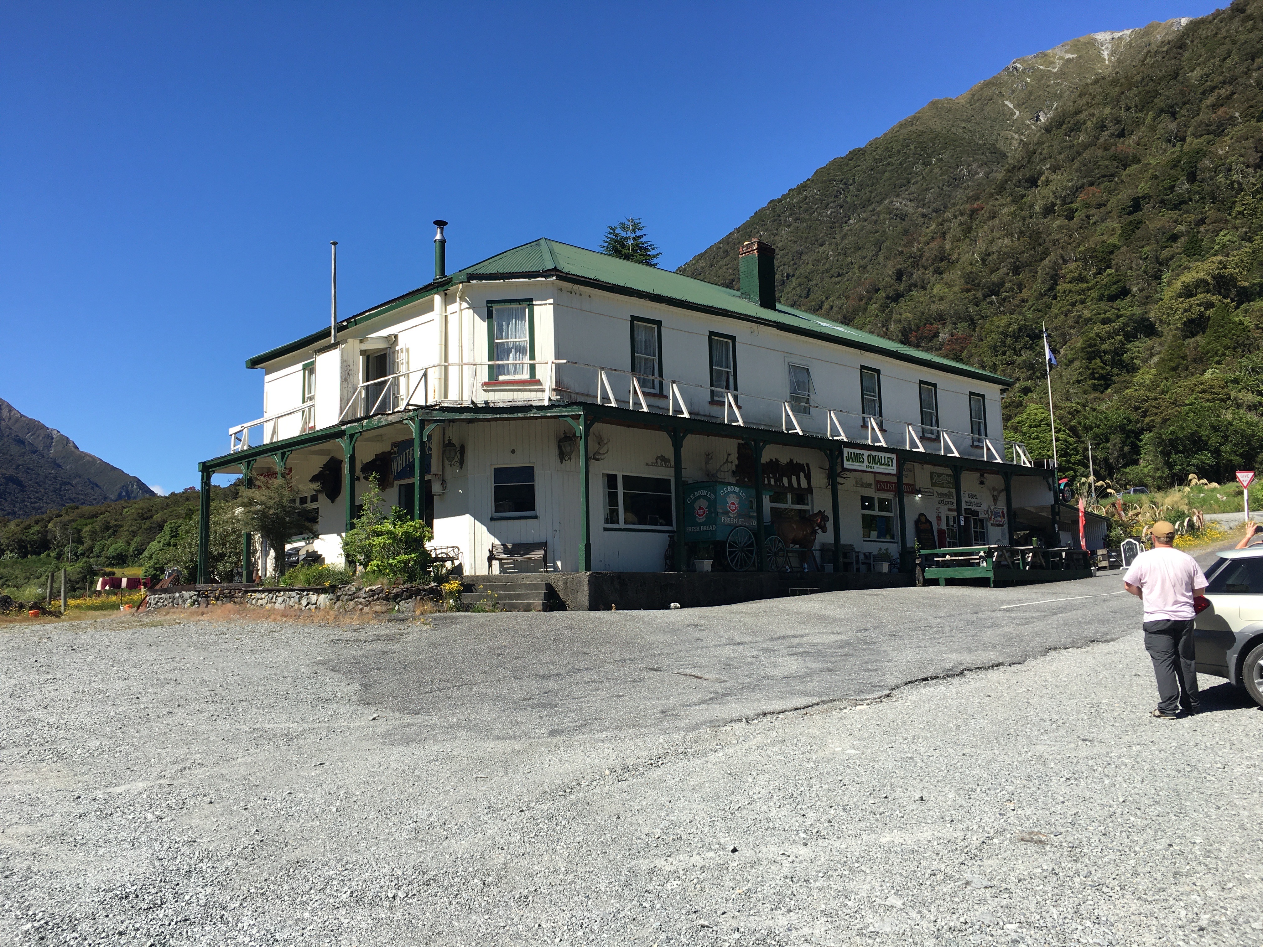
Our daughter wanted to go to the west coast for professional reasons (to photograph mosses for a project she’s doing), so my husband and I happily agreed to accompany her for a weekend getaway.

We left Friday evening, stopping at Lake Pearson (Moana Rua) for a lovely picnic dinner, and then carrying on over the mountains to camp at Goldsborough Campsite near Kumara. We pulled into the campsite around eight o’clock and set up camp. With the light already fading, we decided to wander up one of the tracks that followed old gold mining tracks through the bush. 

Old mining water race tunnelling through the hillside

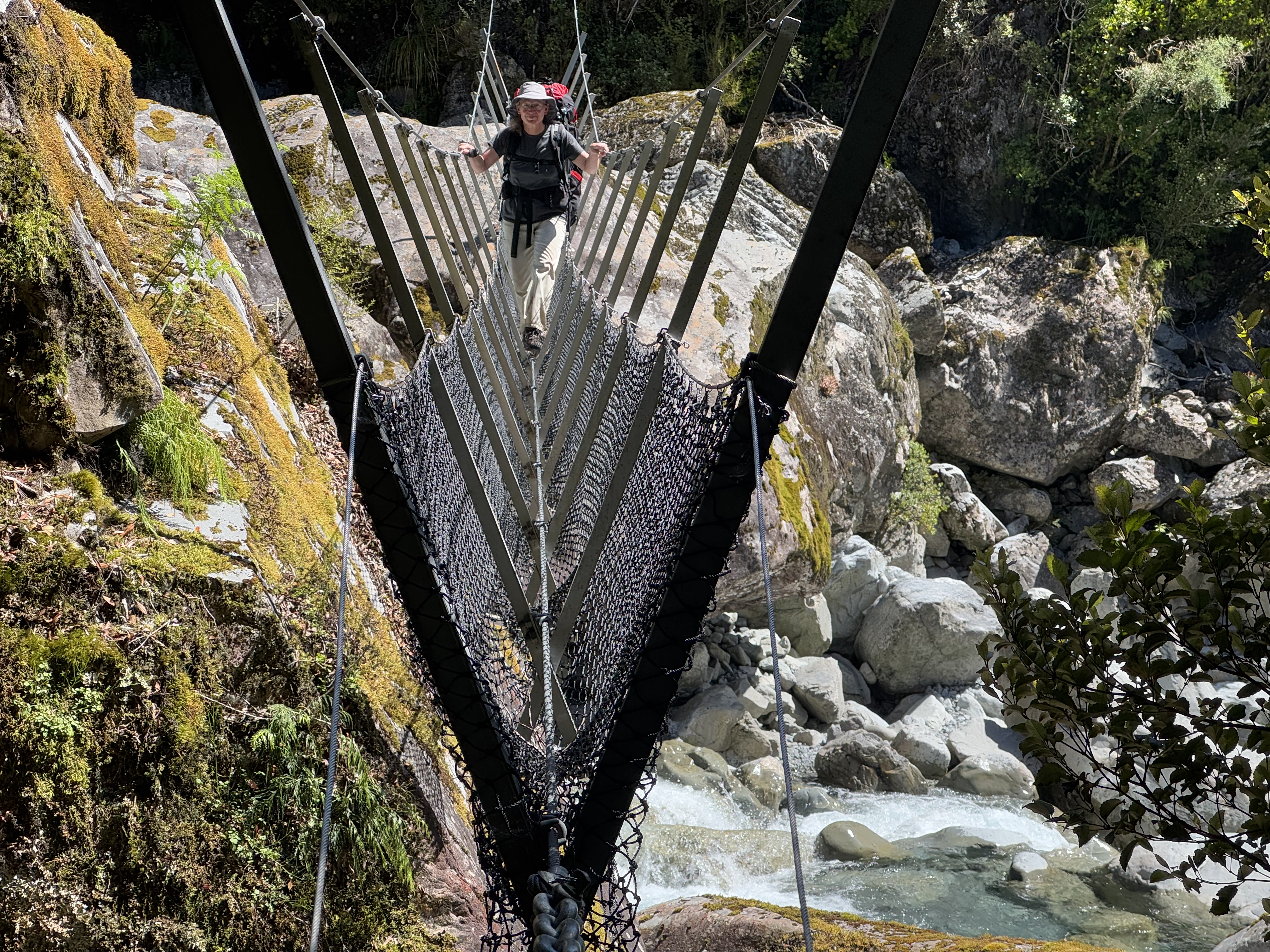
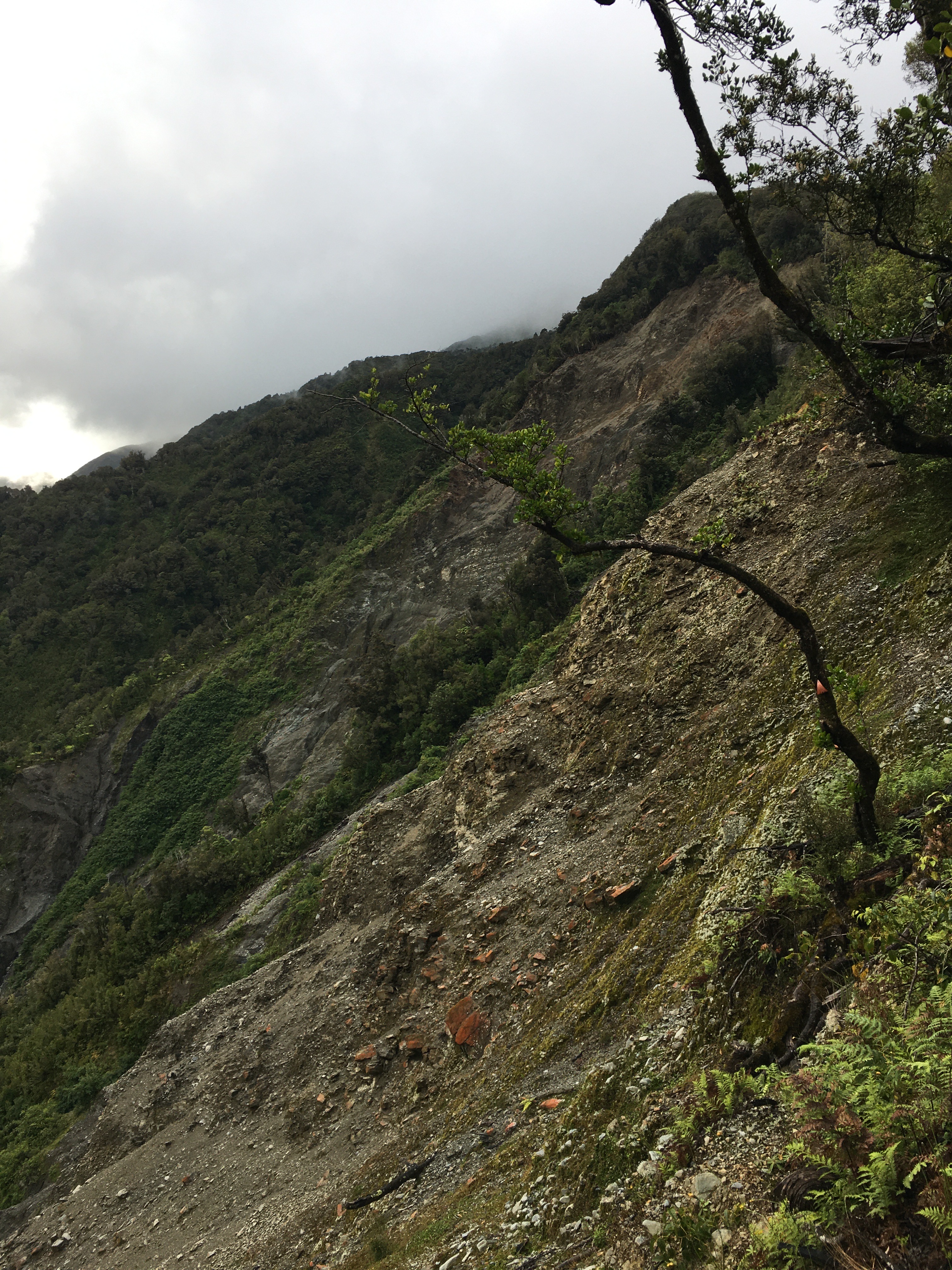
We started up German Gully Track, thinking we’d just go up a little ways, then return. The track passed an old mining water race that looked like a cathedral-shaped tunnel as it snaked steadily up the hill. Soon we were close enough to the end of the track that, of course, we had to finish. 

We popped out onto a broad, modern gold mining road. The sign at the road indicated that we could either return to the track the way we came (30 minutes, according to the sign), or return via Goff’s Track (65 minutes). It was 8.55 pm. To take Goff’s Track would, theoretically, have us arriving back at the campsite at 10 pm. After ascertaining we all had our head torches with us, we powered up the road towards Goff’s Track.

German Gully track–an old mining road

The west coast was unusually dry, for which I was glad as we picked our way down Goff’s Track in the gloom—while most of the track was easy going, the steeper sections would have been slick and no fun in low light.

Knowing we were racing the light, we kept the pace up, and didn’t even need to use our torches, arriving back at the campsite around 9.30. A nice little evening hike!

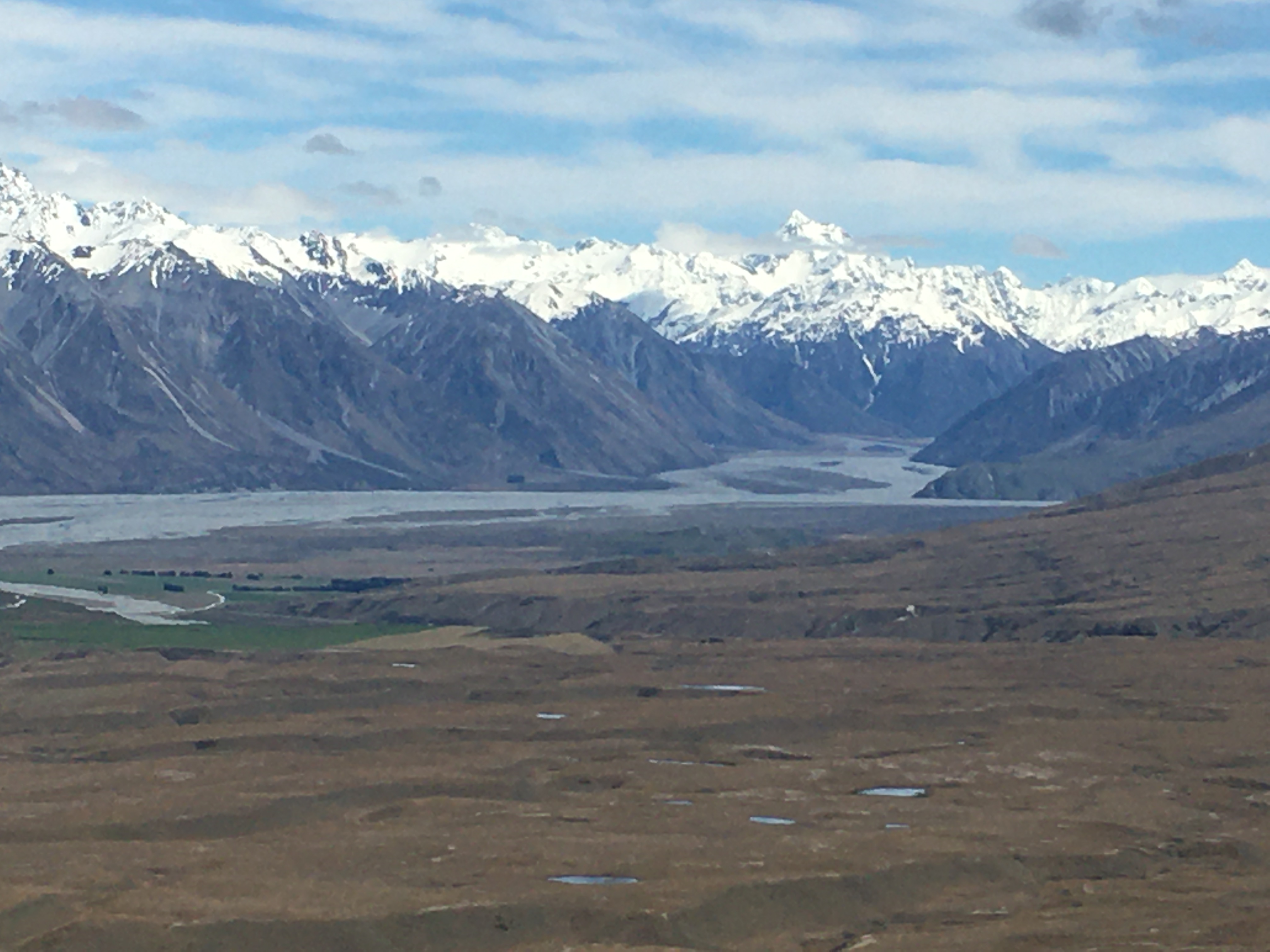
The following day, we got an early start and hiked up Mount French, near Lake Brunner. None of the track descriptions have much to say, except that the hike is a steady climb of over 1000 vertical metres. Telling, however, are the listed track length and times: 7 km return, 8 hours return. That’s a walking speed of only 875 metres per hour. 

View from the top of Mount French towards the Tasman Sea

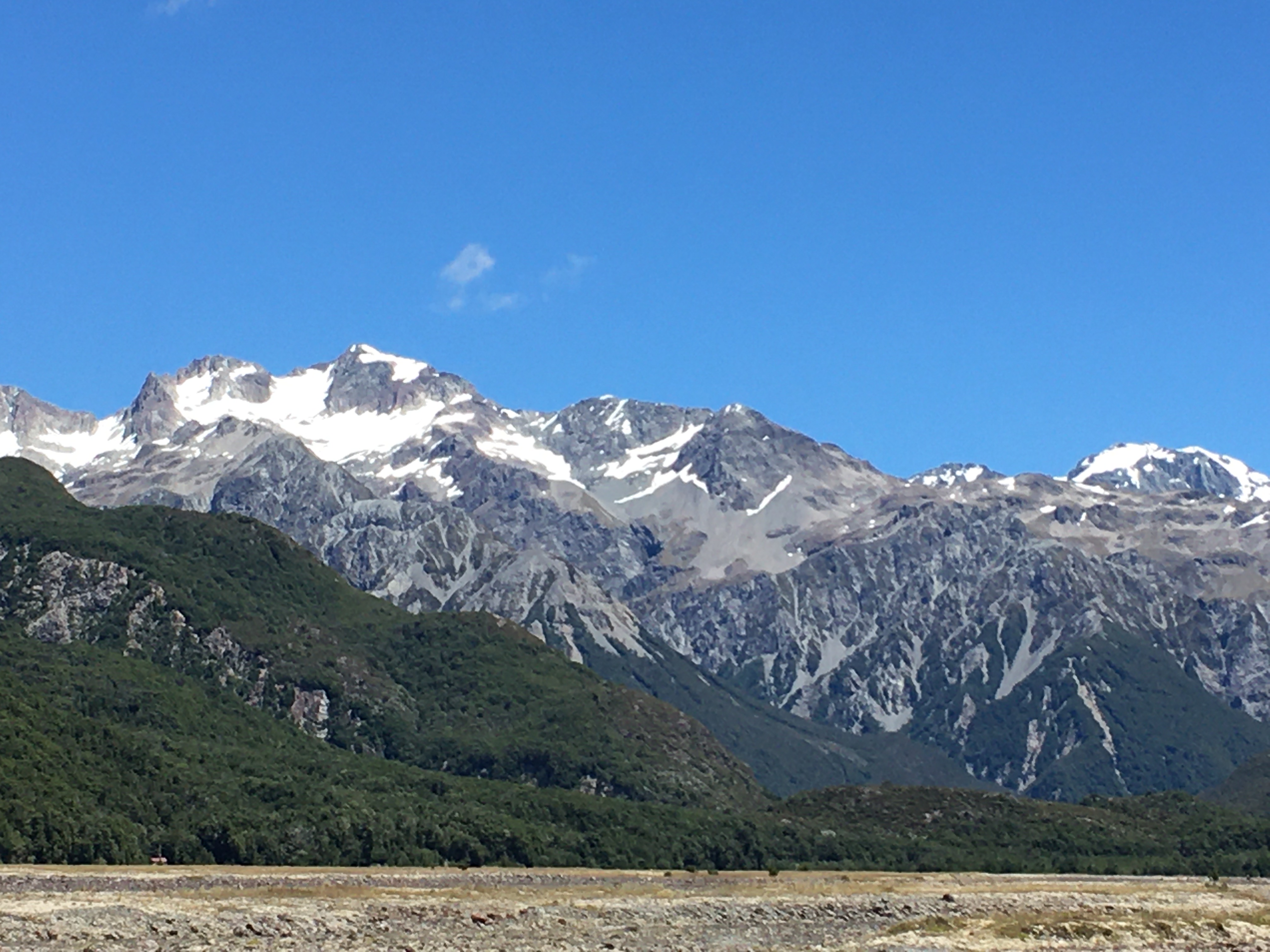
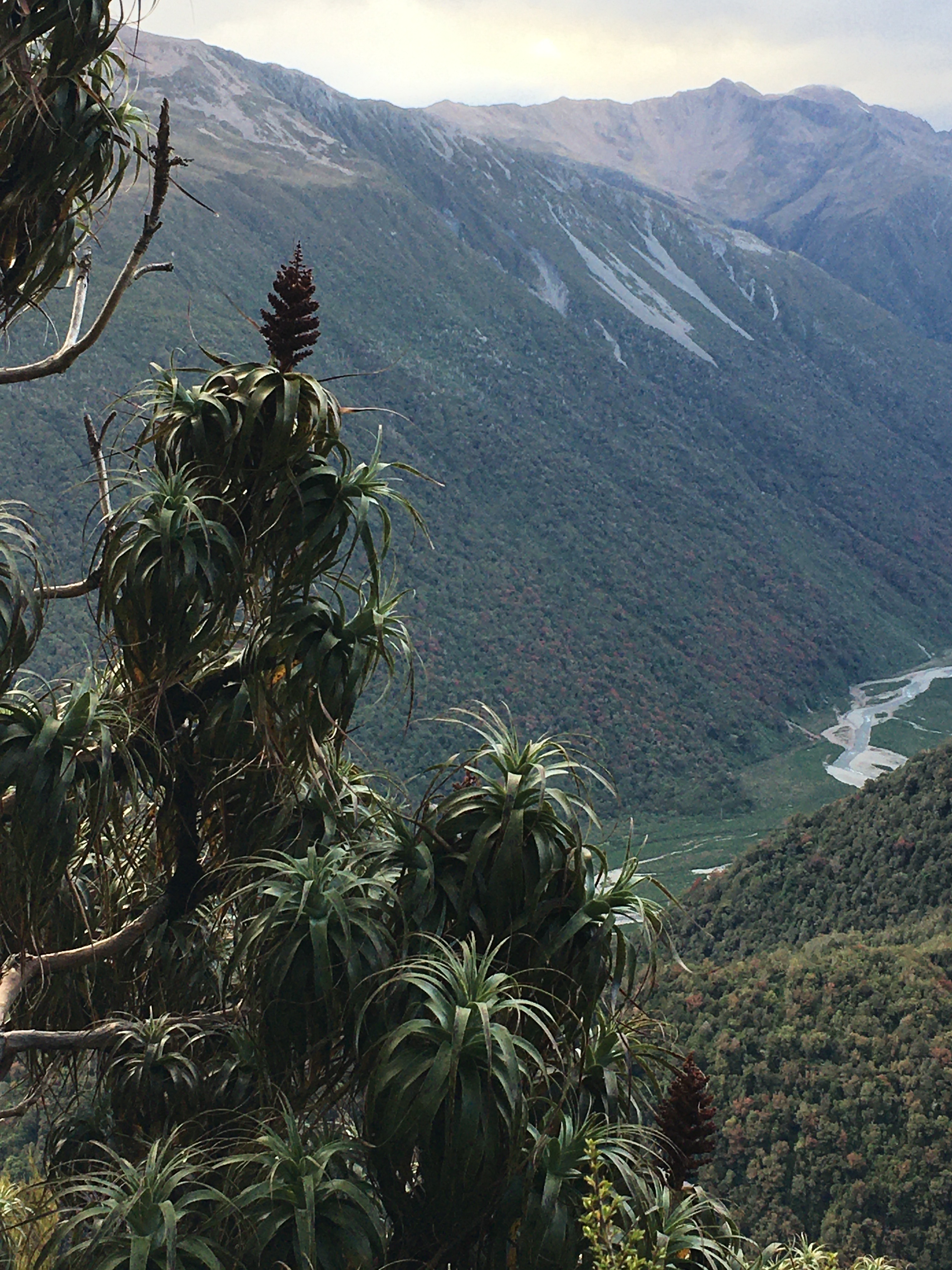
We did slightly better, making the 3.5 kilometre trip to the summit in 3 hours forty-five minutes, for a walking speed of 933 metres per hour. Most of the hike up is through dense west coast rainforest, so other than the forest itself, there’s not much to see. When we hit the alpine vegetation near the top, the views opened up and it was spectacular. At first we were a little worried we’d struggle to find our way across the multiple false peaks to the actual summit, because clouds obscured the tops. In hindsight, I’m glad the cloud was there, because when it did clear and we finally got a view of the summit, I was disappointed at how far away it still was. LOL! Though the elevational change from the bottom to the top is officially a bit over 1000 metres, there are several significant dips along the ridge, so I suspect the actual amount of climbing you do to reach the summit is more like 1200 metres.

Looking back down the ridge from the summit of Mount French

But we made it, and by the time we were on the summit the clouds had cleared entirely. We had stunning views to the Tasman Sea on one side, and to the mountains on the other. Lake Brunner glittered in the sun far below us. 

We had lunch on the peak and spent a good bit of time enjoying the view and exploring the plants and insects at the top before tackling the descent.

Lake Brunner seen from the summit of Mount French

Going down was faster than going up, and we reached the car shortly after 3 pm, hot and sweaty and ready for a swim. After a quick dip in Lake Brunner, and a change of clothes, we headed to Hokitika for dinner and a short stroll on the beach.

All of us were in bed and asleep early Saturday night.

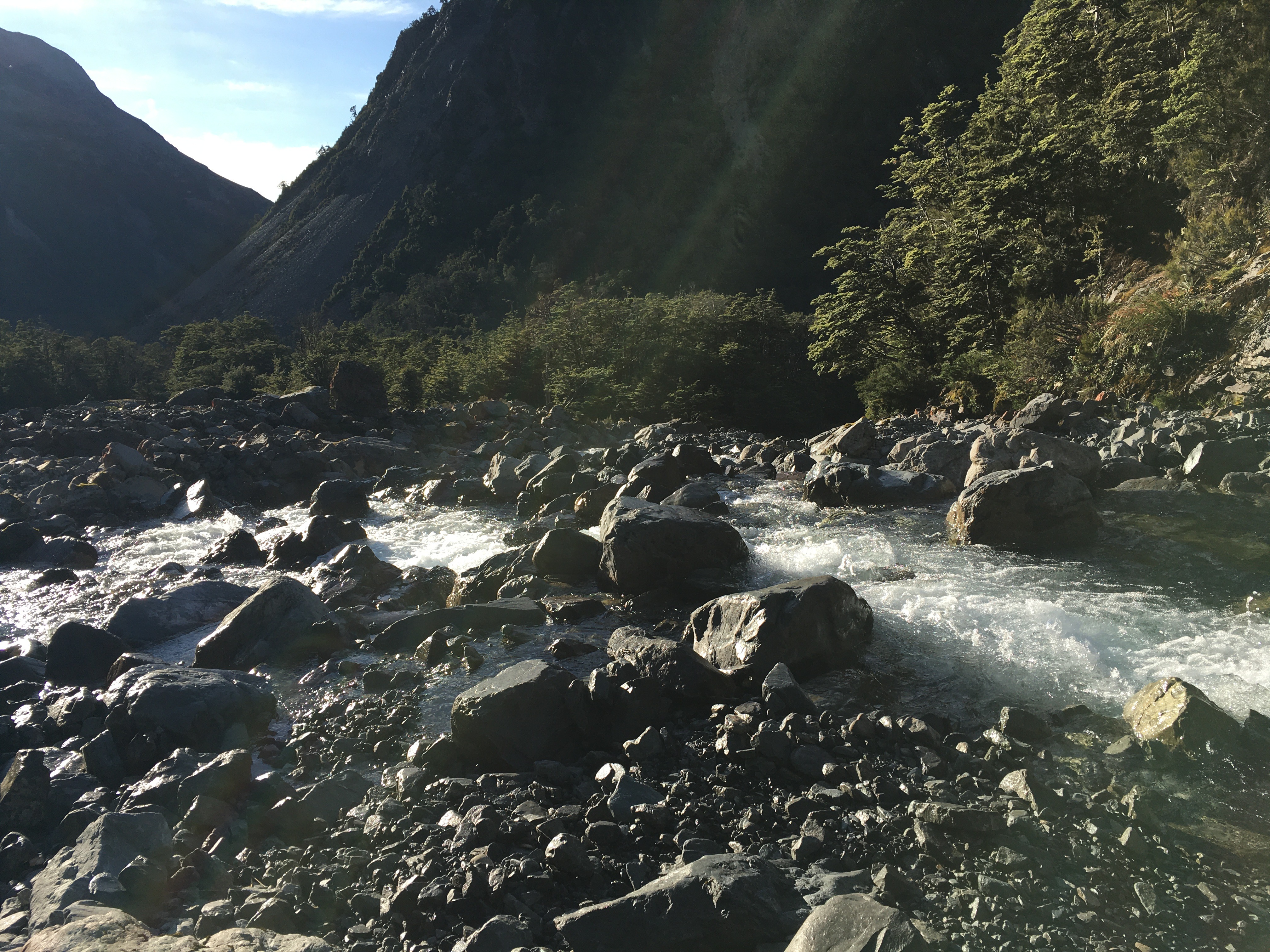
Sunday, we packed up camp and headed to Lake Kaniere to hike the Lake Kaniere walkway. We’ve done part of this walk several times. It’s a mostly flat, well maintained track that follows the entire western edge of the lake. There are multiple stony beaches to stop at along the way, and amazing lowland rainforest vegetation. 

A reflective early morning Lake Kaniere

On Sunday, it was also really hot (28 degrees by early afternoon). And even on the flat, we were sweating. My husband turned back about a third of the way into the hike, in order to drive the car to the end of the one-way track. My daughter and I continued on, stopping for a quick skinny dip at Lawyer’s Delight beach, before meeting my husband walking back towards us from the far end, about a kilometre from the end of the track.

Carové’s giant dragonfly at Dorothy Falls

We had lunch, a stop a Dorothy Falls, and another swim in Lake Kaniere, then headed home.

The entire weekend on the west coast was hot and sunny, so it was a bit of a shock to hit Porter’s Pass and drive into drizzle and 12 degrees. It was a chilly 15 at home under overcast skies. Poor Canterbury—this summer has been anything but summery here. It’s no wonder the west coast was absolutely packed with vacationing families.

And now I have one week left before returning to the day job. My summer to-do list is getting shorter, but I will definitely not accomplish everything on it. But it’s been a good summer for getting out and hiking, so I can’t complain. Now I just need to knuckle down and get some writing in while I can.

Holiday Tramp–Harman Pass

This year was something of a milestone—it was the first year in about 16 that we didn’t do a pre-Christmas backpacking trip with the kids. It was bound to happen sometime soon, since the kids are all grown up now and doing their own things.

Instead, my husband and I had a post-Christmas hike all on our own. Let me say right now that I loved tramping with the kids, but doing the Christmas hike with just my husband was REALLY nice—just like old times … except that we’re a lot older. It was nice hiking at 54-year-old pace (instead of being dragged along by impatient 20-something kids), and we could also go places that appealed to us, without considering if the kids would enjoy it.

So we stayed relatively close to home, but took a route we hadn’t ever explored.

Day one began with dropping a car at the far end of our hike, near Kelly Creek. There was a bit of faffing around to charge the electric car (with the charger in Arthur’s Pass out of order, and the one in Otira busy), but it gave us an excuse to have a coffee at the Otira Hotel, which is an experience of its own. 

Then we drove back to the Waimakariri River, parked car number two at Klondyke Corner, and hiked up the Waimakariri to Carrington Hut. 

This hike is a bit of a slog and involves crossing the river a couple of times. In fact, the first river crossing comes within the first five minutes of hiking, which was fine—we were going to spend four and a half days walking rivers. There was no way we were going to have dry feet.

In spite of the dull nature of the actual hiking up to Carrington Hut, the scenery is fabulous, and only improves as you go further up the watershed. We were lucky to have a tern hunting the river alongside of us for a while, and we scared up a pair of banded dotterels, too. 

After passing Anti Crow Hut, we left the riverbed to follow a track over a couple of roche moutonnée—rocky mounds left behind by glaciation. A series of tarns on the mounds give them a magical sort of quality, and the short break from river walking is nice.

The last time we were at Carrington Hut, it was incredibly crowded and unpleasant, so we carried a tent this time, just in case. But the 36-bunk hut housed only five of us that night, and we barely saw one another.

Day 2, we hiked over Harman Pass—up the Taipoiti River (click here for a video), then down Mary Creek. Again, the first act of the day was crossing a river, and then it was river crossings all day, back and forth across the Taipoiti as it rushed through a narrow valley which at times could be more properly called a gorge. It was another fabulous day, weather-wise, and the scenery was spectacular. So were the alpine plants. It seemed like EVERYTHING was in flower, and it was a slow hike up to the pass, because we were photographing all the way. 

At the pass, we took a little jaunt up to see some tarns higher up, and then hung out for a while with a curious kea (click here for a video). Kea are an odd mix of highly endangered (there are 1,000-5,000 of them left), and incredibly pesky, thanks to their intelligence, curiosity and a beak shaped like a giant can opener (their peskiness is unfortunately part of the reason they’re endangered). The world’s only alpine parrot, it’s common to encounter them at elevation near Arthur’s Pass, but it never gets old.

Mary Creek was more of the same—river crossings, beautiful scenery, endangered birds. We spent some time watching a pair of whio (blue ducks) having a nap on a rock in the middle of the stream. There are only 3000 whio left and unfortunately the population is skewed strongly to males, because females are vulnerable to introduced predators when sitting on the nest. We were lucky enough to encounter two pairs on our trip.

After a 3-wire bridge crossing at the bottom of Mary Creek, we arrived at Julia Hut. The hut is relatively small, and with another couple there already, we decided to tent. After setting up the tent and settling in, we had the rest of the sunny afternoon to explore. A natural hot spring was our destination. Only five minutes walk from the hut, next to the icy, swiftly flowing Julia Creek (click here for a video), the hot pool did not disappoint. It was initially too hot to sit in, and we had to redirect some river water into it to temper the heat. 

After a sweaty hike, I have to say I wasn’t all that interested in sitting in a hot pool, but I took a dunk in the river first, and then the hot pool was pretty nice. You couldn’t fault the setting—two days hike from a road, on an absolutely stunning mountain stream in the bush. It beat Hanmer Springs by a mile!

There is clearly a lot of geothermal activity in the area—the smell of sulphur was prevalent all along Julia Creek—and I suspect if you fossicked around, you’d find more hot pools. 

Day 3 was a lot of river walking (again), punctuated by a couple more three-wire bridges. We hiked down Julia Creek and the Taipo River to Dillon Hut. Well, we intended to stay at Dillon Hut, but when we arrived we were informed by a very cute four-year-old that there were ‘no more mattresses’ (Dillon hut is only a 2-hour hike from the road, and is clearly a great destination for a short family hike). So we moved on to Dillon Homestead Hut, just 500 metres down the track. 

Dillon Homestead Hut is just that—an old homestead. Built of hand-hewn timber and clad in whatever the original owners could scrounge, it is quite the historical experience to spend the night there. It’s clearly beloved by local four-wheel drivers and dirt bikers, but is in sore need of some upkeep. Still, it was shelter when the skies opened up and dumped rain all night, and if it had been cold, there was a big open fireplace surrounded by three tatty, 1950s-era armchairs. And once you brushed the rat droppings off the sleeping platforms, tables and chairs, it had everything you needed to spend the night. 

Fortunately the rats weren’t as active inside the hut as I had feared, and we spent a reasonably comfortable night (if a bit smelly) in the hut. In the morning, however, I trudged out to the long drop through soaking wet, waist-high grass. The loo is as old as the hut, and was stocked with three mouldy, rat-poo-festooned rolls of toilet paper. I didn’t stop to investigate the myriad spider webs (there may have been some interesting native spiders), but in retrospect I should have inspected my surroundings a bit more. Leaving the door open for light and ventilation, I dropped my pants to do my business. 

A scuttling overhead was all the warning I got before a rat leapt out of the rafters and landed on my head. I may have sworn. But the four-letter word had barely left my lips before the rat was off again, leaping for the toilet seat and then the floor before racing off into the bush.

So, a warning to you—the Dillon Homestead Hut loo is guarded by an attack rat.

After that exciting start, the rest of Day four was a hard climb. From Dillon Homestead Hut, we followed Seven Mile Creek briefly to a track that climbs steeply through dense west coast forest up to the Kelly Range. It was dark and humid in the forest. At one point, the track passed through a narrow gorge that was almost tunnel-like. It felt like we were crawling uphill, and often it was literally true, as it took both hands and feet. Pīwakawaka kept flitting around us, taunting us with their darting flight and chittering voices—what was so difficult about this slope, they seemed to ask.

At one point, the track met a huge slip hundreds of metres across and hundreds of metres tall. A blaze remained on a lone tree suspended at the top of the slip. The rerouted track scrambled precariously around the top of the slip, and I breathed easier once we were past it.

After 700 metres of elevation gain, we reached tree line and got a view back down to where we’d come from that morning—it was a long way down, and we still had more climbing to do.

The tops were dotted with tarns, and even where there wasn’t standing water, it was wet. We walked through fields of sundew plants, and took our breaks amid alpine orchids and daisies. 

Clouds prevented us from having great views, but turned the views we did have into a dramatic, ever-changing landscape. By the time we’d reached the top of our climb—a thousand metres above Dillon Homestead Hut—the clouds were swirling around us. 

A relatively short descent brought us to Caroll Hut just as the first raindrops began to fall. We had a late lunch of soup and peanut butter crackers as the wind picked up and the rain lashed the hut. 

We shared Caroll Hut with a UK expat who lives in Wellington, a pair from Whanganui, and a fellow from Adelaide. It was a great mix, and we had a nice afternoon and evening chatting with them all. The best of hut life.

All night the wind howled, and I was thankful for the steel cables tethering the hut in place. Although the rain ended before dark, the wind continued through to morning, so it was a cold and windy start to Day 5. An early morning treat at the hut was a family of weka with fluffy chicks fossicking around the hut. 

Day 5 was a short (hour and a half) jaunt out to the road from Caroll Hut. The ‘jaunt’ involved a good 800 metre elevation change, steeply downhill, but not bad going, with some nice views from time to time. And just when we thought we were done with wet boots, there was a stream crossing in the last 20 metres.

We were home by lunchtime, wet and tired, but having had an excellent five days. It was a fabulous way to spend the Christmas-New Year gap.

Feathered Friend

The vast majority of the birds in our yard are non-native invasive pests—English sparrows, European starlings, blackbirds, goldfinches and song thrushes wreak havoc in the garden. They eat fruits and vegetables, dig up seedlings, spread mulch all over the lawn, and strip young plants of leaves. If I could net the entire yard to keep them all out I would.

But some of the avian visitors to our place are welcome. The fantails that flit in and out of the house snapping up flies are a delight. The silvereyes picking aphids off the trees are both adorable and helpful. And the magpies may be noisy and aggressive, but they are quite entertaining as they dive bomb the cat or squabble with each other.

The tall trees across the road from our place are home to a host of white-faced herons. They croak and grumble among the branches like modern pterodactyls, and I love to watch them winging home in the evenings, landing awkwardly before settling down for the night. 

They rarely give our yard a second glance, but for the past week, a young heron has taken a liking to our porch and front garden. 

There’s something wrong with him. I say that not because of his interest in our porch—it is a nice place to hang out—but because his legs are oddly splayed and he wobbles when he walks. Still, he seems to be holding his own, and he has no trouble flying out of range of the cat when he comes stalking. It’s possible his flight is impaired as well, and that’s why he’s foraging close to home in our garden. Or maybe he’s discovered our soil has lots of worms to offer. Either way, I wouldn’t mind if this bird stuck around.

The Little Things–Hakatere Conservation Park

As usual, I spent most of the long Labour Day weekend in the vegetable garden. I weeded, prepared garden beds, and planted my cucurbits in trays.

Lake Clearwater with mountains
Lake Clearwater was a mirror in the morning’s still air.

But as they say, all work and no play … I didn’t want to spend the whole holiday weekend sweating in the garden.

So on Monday my husband and I went to Hakatere Conservation Park and sweated on Mount Guy instead.

The Ashburton Lakes region is a glacially formed landscape dotted with lakes and tarns. The land around the wetlands is largely tussock grassland studded with spiny matagauri bushes. An unforgiving, windswept landscape that can feel downright bleak.

That was my impression the first time I visited. Fifteen years ago, I was hired to develop an interpretation plan for what was then a proposed park only. I had the great fortune to tour the area with a Department of Conservation ranger who had worked in the area for decades and had a great love of the landscape. He showed me the little things—not necessarily obvious at first—that set the region apart. Rare insects (including an aquatic moth!), waterfowl and lizards. Unique and diverse plants. Historical use of the land, and massive changes over geologic time. There’s a lot more than meets the eye.

skink
One of the many skinks we saw.

On Monday, we were treated to a glorious day—sunny and calm at first, with a brisk breeze kicking in just when the day began to feel too warm. We parked at Lake Clearwater and hiked the track to the summit of Mount Guy. On our return, we followed the tussocky ridge down to a saddle where we picked up Te Araroa, following the track back to the edge of Lake Clearwater where we completed our large, loopy circuit of the lake.

mountains and river valley
View from near the top of Mount Guy. Mount Sunday is a small mound in the river valley, just to the right of centre in the photo.

The hike afforded stunning views of jagged, snow-capped peaks, and a view of Mount Sunday down in the river valley.

Oddly, out of all the “mountains” in the park, Mount Sunday may be the most famous. The hill was used as the location for Edoras in the Lord of the Rings movies. In the enormity of the surrounding landscape, however, it is an insignificant lump of rock.

Perhaps, like the hidden insects, birds, and plants, it is the little details that are the interesting bits.

Living With Earth

Coes Ford–open…just.

Nature is bigger than we are.

That’s been clear from world events the past few weeks—flooding in Indonesia, earthquake in Mexico, multiple hurricanes in the Atlantic.

We can pretend the natural world doesn’t affect us. We can do our best to engineer human structures and our daily lives so that, most of the time, we forget we are an integral part of Earth. But I think this is a terrible mistake.

On my way to and from town every day, I cross the Selwyn River. Normally, I do this at a spot called Coes Ford.

The Selwyn River floods. It’s simply part of the hydrology and ecology of the river. The low bridge over the Selwyn at Coes Ford acknowledges flooding. The bridge was never meant to allow passage over the river during a flood. It was meant to survive floods intact, and provide passage during low water.

The ford has been closed for several weeks, but reopened yesterday. The bridge itself is still underwater, but it’s passable.

To me, there is something right and good about an infrastructure that acknowledges the forces of nature and doesn’t try to control them. It is good for us to accept that, while we have great influence, we are not masters of the planet. At Coes Ford, we will be inconvenienced by floods. This is part of the natural order. It is part of what it means to live here. And if we are inconvenienced by floods, we will notice when the pattern of flooding changes. We will feel that something is amiss. Hopefully, we will do something about it. It’s not a coincidence that when the Selwyn stopped flooding and dried up last summer, the focus of the worry was at Coes Ford—that’s where the locals understand the river’s pulse the best.

If we are separated from the rhythms of the planet, we won’t notice when something is wrong, locally or globally. When we are separated from the rhythms of the planet, we may not notice problems with our life-support system until it is too late. Separated from, and ignorant of the rhythms of the planet, it’s easy to deny that there are any problems.

And so, I embrace the inconvenience of Coes Ford. I thank the engineers who chose to accept the Selwyn River for what it is. I hope that, as human technology advances, we continue to remember our interdependence on the natural systems of Earth. We must live with the earth, not on it.

Impossible Sky

I couldn't capture today's sky, but it was something like this...

I couldn’t capture today’s sky, but it was something like this…

It was another of those drive-off-the-road-gorgeous skies this evening. The kind that is completely impossible to capture in a photograph, and is more likely to be seen in a cheap painting for sale alongside velvet paintings of Elvis.

I can get lost in one of those skies.

Ripples and waves of grey cloud surging across the sky. A break just big enough to illuminate the edges, just big enough for the sea foam-salmon pink-blue of evening to peek through. The ragged shreds of dark cloud caught in shadow. And far out across the plains, a shaft of brilliant sun lighting sheets of mist shrouding the mountains.

These things only happen in bad paintings.

Or so I thought.

But the New Zealand sky is like the Andes Mountains. As a child, I was obsessed with the Andes–so impossible, so improbable in the National Geographic photos, I couldn’t believe they were real. And then I went there and climbed them, and I knew they were not.

It is the same with the New Zealand sky. To see it is to know it cannot possibly be real. It is a storybook caricature of a sky. It is a fantasy sky. It is a sky so dense with colour, you think it must have drained the rest of the world, casting everything else in black and white.

And I am so profoundly humbled and honoured to be able to call it my sky. My home.