The Beautiful Banks Peninsula

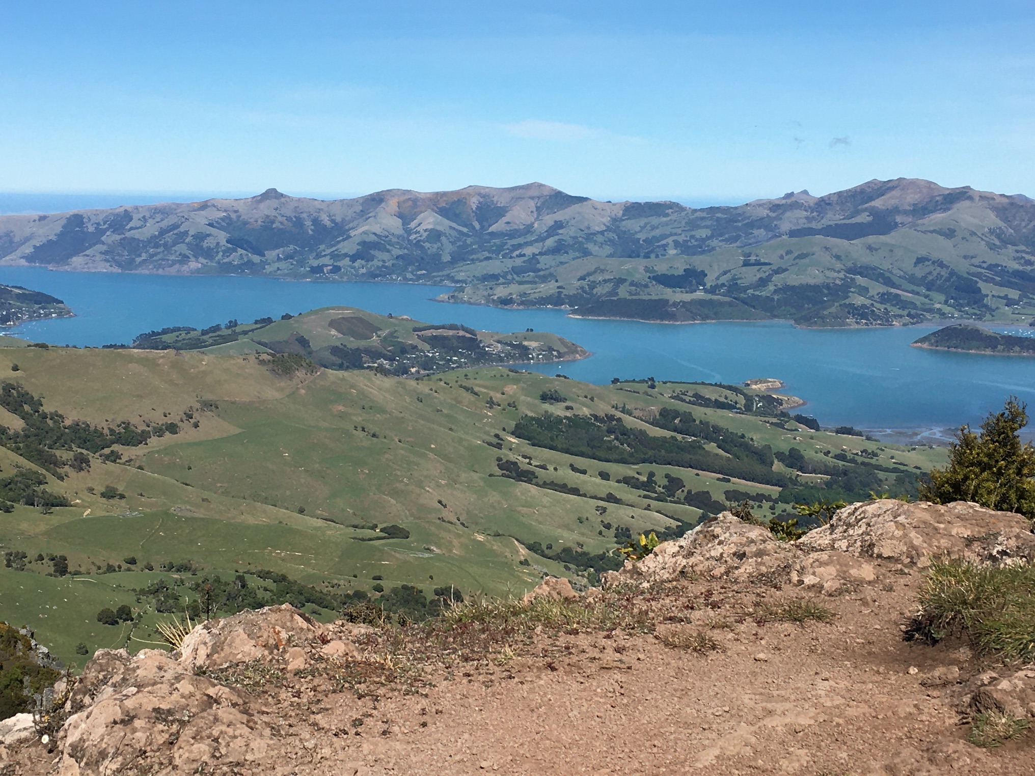
View from the top of Lavericks Peak Loop Track.

I still remember my first trip to the Banks Peninsula. It was probably less than 48 hours after we’d arrived in New Zealand and the only part of the country I’d seen was Hagley Park in central Christchurch.

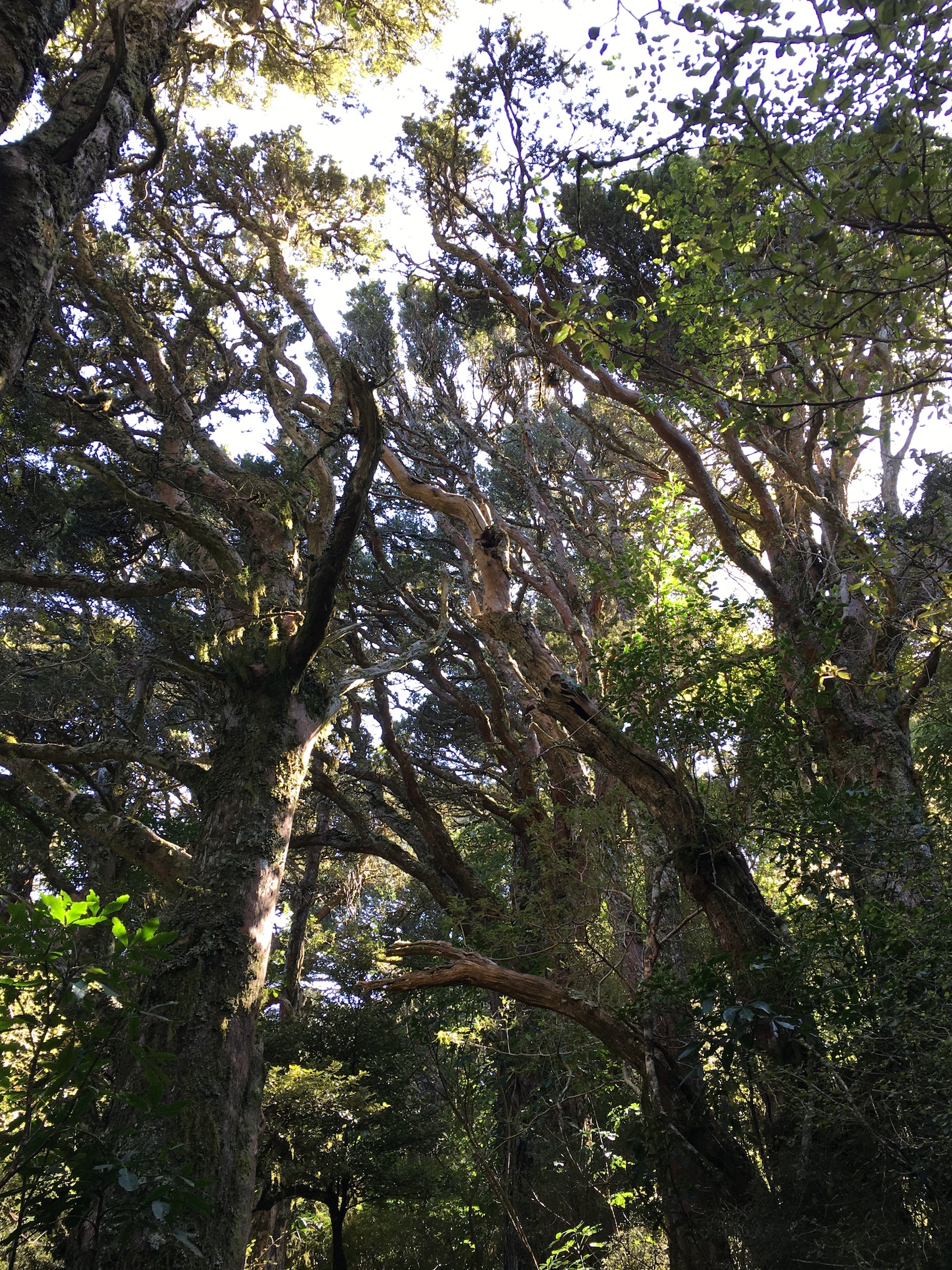
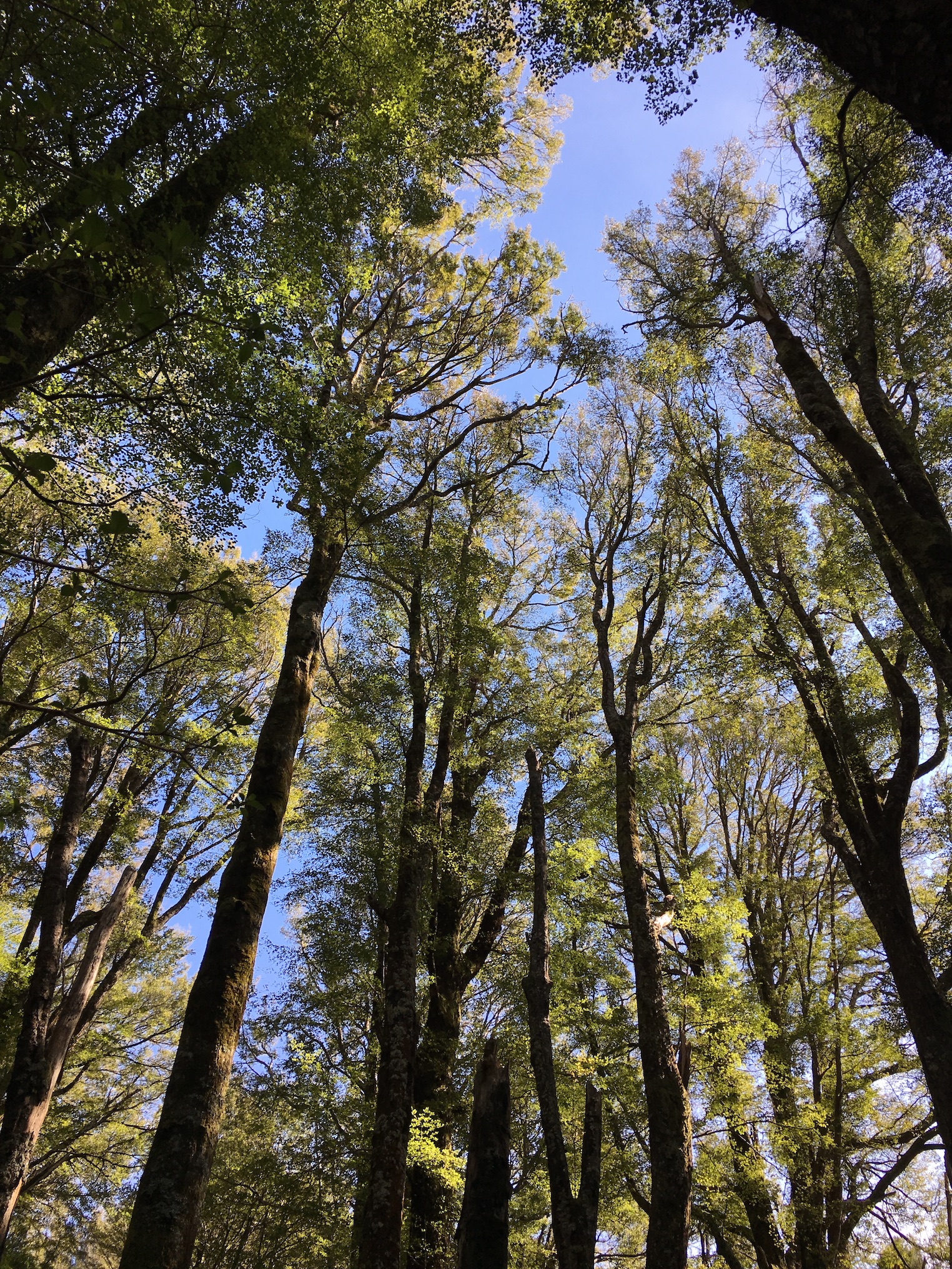
The bush at Otepatotu Reserve

When we rounded the bend and the road sidled up to Wairewa/Lake Forsyth, my face split in a grin. I craned my neck to look up the steep slopes on the left while black swans cruised the sparkling lake on the right.

We stopped in Little River for a toilet break (we had toddlers then—we stopped at every toilet), and I fell in love with the Little River Cafe and the attached Little River Art Gallery.

Carrying on toward Akaroa, we crested Hilltop, and Akaroa Harbour glittered tropical blue down below. Onawe Peninsula jutted like a bead pendant into the harbour and the road wound down through a patchwork of forest and paddock toward the sea.

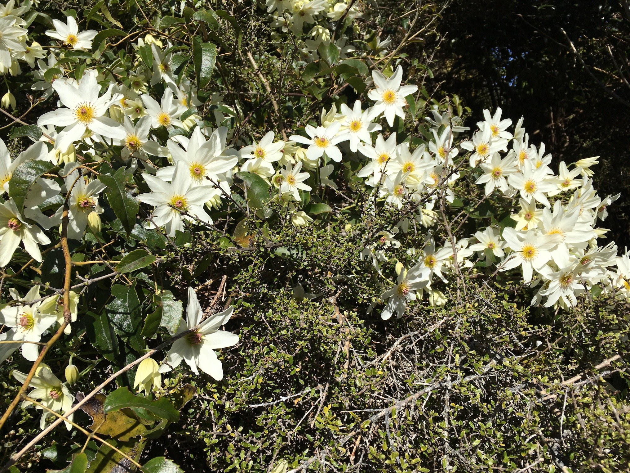
Native clematis in bloom.

I have made that drive countless times in the nearly sixteen years since the first trip. I still get that silly grin on my face. Every. Single. Time. Since that first visit I’ve scaled taller mountains, seen glaciers, stood at the base of Tane Mahuta, cruised Milford Sound … By comparison, the Banks Peninsula is positively dull.

But for me it defines summer in New Zealand. Even in winter, I feel like I’m on summer holiday when I’m out on the Banks Peninsula. I forget the to-do list. I turn off the cell phone. the daily stresses vanish.

Cushion star in a tidepool at Okains Bay

We hadn’t been to the Banks Peninsula since March, before lockdown confined us to home. But last Sunday we ventured out to sample everything we’ve been missing: morning tea in Little River, a lovely little hike through old totara and tree fuchsia in Otepatotu Scenic Reserve, a very chilly dip in the sea at Okains Bay and rock hopping along the coast to Little Okains Bay, and finally beer and chips in Akaroa and a stroll through the Garden of Tane.

We arrived home tired, crusted with salt and sand, and thoroughly satisfied with the day.

This weekend is supposed to be warm and sunny … we might just go and do it all again.

Alpine Therapy

Last week was a difficult one for all of New Zealand. On Tuesday, four cases of Covid-19 cropped up outside of managed isolation facilities at the border. The virus was circulating in the community again.

Auckland, where the cases occurred, was placed into alert level 3, with schools closed, and movement and business activity restricted. The rest of the country moved to alert level 2—not as strict, but in some ways more stressful, because we weren’t confined to the safety of our home and personal ‘bubble’. Once again, we navigated work and the rest of daily life knowing the virus could be lurking among us. Once again, we looked on every sniffle and cough with suspicion.

I’m proud to report that New Zealanders once again have stepped up to the challenge and are doing their part to stamp this new outbreak out so we can all return as quickly as possible to alert level 1. Still, stress levels were high in our household all week. So Saturday we took in some alpine therapy.

It was a shivery -3 degrees when we started up the Bealey Spur Track. We’d hiked the track many times when the kids were young, but never got far. On Saturday, we set a rapid, stress-relieving pace, reaching the Bealey Spur Hut (and the official end of the track) in just two hours. The peaks above called, so we carried on past the hut along Hut Spur, enjoying stunning views of the Waimakariri River below, and Mount Rolleston and Crow Glacier above. 

We relived memories of past hikes, tracing their routes along the ridges and through the valleys around us. We watched cars snake across the wide bed of the Waimakariri River, noting how easily the river could wipe out the road. We examined plants and fungi and slime moulds. We contemplated the uncertain future of Crow Glacier. 

And, yes, occasionally we discussed Covid-19, particularly as we descended, meeting dozens of people heading upward for their own alpine therapy. But somehow it was all easier to manage with tired legs and lungs filled with icy alpine air. 

Caroll Hut, Arthur’s Pass National Park

Impressive old southern rātā along the track.

Just beyond Otira, the main highway snakes along, with the Otira River on one side and impossibly steep slopes on the other. A track takes off from Kelly Creek and shoots straight up. My husband said he’d often looked up at those slopes thinking, “Glad I’m not going up there.”

But that’s exactly where we went Friday. Eight hundred twenty-five vertical metres over a mere 2700 metres horizontal distance, if the topo map is to be believed. That’s an average slope of 17 degrees, which doesn’t seem like much, except that parts of the track are flat or go down, so many sections are practically ladders, and require hands and feet.

In spite of the steep grade, it’s not a difficult climb—tree roots and rocks provide plenty of hand and foot holds. And the slow climb upward affords plenty of time to gaze back up the valley towards Otira, watch a train rumble down the tracks below, enjoy a waterfall, examine the flora, and listen to the bellbirds. The forest is full of gems like southern rātā and mountain neinei (a tree that could only have come from Dr. Seuss’ imagination).

View towards the west coast from above Caroll Hut

You emerge above tree line to a gentle climb to Caroll Hut. A little further uphill, cresting Kelly’s Saddle, the view opens to the west coast, and you can see all the way to the Tasman Sea. 

It’s not a hike you’d want to do in bad weather, but Friday’s calm clear air was perfect. A lovely day out.

Old Friends, New Perspectives

We regularly seek out new places to hike, but sometimes it’s nice to visit old friends.

Kura Tawhiti / Castle Hill is one of those old friends. We’ve been going there since we arrived in New Zealand 15 years ago. Lately, we’ve been there a lot, because the kids enjoy bouldering there.

I never get tired of the place. There are so many nooks and crannies to explore, it feels like every visit is new. And the place shows different faces in different weather—fog, rain, snow, or sparkling blue skies. It never gets old.

Last week when we visited, there was a carpet of daisies blooming in a spot I rarely pay attention to. It made me stop and take note of the location as though I’d never been there before.

On every visit, I make the climb to the top of Castle Hill—the highest point at Kura Tawhiti on which stands a glorious sentinel rock. It’s a stiff climb of about 160 vertical metres. From there you can look down on the rest of the limestone formation.

Looking down at Kura Tawhiti from Castle Hill Peak.

I was lucky to have the opportunity, not only to visit Kura Tawhiti on Wednesday last week, but to look down upon it from a much higher vantage point on Friday.

We hiked up from Porter’s Pass to Castle Hill Peak (1078 metres higher than Castle Hill, and a serious slog on unrelenting scree), from which all of Kura Tawhiti looks like a little bump on the valley floor below. It was interesting to see what I think of as a large part of the landscape put into perspective. And it was a great reminder of just how many places there are to explore, big and small—it’s a great wide world out there!

Nelson Lakes Tramping

Before Christmas, the family spent five days tramping in Nelson Lakes National Park. We have tried several times to plan a trip to the area around Angelus Hut, but something has always happened to cancel it—once it was bad weather, another time it was a gastrointestinal bug at Angelus Hut that laid 30 hikers low, another time it was the Kaikoura earthquake. But this year, we managed, with only a 24-hour postponement due to the weather.

We rolled in late on day one. With only a two-hour hike to the first hut and pouring rain forecast to clear late in the day, there was no reason to start early. We lucked out, and the last raindrops fell as we were getting out of the car. The climb to Bushline Hut on Paddy’s Track was a bit of a monotonous uphill, but with nice views. If I were doing it again though, I’d give Bushline Hut a miss. The place is overrun by mice—if the noise of them nibbling into everyone’s packs didn’t keep you awake all night, their pattering feet over your bed or down your neck did. It was less than pleasant.

Vegetable sheep (Raoulia spp)

Leaving the mice behind in sparkling sunshine the next morning, we followed Robert Ridge to Angelus Hut. Well above tree line, the ridge is one continuous spectacular view of the mountains and lakes in and around the park. We were prepared for wind and cold (it had snowed on the ridge the day before), but enjoyed sun all day with very little wind. My favourite part of the ridge was the profusion of vegetable sheep—some of the most spectacular specimens I’ve ever seen.

Angelus hut dwarfed by the surrounding landscape.

We made good time and enjoyed lunch overlooking a mountain tarn just a few minutes before reaching Angelus Hut, in its dramatic location at the edge of Lake Rotomaninitua. That left us all afternoon to explore the stunning tarns, streams and rocks around the hut. Rain from the preceding days had left all the tarns and streams overflowing, and the sound of flowing water was a constant—trickling through rocks underfoot or rushing in torrents down the mountainsides.

Mt. Cedric Route

The following day was the hardest and most spectacular, following the Mt. Cedric Route to Sabine Hut. I thought Robert Ridge was spectacular, but the Mt. Cedric Route blew Robert Ridge out of the water! Again, we had fabulous weather and enjoyed the views. The route skirts around an unnamed 1880-metre peak, which we summited—an easy scramble without packs, and well worth it for the views. From that high point, the rest of the track is downhill. Fourteen hundred metres vertically, to be exact, most of which happens in the incredibly steep final 1.5 km. While the ridges and scree slopes of the majority of the route are visually and mentally daunting, they’re relatively easy to traverse. But the drop through the forest, on slick wet leaves, was basically one long ungainly fall.

We were rewarded at the end by Sabine Hut on the shore of Lake Rotoroa. A nice swim in the lake and a gentle walk to the Sabine River made for a relaxing afternoon.

Day four was a long uphill, which was actually welcome after so much downhill the previous day, ending at Speargrass Hut. Unlike the previous two days, the Sabine-Speargrass Track is entirely in the forest. And it is a magical forest—lush and wet, but it gives the impression of perching on nothing but great blocks of rock. The track regularly traverses roots with deep holes between them, and you could hear water gurgling underfoot in many locations.

The most magical spot along this section of track was an open bog not far from Speargrass Hut. A long boardwalk climbs to a platform perched in the bog. Benches provide a nice place to sit and take in the view. Coming out of the forest into a landscape so rich in colour felt like entering a painting—colours just a little too saturated, bog falling away a little too perfectly to reveal distant peaks a little too sharp and dramatic to be quite real. 

Day five was a quick, relatively unremarkable jaunt out to the carpark along Speargrass Track, and then a long drive home.

Quite possibly one of the most spectacular pre-Christmas tramps we’ve done. It was definitely worth waiting for.

A Day Off

Cathedral of red beech

Sunday dawned warm and sunny, and I prepared myself for another day of hard work in the garden, in spite of my aching back. It would be a crunch to finish what I needed to stay on track—my garden to-do lists get longer each week, and I don’t dare fall behind at this time of year.

Meanwhile, my husband was fretting about the lectures he still needed to prepare for this week. But he’s much better at relaxation than I am. Before I had a chance to gather my tools, he suggested a hike instead of a day of work.

So we ignored our pesky to-do lists and enjoyed a day at Hinewai. 

Hinewai Reserve is privately owned, and encompasses 1250 hectares of the outer Banks Peninsula. It includes a glorious mix of vegetation types.

The track forms an avenue within a dense kānuka stand.

Probably the most impressive are the 50 hectares of old growth forest. The red beech create a green cathedral, shading out much of the undergrowth. The effect is in stark contrast to the dense kānuka stands that blanket other parts of the reserve.

At this time of year, the gorse is in full bloom. Management at Hinewai allows this invasive weed to grow, because it provides an effective nursery for native trees. Eventually, the native plants will overtop the gorse and shade it out, but in areas recently disturbed by fire, the gorse is thick. On Sunday, the tops of the hills looked like they’d been capped with bright yellow snow, for all the gorse.

Gorse in full bloom in a recently burned area.

With 330 species of native vascular plants, and 60 species of fern (including six species of tree fern), Hinewai is probably the most diverse site on the Banks Peninsula. We never fail to see interesting things when we visit. This visit was no exception. A bright purple fungus creeping along a rotting branch was probably the most unusual find on Sunday, but we were treated to tree fuchsia in bloom, kererū swooping overhead, and pīwakawaka and tomtits flitting around among leafy lacebarks, kahikatea, tōtara, and kōwhai. I enjoyed seeing my favourite filmy ferns, with their translucent fronds. Large quantities of ongaonga (tree nettle) supported the red admiral butterflies that were enjoying the warm day along with us, flitting through the dappled light in the forest.

View down to Otanerito/Long Bay

And, of course, as with most spots on the Banks Peninsula, the views from the clearings at Hinewai were spectacular. 

My weekend to-do list forgotten, I had a lovely day enjoying the outdoors. Next weekend’s list is necessarily longer now, but it was good to take a day off. I must remember to do that more often.


Sub-Alpine Idyll

We recently went on a lovely hike up Peak Hill, overlooking Lake Coleridge. The start of the track crosses paddocks, but once on the reserve land, the vegetation changes to a beautiful sub-alpine spread of daisies, Spaniard, matagouri, and tussocks. The daisies, in particular, were spectacular—so many were in bloom that the whole hillside looked frosted. The Spaniard was blooming, too, spiky flower heads rising above the daisies like something from a Dr. Seuss book. Native bees, mānuka beetles, and syrphid flies were all taking advantage of the abundance of nectar and pollen. The air hummed with insects.

You could be forgiven for thinking it was a beautiful, peaceful place. And it was, for us. But among the insects buzzing around were predators—pompillid wasps hunting for spider prey, robber flies snatching unwary insects out of the air, and birds snapping up bugs to feed to their young.

And then there were the plants themselves. At least one hapless beetle impaled itself on a Spaniard leaf. 

It may be pretty, but it’s a rough world out there when you’re insect-sized.

A Little Bit of Crazy

On the lower slopes, looking up to the clouds.

You have to be some kind of crazy to summit Mount Herbert in a raging Nor’easter. Apparently my family and I are some kind of crazy.

To be fair, we didn’t set out to summit. We’d hoped for a day at the beach, but the wind and cloud cover wasn’t promising. So we pulled into Orton Bradley Park thinking we’d do a nice little hike.

We thought, ‘Let’s go toward Mount Herbert; we haven’t actually hiked that track before.’

It’s a typical Banks Peninsula track, winding through non-native forestry blocks, pasture, and scrubby native bush on its way up the mountain. As we got higher and higher, the wind picked up. The ridge line and summit were shrouded in cloud. It certainly wouldn’t be nice up there.

But, hey, it was great hiking weather down lower—not too sunny, and the breeze was nice … until it started whipping off our hats. We carried on up the slope.

By the time we reached the bottom of the cloud layer, the wind was getting a bit ridiculous. We checked our location on the topo map.

Well, it wasn’t too much farther to a shelter where we could eat lunch. Surely we could go that far. We carried on, around a switchback so the wind was blowing full in our faces. I laughed and shouted, ‘This is silly!’ But no one heard me over the wind.

We were in the cloud now, hiking blind to the shelter. When we found it, we tumbled inside, laughing and a little breathless. As we ate our lunch, the sturdily-built shelter shimmied and moaned in the wind. Billowing waves of cloud poured in with each gust.

It would be ridiculous to go on in this weather. What would there be to see, anyway, in the cloud?

But it was only a little bit further to the summit …

We donned our raincoats, shoved our useless hats into our bags, and made for the top.

And so there I was, leaning into the wind, a cramp in my left thigh and a blister on my right heel, condensation dripping off my hair and running down my glasses, unable to see the rest of my family just ten metres ahead of me through the cloud … and stupid-grinning the whole way.

At the summit (the highest point on the Banks Peninsula) we should have been able to see a huge expanse of the South Island spread out around us. We could barely see each other. We cheered our accomplishment, admired the view, and then set off back down.

Our little walk ended up traversing 15 kilometres and climbing 900 vertical metres. It was a ridiculous walk to do, given the weather conditions, but it was absolutely brilliant.

And we got our beach time in, too. By the time we made it back to sea level, it was sunny and hot, so we had a little splash in the sea before returning home.

Sometimes a little bit of crazy is perfect.

Respite on the Rakaia

The temperature is squatting at 37 degrees C. Body temperature. I’ve experienced hotter, but when it hits 37, it’s just hot, no way to argue it’s not.

So we headed down to the Rakaia River, just a short drive from our place.

The walk in from the settlement of Rakaia Huts is green and humid. The track is maintained only by the feet that tread it and winds through a magical scrubby forest. Non-natives brush leaves with natives, feral fruit trees share space with hydrangeas. The worst of Canterbury’s weeds coexist with a remarkable array of native shrubs and ferns—it’s the Peaceable Kingdom of the plant world.

Twenty minutes of walking through this green glade brings you to the river. The Rakaia is a braided river, so you cross and re-cross channels to reach one suitable for swimming. Down near the mouth, there are many swimming holes—deep and turquoise with suspended loess (wind-blown rock dust)—separated by sparkling riffles. We followed the river to the sea, testing each pool to find the best one.

They were all delightful, all ours for the taking, because there was no one else there.

Back home, we stayed in our wet togs until they dried, bringing the cool river with us.

In the time it’s taken me to write this blog, the temperature has risen further. The river water has long since evaporated. Now we have just the memory to keep us cool.