Last weekend, my husband and I got out for a tramping trip in the Two Thumb Range, in Te Kahui Kaupeka Conservation Park. We parked on Rangitata Gorge Road at Forest Stream, then slogged two hours up the road to Bush Stream—not a very exciting start, but better then than at the end of the tramp. We followed Bush Stream Track up the stream to Crooked Spur Hut. The stream flows through some pretty spectacular scenery, and you ‘get’ to cross the stream quite a few times before a steep climb to the hut.
Crooked Spur Hut is one of several historic musterer’s huts in the area. It’s old and the walls are full of holes and rats. We opted to sleep in the tent, but we hung out in the hut, since we had it all to ourselves.
Kea on a cold tin roof.
On the approach to the hut, a kea came to investigate, watching us climb the hill. It must have invited its friends later, because shortly after dark, while I was reading in the tent, I heard the thump-thump-thump of a couple of kea bouncing around outside. I shooed them away, knowing their penchant for mischief, and eventually they got the hint and left.
But by morning the kea had mustered reinforcements. They started about 4 am, thumping around outside the tent, plucking at the tent strings, and calling loudly right by our heads. By 5 am, we were up out of a sense of self-preservation, retreating to the hut to start our day.
When I stepped out of the hut a few minutes later, there were three kea, each one working on pulling out a tent stake, and more calling in the darkness beyond. We quickly took down the tent in the dark, before the kea tore it to shreds.
We got the billy boiling to the sound of kea on the tin roof. They seemed to have multiplied. The noise was deafening, and grew louder as dawn approached. Our trips out to the loo were accompanied by no less than three kea, who then sat on the loo roof, peering in through the skylight to watch the show.
Returning from the loo, I counted fifteen kea, most of them on the hut roof, picking at the roofing nails (which thankfully had been replaced with non-leaded ones, because the old lead nails kill kea), and sliding down the tin. It was the most kea I’d ever seen at once. And as obnoxious as the cheeky buggers are, it was the highlight of the trip.
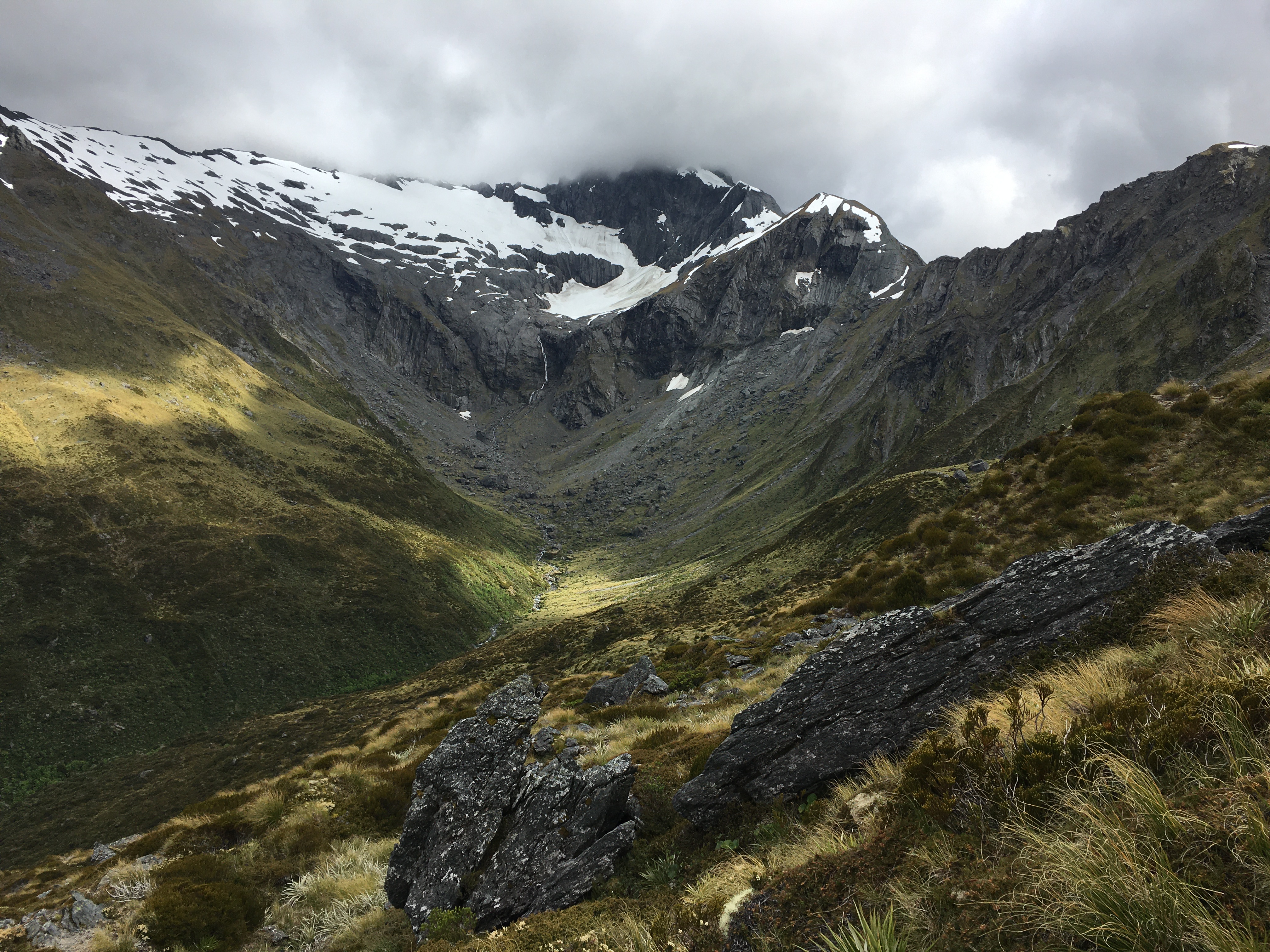
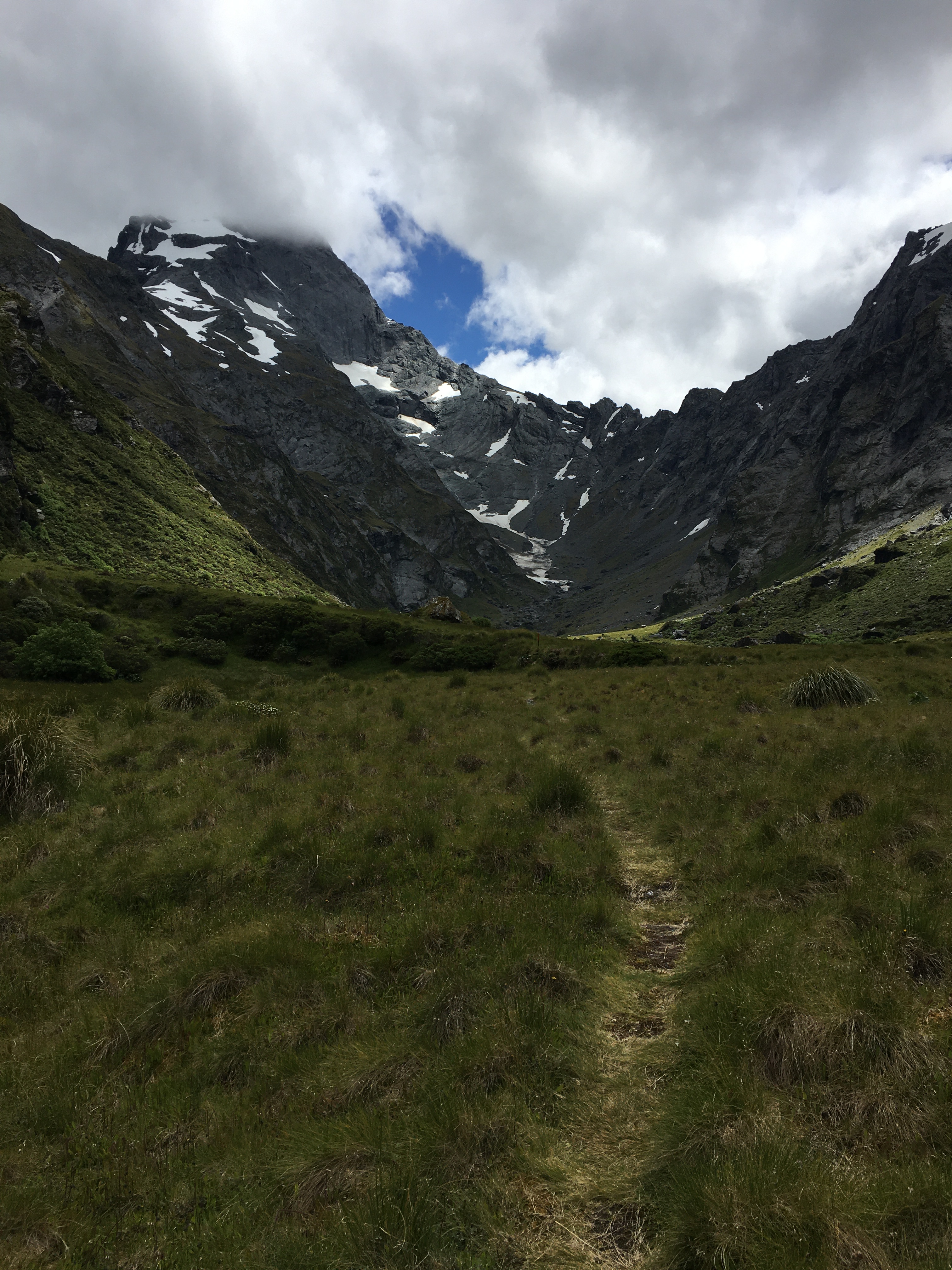
Leaving the kea behind, on day two, we hiked up from the hut through frosty tussocks to a scree-covered saddle where we were treated to some new spectacular scenery—tussock, scree and craggy peaks all around. At Swamps Stream we scared up a herd of 28 tahr—a non-native pest, but cool to see nonetheless. We arrived at Stone Hut at lunchtime, and had a lovely meal next to the stream before carrying on to Royal Hut.
Interior of Royal Hut.
Royal Hut is similar in age and condition to all the old musterer’s huts, but has the distinction of having been visited by royalty. The accounts I’ve found differ in the details—it was either in the 1960s or in 1970, and the royals involved were either Prince Charles and Princess Anne, or Prince Charles and Princess Diana (Diana being highly unlikely, given the date range suggested for the event).
In any case, it is said the royals zipped in by helicopter for a ‘brief’ visit. I doubt they spent the night. With mice scrabbling over our packs within 15 minutes of our arrival at the hut, we opted for the tent again.
Frost heave on the track, with 4 cm-long ice needles.
The morning of day three was fine and frosty (with frost inside the tent!). The DOC signage indicated we had an 11-hour hike to the road, and with daylight only being 11 hours or so long at this time of year, we made an early start, as soon as it was light enough to see the track.
We warmed up quickly, with the first leg of the day being a climb to Bullock Bow Saddle.
By the time we reached the saddle, I knew I’d pushed too hard over the previous couple of days—my left knee was stuffed, and hurt with every step.
It was a loooong 14 or 15 km from there to the road—the first few kilometres steeply downhill, then a long slog down the Forest Creek riverbed.
Still, we made it to the car well before dusk, and enjoyed more spectacular scenery (and a few more river crossings) along the way.
Overall, a fun long weekend! Spectacular views, awesome wildlife, and some real character huts. And the weather couldn’t have been better.
This year was something of a milestone—it was the first year in about 16 that we didn’t do a pre-Christmas backpacking trip with the kids. It was bound to happen sometime soon, since the kids are all grown up now and doing their own things.
Instead, my husband and I had a post-Christmas hike all on our own. Let me say right now that I loved tramping with the kids, but doing the Christmas hike with just my husband was REALLY nice—just like old times … except that we’re a lot older. It was nice hiking at 54-year-old pace (instead of being dragged along by impatient 20-something kids), and we could also go places that appealed to us, without considering if the kids would enjoy it.
So we stayed relatively close to home, but took a route we hadn’t ever explored.
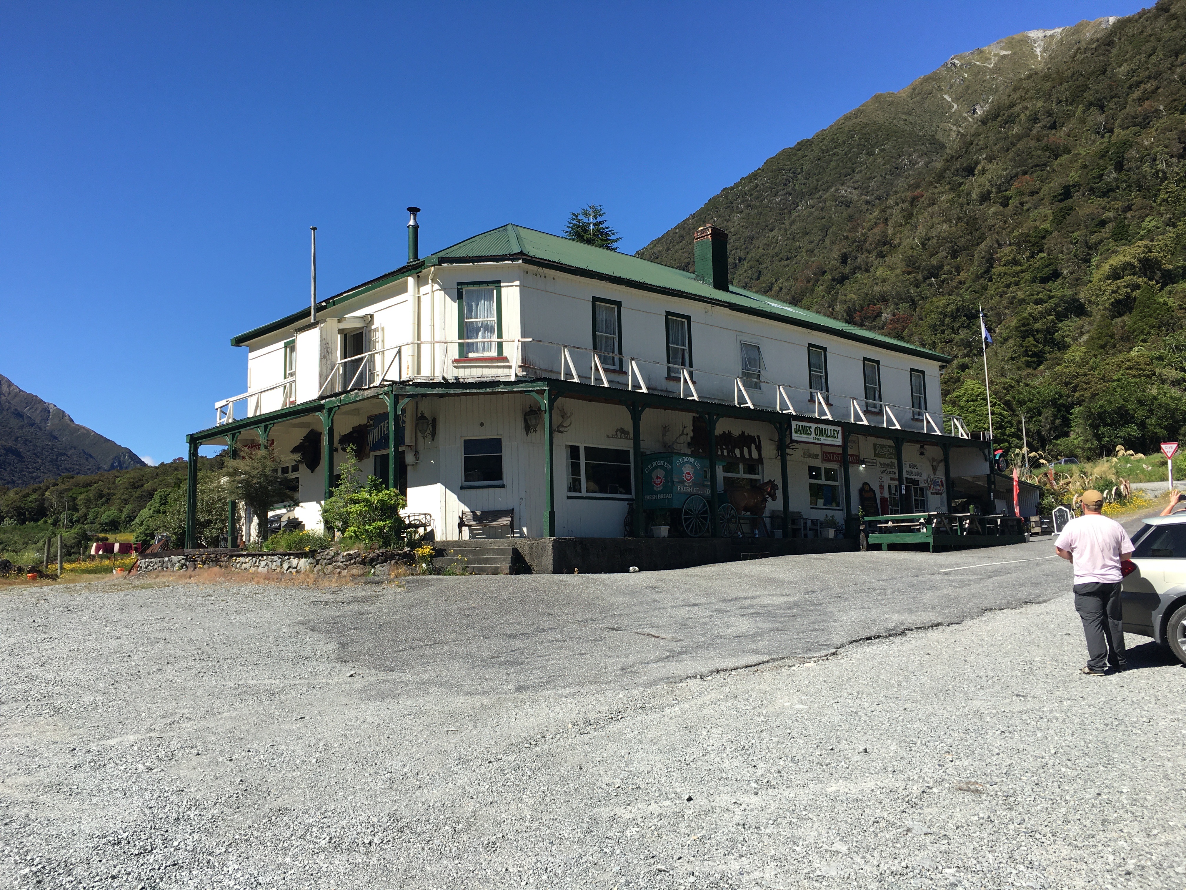
Day one began with dropping a car at the far end of our hike, near Kelly Creek. There was a bit of faffing around to charge the electric car (with the charger in Arthur’s Pass out of order, and the one in Otira busy), but it gave us an excuse to have a coffee at the Otira Hotel, which is an experience of its own.
Then we drove back to the Waimakariri River, parked car number two at Klondyke Corner, and hiked up the Waimakariri to Carrington Hut.
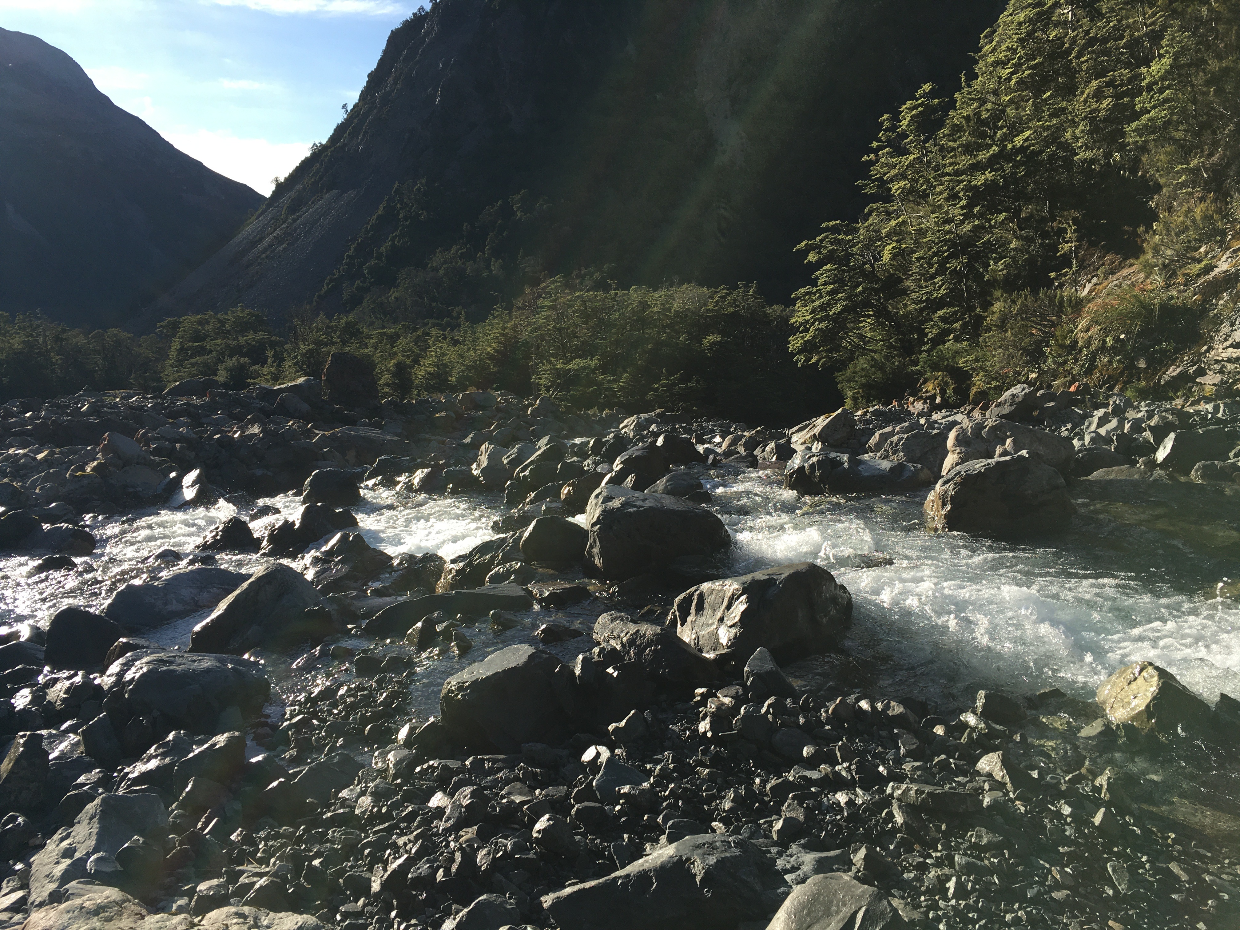
This hike is a bit of a slog and involves crossing the river a couple of times. In fact, the first river crossing comes within the first five minutes of hiking, which was fine—we were going to spend four and a half days walking rivers. There was no way we were going to have dry feet.
In spite of the dull nature of the actual hiking up to Carrington Hut, the scenery is fabulous, and only improves as you go further up the watershed. We were lucky to have a tern hunting the river alongside of us for a while, and we scared up a pair of banded dotterels, too.
After passing Anti Crow Hut, we left the riverbed to follow a track over a couple of roche moutonnée—rocky mounds left behind by glaciation. A series of tarns on the mounds give them a magical sort of quality, and the short break from river walking is nice.
The last time we were at Carrington Hut, it was incredibly crowded and unpleasant, so we carried a tent this time, just in case. But the 36-bunk hut housed only five of us that night, and we barely saw one another.
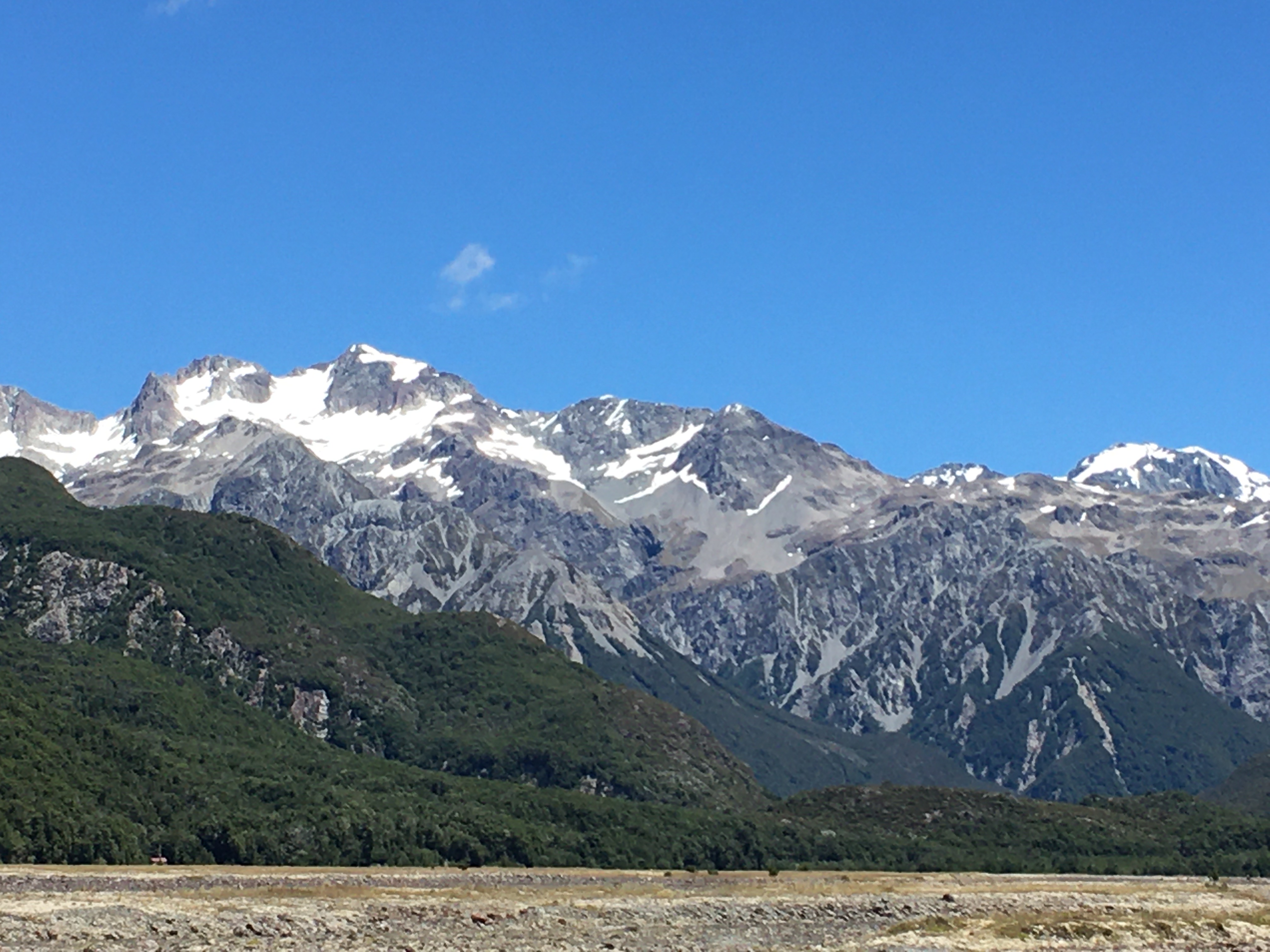
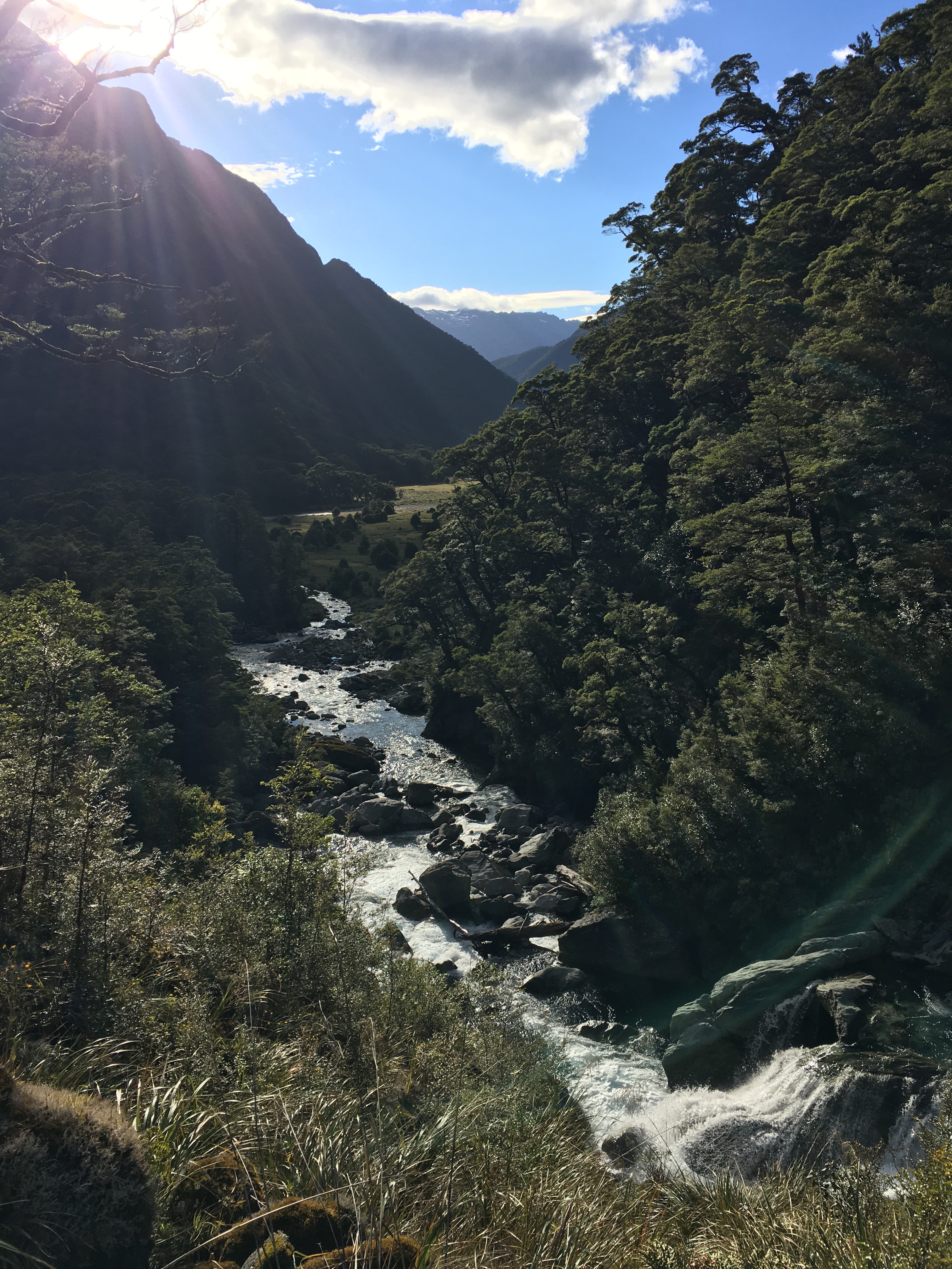
Day 2, we hiked over Harman Pass—up the Taipoiti River (click here for a video), then down Mary Creek. Again, the first act of the day was crossing a river, and then it was river crossings all day, back and forth across the Taipoiti as it rushed through a narrow valley which at times could be more properly called a gorge. It was another fabulous day, weather-wise, and the scenery was spectacular. So were the alpine plants. It seemed like EVERYTHING was in flower, and it was a slow hike up to the pass, because we were photographing all the way.
At the pass, we took a little jaunt up to see some tarns higher up, and then hung out for a while with a curious kea (click here for a video). Kea are an odd mix of highly endangered (there are 1,000-5,000 of them left), and incredibly pesky, thanks to their intelligence, curiosity and a beak shaped like a giant can opener (their peskiness is unfortunately part of the reason they’re endangered). The world’s only alpine parrot, it’s common to encounter them at elevation near Arthur’s Pass, but it never gets old.
Mary Creek was more of the same—river crossings, beautiful scenery, endangered birds. We spent some time watching a pair of whio (blue ducks) having a nap on a rock in the middle of the stream. There are only 3000 whio left and unfortunately the population is skewed strongly to males, because females are vulnerable to introduced predators when sitting on the nest. We were lucky enough to encounter two pairs on our trip.
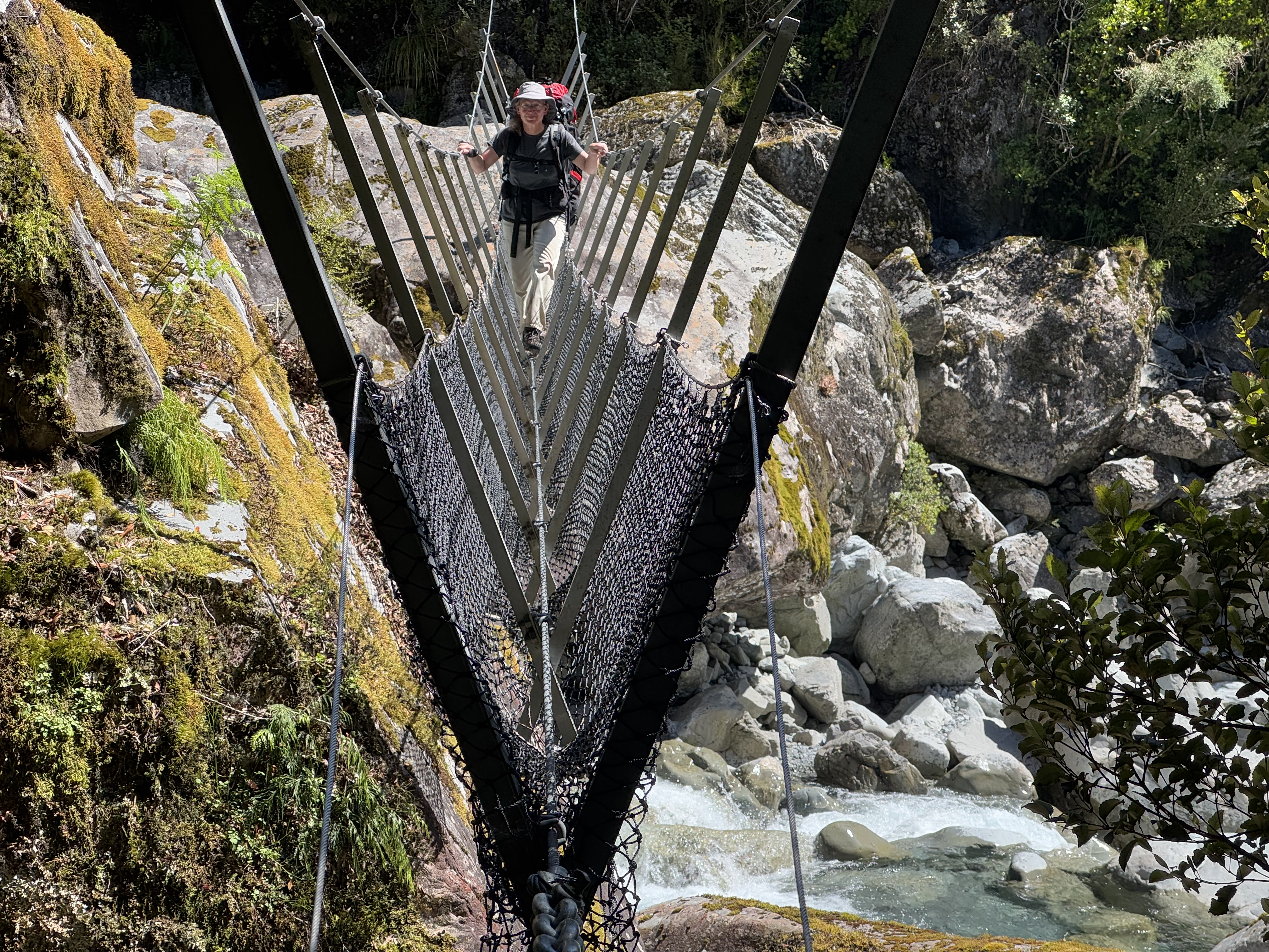
After a 3-wire bridge crossing at the bottom of Mary Creek, we arrived at Julia Hut. The hut is relatively small, and with another couple there already, we decided to tent. After setting up the tent and settling in, we had the rest of the sunny afternoon to explore. A natural hot spring was our destination. Only five minutes walk from the hut, next to the icy, swiftly flowing Julia Creek (click here for a video), the hot pool did not disappoint. It was initially too hot to sit in, and we had to redirect some river water into it to temper the heat.
After a sweaty hike, I have to say I wasn’t all that interested in sitting in a hot pool, but I took a dunk in the river first, and then the hot pool was pretty nice. You couldn’t fault the setting—two days hike from a road, on an absolutely stunning mountain stream in the bush. It beat Hanmer Springs by a mile!
There is clearly a lot of geothermal activity in the area—the smell of sulphur was prevalent all along Julia Creek—and I suspect if you fossicked around, you’d find more hot pools.
Day 3 was a lot of river walking (again), punctuated by a couple more three-wire bridges. We hiked down Julia Creek and the Taipo River to Dillon Hut. Well, we intended to stay at Dillon Hut, but when we arrived we were informed by a very cute four-year-old that there were ‘no more mattresses’ (Dillon hut is only a 2-hour hike from the road, and is clearly a great destination for a short family hike). So we moved on to Dillon Homestead Hut, just 500 metres down the track.
Dillon Homestead Hut is just that—an old homestead. Built of hand-hewn timber and clad in whatever the original owners could scrounge, it is quite the historical experience to spend the night there. It’s clearly beloved by local four-wheel drivers and dirt bikers, but is in sore need of some upkeep. Still, it was shelter when the skies opened up and dumped rain all night, and if it had been cold, there was a big open fireplace surrounded by three tatty, 1950s-era armchairs. And once you brushed the rat droppings off the sleeping platforms, tables and chairs, it had everything you needed to spend the night.
Fortunately the rats weren’t as active inside the hut as I had feared, and we spent a reasonably comfortable night (if a bit smelly) in the hut. In the morning, however, I trudged out to the long drop through soaking wet, waist-high grass. The loo is as old as the hut, and was stocked with three mouldy, rat-poo-festooned rolls of toilet paper. I didn’t stop to investigate the myriad spider webs (there may have been some interesting native spiders), but in retrospect I should have inspected my surroundings a bit more. Leaving the door open for light and ventilation, I dropped my pants to do my business.
A scuttling overhead was all the warning I got before a rat leapt out of the rafters and landed on my head. I may have sworn. But the four-letter word had barely left my lips before the rat was off again, leaping for the toilet seat and then the floor before racing off into the bush.
So, a warning to you—the Dillon Homestead Hut loo is guarded by an attack rat.
After that exciting start, the rest of Day four was a hard climb. From Dillon Homestead Hut, we followed Seven Mile Creek briefly to a track that climbs steeply through dense west coast forest up to the Kelly Range. It was dark and humid in the forest. At one point, the track passed through a narrow gorge that was almost tunnel-like. It felt like we were crawling uphill, and often it was literally true, as it took both hands and feet. Pīwakawaka kept flitting around us, taunting us with their darting flight and chittering voices—what was so difficult about this slope, they seemed to ask.
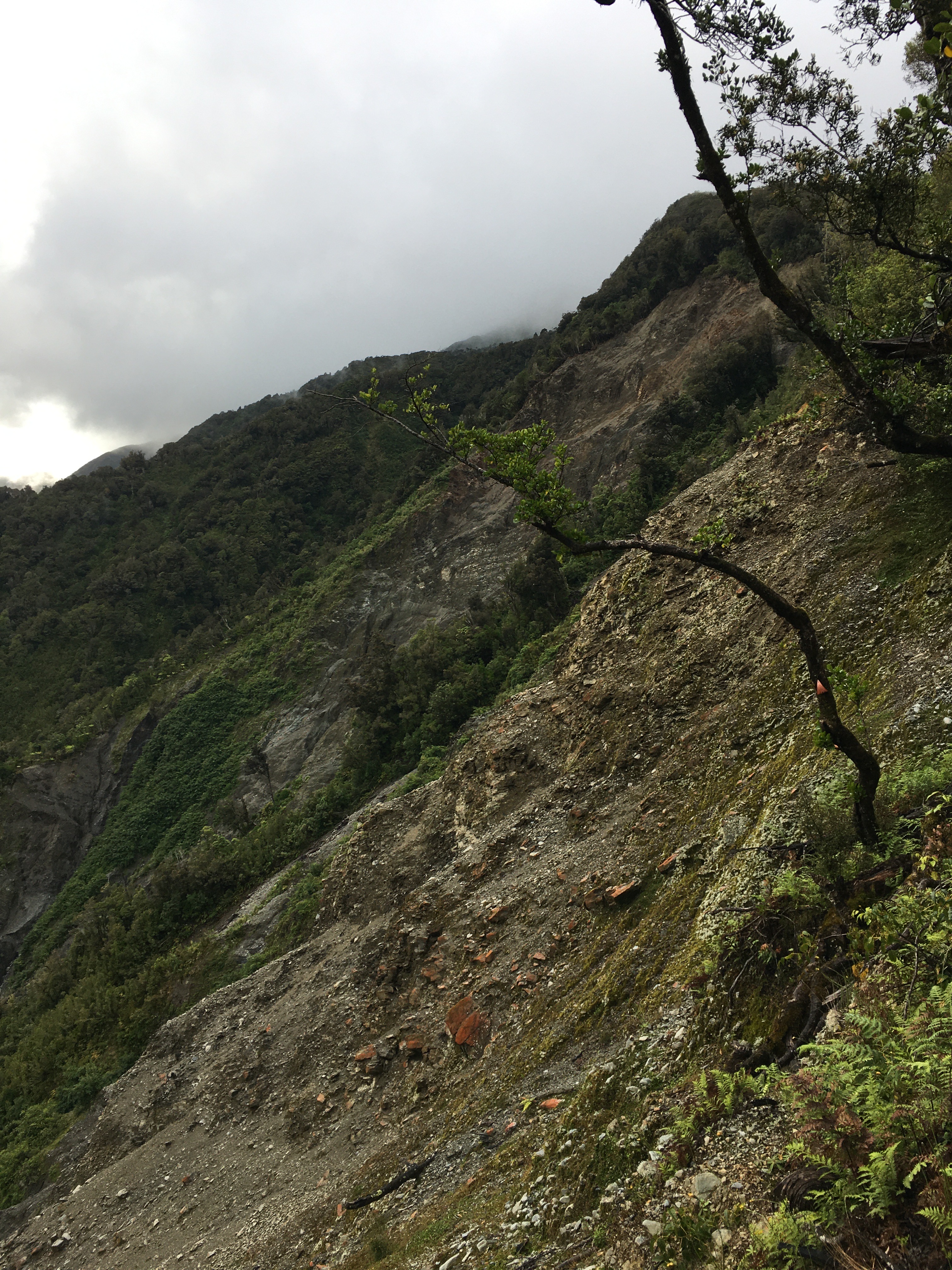
At one point, the track met a huge slip hundreds of metres across and hundreds of metres tall. A blaze remained on a lone tree suspended at the top of the slip. The rerouted track scrambled precariously around the top of the slip, and I breathed easier once we were past it.
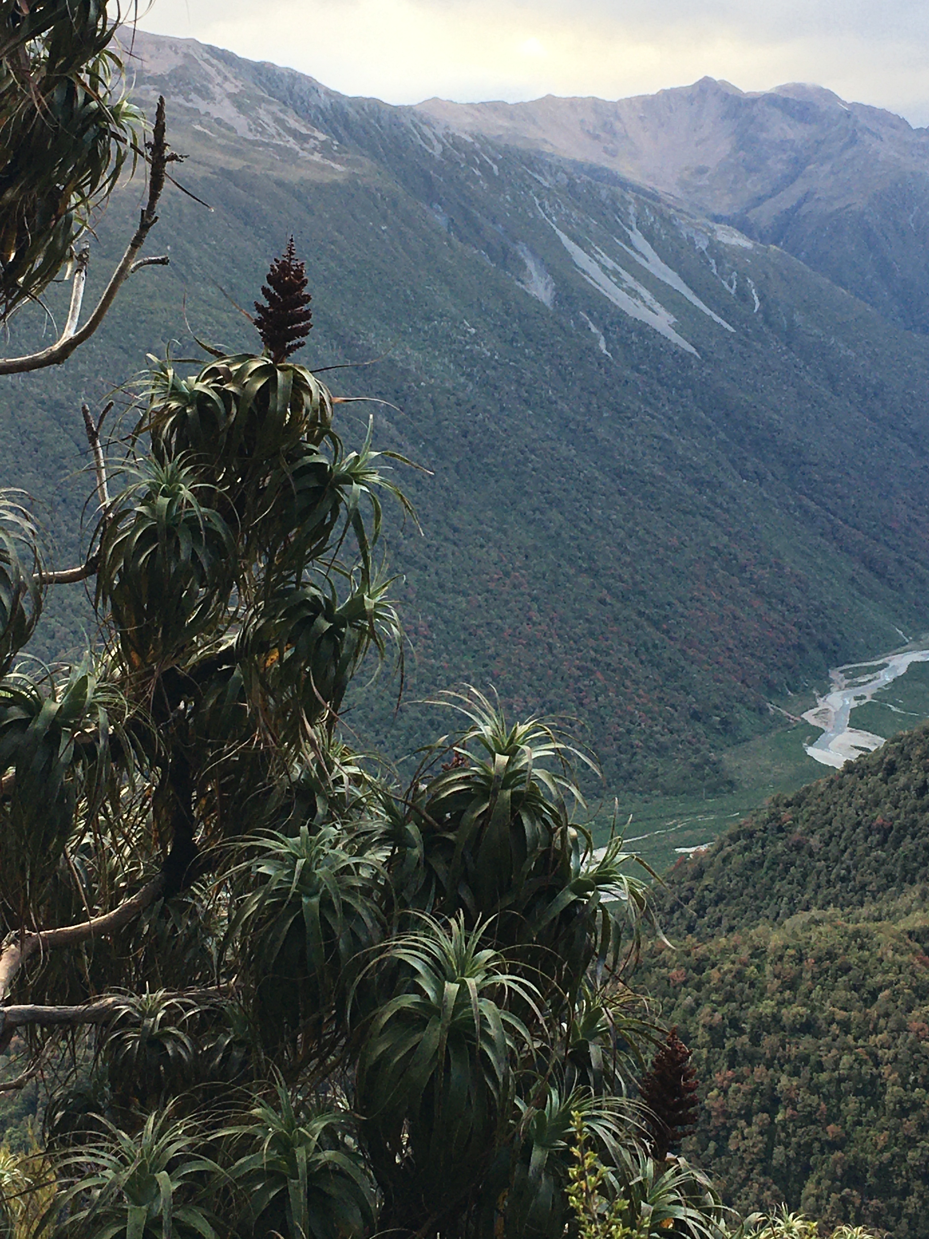
After 700 metres of elevation gain, we reached tree line and got a view back down to where we’d come from that morning—it was a long way down, and we still had more climbing to do.
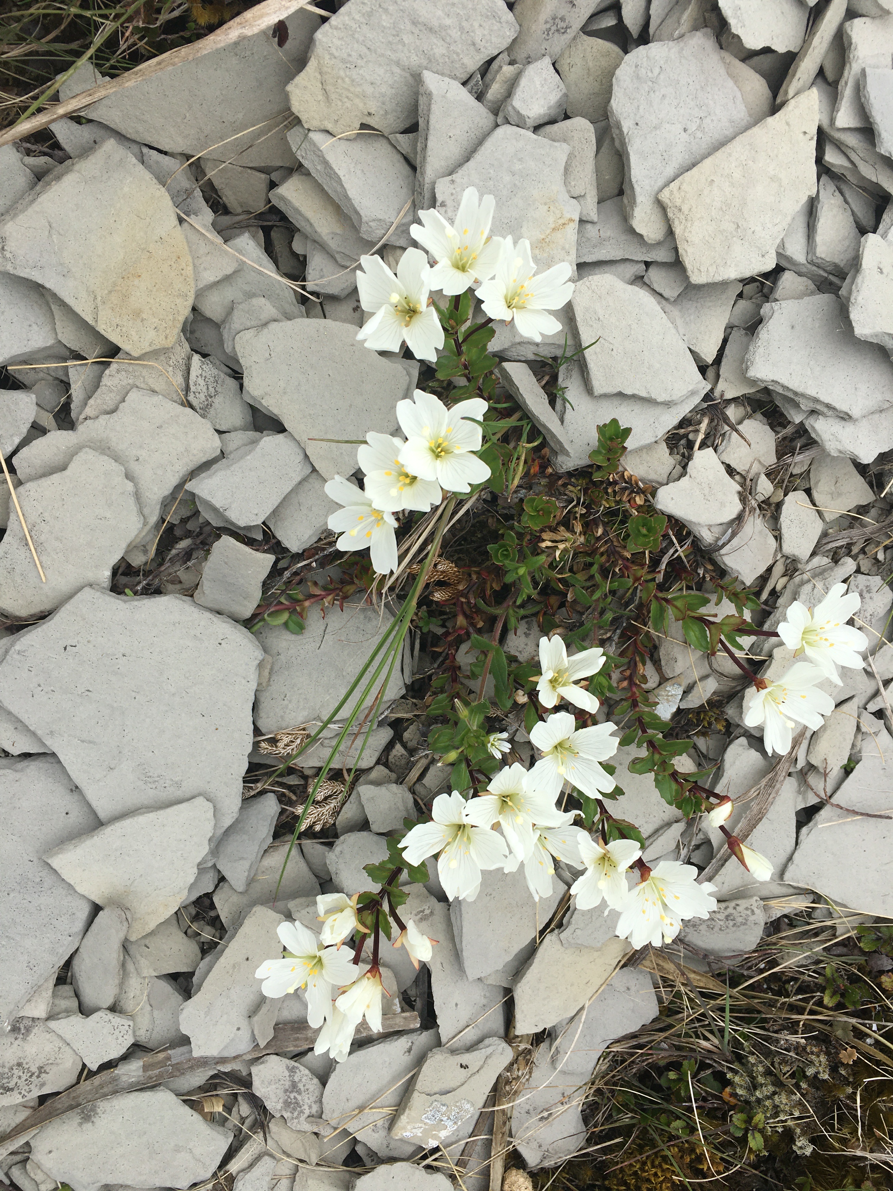
The tops were dotted with tarns, and even where there wasn’t standing water, it was wet. We walked through fields of sundew plants, and took our breaks amid alpine orchids and daisies.
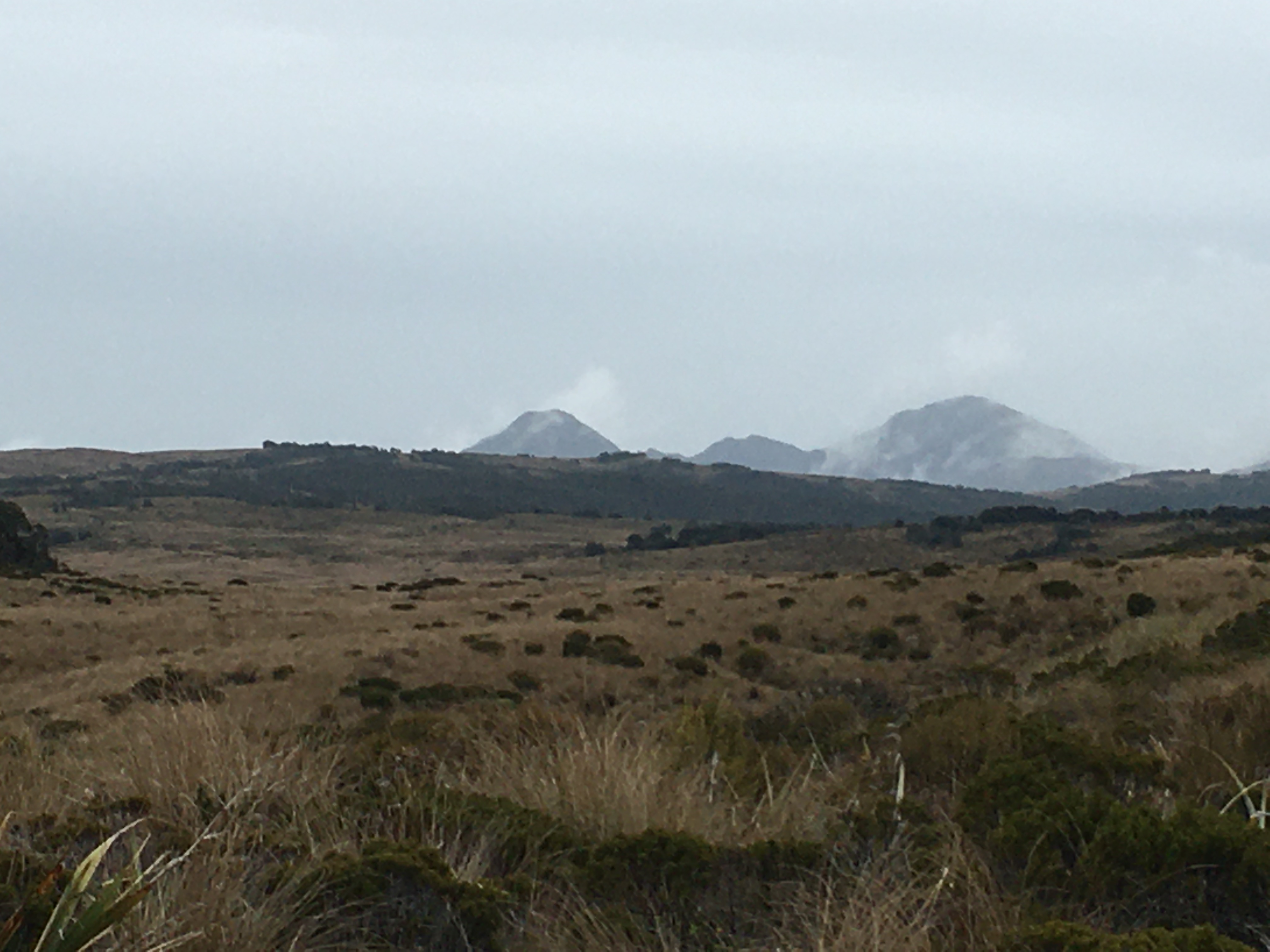
Clouds prevented us from having great views, but turned the views we did have into a dramatic, ever-changing landscape. By the time we’d reached the top of our climb—a thousand metres above Dillon Homestead Hut—the clouds were swirling around us.
A relatively short descent brought us to Caroll Hut just as the first raindrops began to fall. We had a late lunch of soup and peanut butter crackers as the wind picked up and the rain lashed the hut.
We shared Caroll Hut with a UK expat who lives in Wellington, a pair from Whanganui, and a fellow from Adelaide. It was a great mix, and we had a nice afternoon and evening chatting with them all. The best of hut life.
All night the wind howled, and I was thankful for the steel cables tethering the hut in place. Although the rain ended before dark, the wind continued through to morning, so it was a cold and windy start to Day 5. An early morning treat at the hut was a family of weka with fluffy chicks fossicking around the hut.
Day 5 was a short (hour and a half) jaunt out to the road from Caroll Hut. The ‘jaunt’ involved a good 800 metre elevation change, steeply downhill, but not bad going, with some nice views from time to time. And just when we thought we were done with wet boots, there was a stream crossing in the last 20 metres.
We were home by lunchtime, wet and tired, but having had an excellent five days. It was a fabulous way to spend the Christmas-New Year gap.
The family’s pre-Christmas tramping trip this year was to the Thousand Acre Plateau in Kahurangi National Park.
Last time we were in Kahurangi National Park was to hike the Kepler, our pre-Christmas tramp a few years ago. On that trip, it poured relentlessly, and we hiked with few breaks, for fear of hypothermia.
This trip was exactly the opposite. With sunshine and temperatures reaching 29℃ (84℉), we took lots of breaks, for fear of heat stroke.
The Needle
Our original plan had been to hike an hour to the Lake Matiri Hut on day one. After a leisurely start and five hours driving, it seemed reasonable not to plan too much hiking. But when we reached the first hut, none of us was ready to stop—we’d only just begun, after all.
The DOC time to Poor Pete’s Hut, on the plateau, was listed as 3 hours. It was only four o’clock, and it was the summer solstice—there was plenty of time to push on to Poor Pete’s.
Unfortunately it was straight up to Poor Pete’s, and the temperature remained stubbornly high. By the time we finally crested onto the plateau I was questioning our decision to push on in the heat. But the plateau was painted gold by the evening sun, and our first glimpse of the remarkable limestone landscape was truly spectacular. We reached Poor Pete’s Hut at 8 pm, enjoying the final 20 minutes of flat-ish hiking as the sun set.
Poor Pete’s Hut is a sweet little 2-bunk hut. Unlike last year’s two-bunk huts that our family of four crammed into, Poor Pete’s has a spacious covered porch area that was brilliant for sleeping, so we snoozed in style as the noisy weka and ruru did their best to keep us up all night. And I can’t discuss Poor Pete’s Hut without mentioning the long drop, which isn’t the standard modern DOC vault toilet. Rather it is an old-style wooden box set atop one of the many deep crevices in the Thousand Acre Plateau landscape. And to make a trip to the loo exciting, the path down to the facilities crosses the crevice in an awkward fashion. I nearly slipped in my first time. Classic.
On day two, we hiked across the rolling landscape of the Thousand Acre Plateau to Larrikin Creek Hut. Compared to the first day, it was an easy stroll, but I can imagine in wetter weather it could be an absolute nightmare. The plateau is mostly wetland, with lots of tarns and wet, mossy and muddy ground. Entries in the hut book at Larrikin Creek Hut mentioned ending up waist deep in some of the boggy holes. We managed it with mostly dry feet.
The Hundred Acre Plateau, as seen from the top of The Needle
It was only 9.30 am when we reached Larrikin Creek Hut, nestled at the edge of the forest near the base of The Haystack, a gravelly limestone ridge that kept shedding rock, even in the still and sunny weather. We had a brief rest, dropped most of our gear, and headed up to the top of The Needle, which looks like a child’s drawing of a mountain. There is no official, marked route to the top of The Needle, and it’s a bit of a scramble up Spaniard-infested scrub to get there. I decided there is no good way up, only less bad ways. But the view from the top is fabulous.
The limestone of the plateau is fractured and crumbling, and with landslides clattering down The Haystack, it wasn’t hard to imagine how the entire plateau will eventually tumble into the valleys below.
Evening at Larrikin Creek Hut was filled with birdlife—a cheeky weka kept us vigilant as it eyed up our boots and snacks. A kea called from somewhere on The Haystack, but thankfully didn’t descend to plunder our gear. Weka, bellbirds, and tūī kept up a cacophony until dark, when the ruru joined the weka (do those birds ever sleep?) for the night shift.
On Day three, we took an early morning jaunt down Larrikin Creek to the point where it plunges off the plateau. There were a couple of lovely pools near the edge, which would be fabulous swimming spots on a hot day (day three dawned coolish and drizzly, so no swimming for us, though we did all take a dip the day before in some shallower pools upstream). Walking across water-smoothed slabs of limestone in the creek bed, we saw lots of fossils and some interesting aquatic invertebrates.
After our stream scramble, we hefted our packs and began the return journey. Lunch at Poor Pete’s Hut in the rain was a real treat—that covered porch working its magic again. The descent off the plateau was not quite as bad as the ascent had been, but the earlier rain only served to make the forest hot and humid, so it was almost as sweaty.
The real treat on the descent was a flock of kākā calling in the treetops, keeping pace with us for a while.
We spent the night at the heavily sandfly-infested Matiri Hut, which we shared with a group of three others who were on their way up. The sandflies drove us out early on day four, and we were back at the car by shortly after 7 am. A nice little tramp in a spectacular landscape!
This year’s pre-Christmas tramp took us to the Lewis Pass area for four days of forests, mountains, and lots of water.
Day 1 was up the Nina Valley Track through beautiful beech forest. We bypassed Nina Hut, planning to camp below Devil’s Den Bivvy. Unfortunately, recent rain had rendered the area below Devil’s Den Biv into a swamp. There was no place to pitch a tent, so we carried on to the biv. Then we had to figure out how to bunk four people in a two-person hut. With three in the biv and one in a tent blocking access to the loo, we managed. It was … cosy.
Day 2, we left the biv in dense fog, hiking down to the Doubtful River on a track that has clearly seen no maintenance for a decade. At times it felt like bush bashing, and there was lots of windfall to clamber over, under and around.
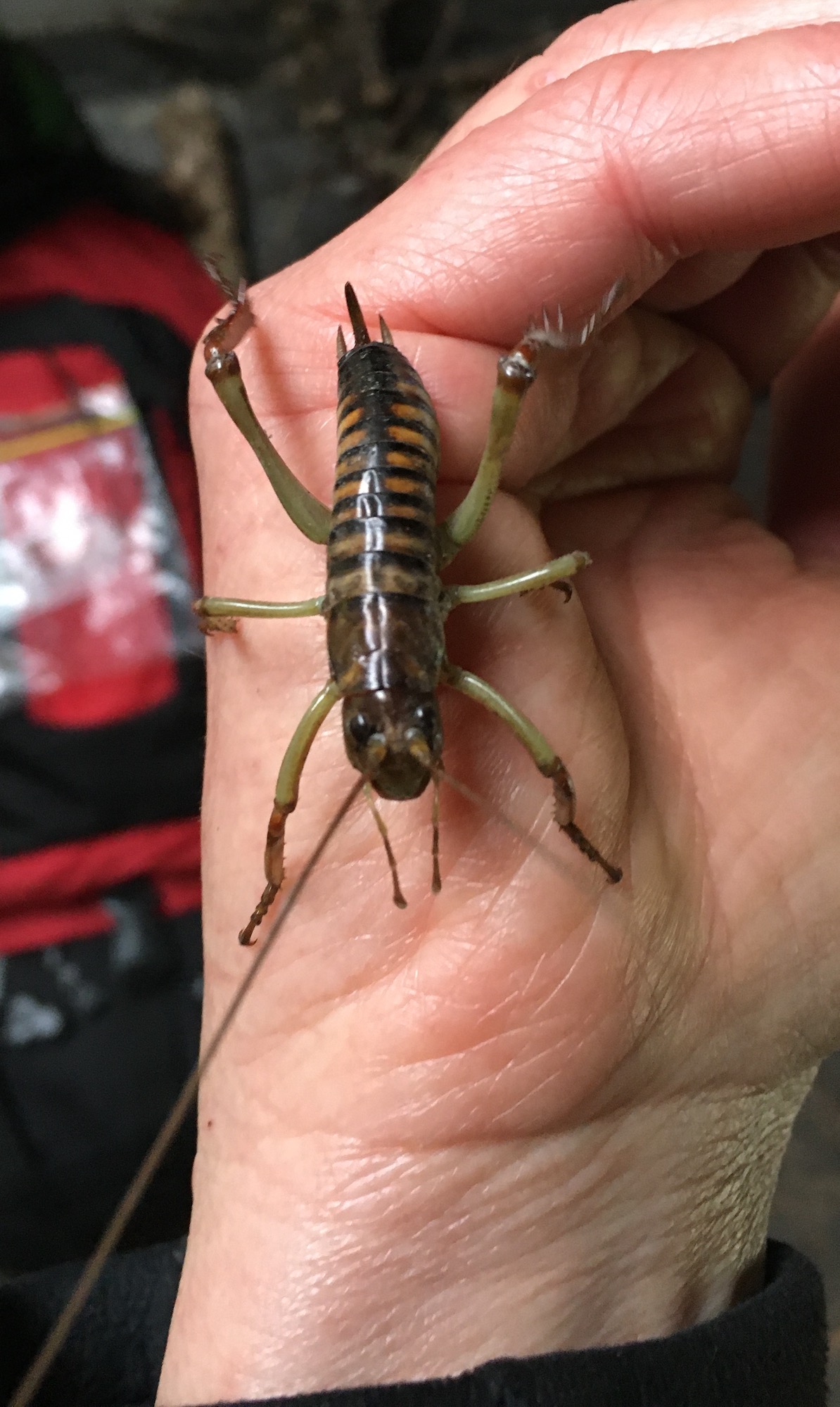
Once at the Doubtful River, a cruisy 40-minute hike took us up to the confluence with the Doubtless River, and shortly thereafter, to the Doubtless Hut, where we had a spacious six bunks to ourselves. Well, almost to ourselves. As we were packing up to leave, we found a beautiful young female Wellington tree wētā in the hut.
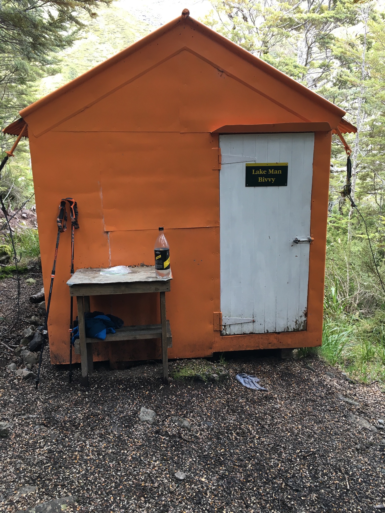
On day 3 we climbed up to Lake Man Biv—another 2-person hut, thankfully with a little more camping space nearby. Lake Man Biv is hobbit-sized. The door is about three-quarters height, and the bunks were so short, even 160-centimetre (5-foot, two-inch) me couldn’t stretch out on them. But in spite of its size, the biv is perfectly appointed, with a small table for cooking (complete with a drawer full of cooking and cleaning supplies) a set of tiny shelves, a fold-down bench, and an empty ammo box for additional seating and mouse-proof storage. Cords along the ceiling provide clothes drying space, and there are even clothes pegs fashioned from beech tree branches. The overall effect is a tidy, fully-functional space, in spite of its size.
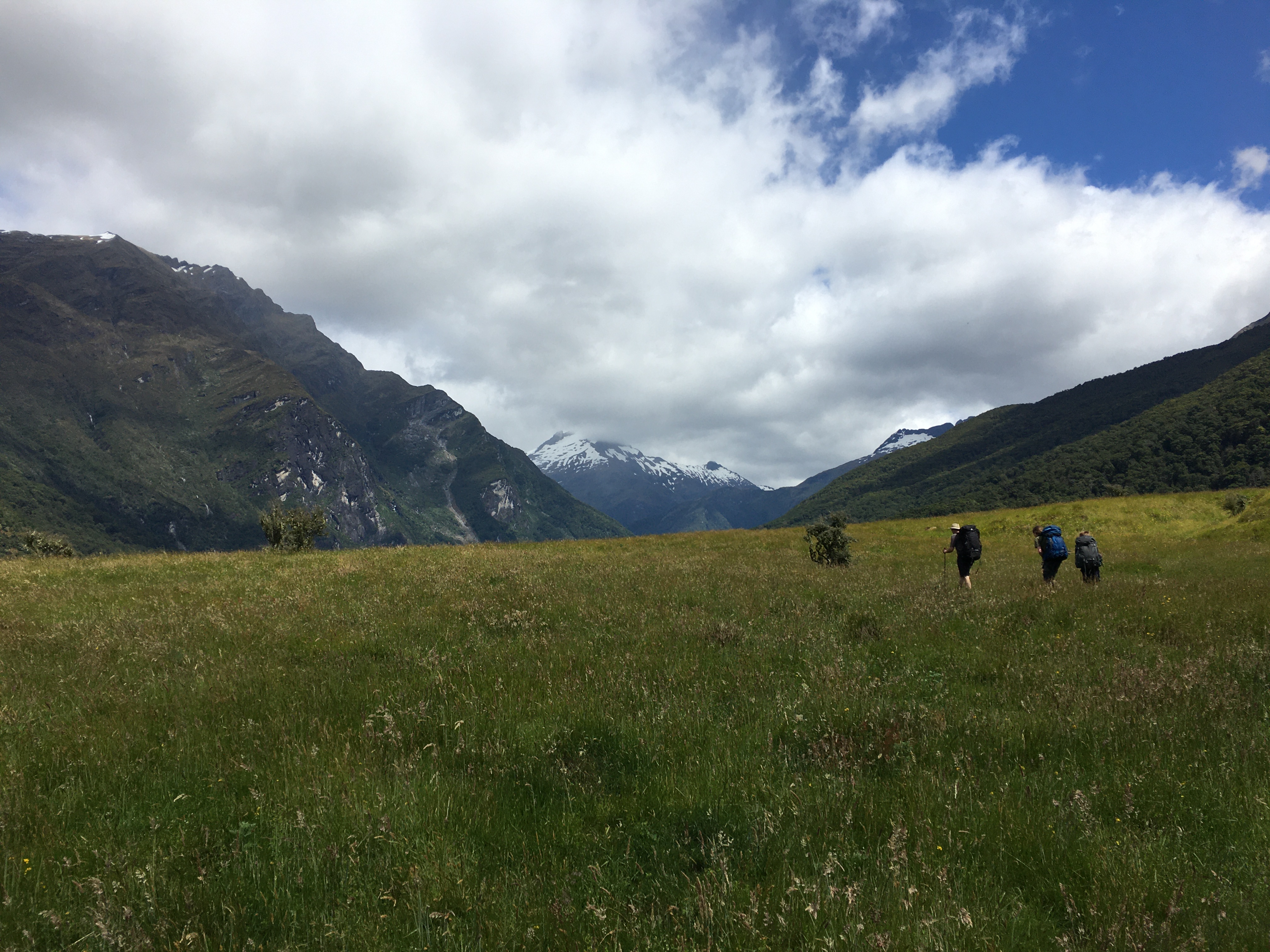
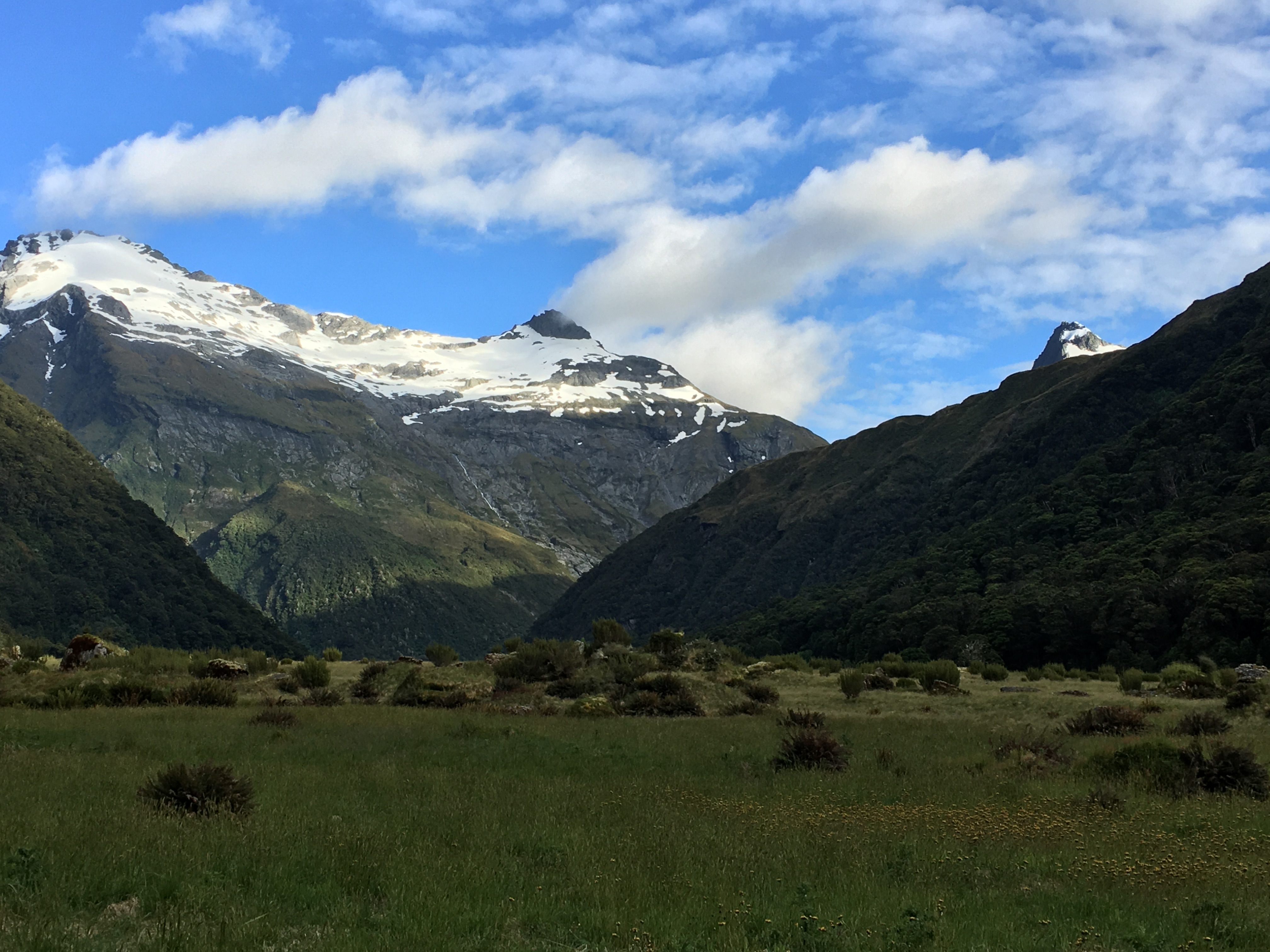
After dropping our gear at Lake Man Biv, we hiked up to Lake Man, an alpine lake where we found our summer solstice snow and had a lovely lunch in the sun, surrounded by awesome alpine vegetation and some cool bugs.
After a cosy night in Lake Man Biv, we hiked out via the Doubtful River. The hike ended with a couple of crossings of the thigh-deep Boyle River and a long river-valley slog—easy hiking, but not terribly exciting.
The trip wasn’t our most strenuous ever, but after having spent the better part of the last six weeks sick, first with Covid, then with a nasty, lingering not-Covid, I was seriously out of shape and thankful for the relatively easy hike.
The family’s Christmas tramp this year took us to the Gillespie Circuit Track in Mount Aspiring National Park. The trip was a good adventure, through a dramatic landscape we don’t often hike in.
Day one started with a jet boat from Makarora to the confluence of the Wilkin and Makarora Rivers. It was my first jet boat ride, and I’ll admit my inner teenager was grinning as we slalomed down the river in a noisy, environmentally unsustainable fashion my adult self disapproves of.
From the mouth of the Wilkin River, we hiked upstream. It was decidedly the least interesting four hours of the trip—the area is grazed, so it was primarily a slog through a cow paddock. The track then turned into the forest and climbed steadily up Siberia Stream to Siberia Hut, where we spent two nights.
On day two, we took a day trip to Crucible Lake. The track to the lake is quite steep, but worth every step. The lake sits in a basin behind a massive glacial moraine. The glacier above the lake drops chunks of ice into the water, making it look like an enormous punch bowl. Apparently it’s popular to take a dip in the lake, but we were deterred by the ice and the cool morning air. The scale of the landscape is deceptive, and photos don’t come close to capturing it.
Day 3, Christmas Day, dawned lightly overcast—perfect for the next stage of the hike, over Gillespie Pass. The track climbs steeply over 1000 metres to the pass, first through the forest, and then into alpine scrub and tussock. Mount Awful looms over the pass, and the surrounding landscape is dominated by jagged peaks and glaciers. The taller peaks, including Mount Awful, were shrouded in cloud, but the views were nonetheless spectacular. We even got a slightly white Christmas, hiking through a couple of snow patches near the top of the pass.
If we thought the way up was steep, the way down proved us wrong—it was even steeper, dropping down a precipitous ridge to the top of the Young River. From there, the nearly flat hike to Young Hut afforded plenty of opportunity to admire the rocky ridges above and the many waterfalls cascading down from them.
Day 4 was a long but relatively gentle hike along the Young River to the Makarora River through the forest. Crossing the thigh-deep Makarora River back to the car was a refreshing end to the trip.
Being a Christmas hike, the trip naturally inspired another bad tramping Christmas song. This year’s song is to the tune of Have Yourself a Merry Little Christmas.
Have yourself a merry tramping Christmas. Make the trailside gay. From now on our cars will be so far away.
Here we are as in olden days, Happy tramping days of yore. Faithful friends who are dear to us Sleeping near to us—they snore!
Through the years we all will tramp together If the joints allow, Even when we’re eighty, though I don’t know how. So have yourself a merry tramping Christmas now.
May you all have a lovely holiday filled with your favourite people doing your favourite things!
Wilkin River ValleySiberia Valley, looking toward Mount AwfulOne of many alpine daisies bloomingPanorama of Crucible LakeCamouflaged spiderMount Awful and Gillespie StreamGillespie Pass with people for scaleReindeer mascot on snowRanuncululsMount Awful from the Young River valleyLooking down the Young River
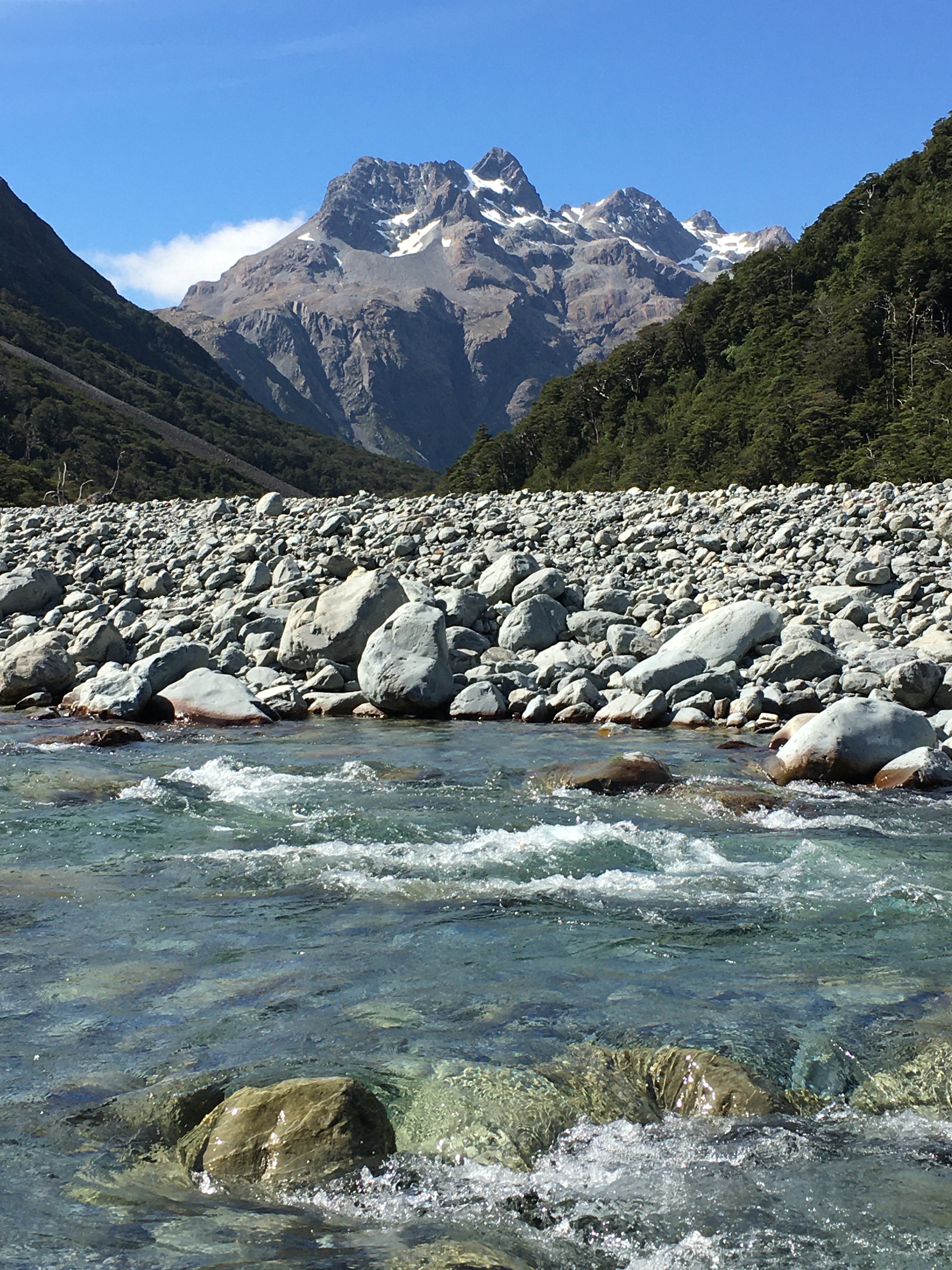
Over the long Waitangi Day weekend, we hiked up the Waimakariri River to Carrington Hut. Using Carrington Hut as a base, we took day walks to Kilmarnock Falls and Waimakariri Falls Hut.
The weather was glorious, and hiking on the riverbed, it was easy to cool off with a quick dip in icy water. The hike to Waimakariri Falls Hut was particularly rewarding: there are two ‘official’ falls on the river, and dozens of smaller streams dropping off the surrounding peaks in spectacular fashion, so you feel as though you’re walking through a watery wonderland.
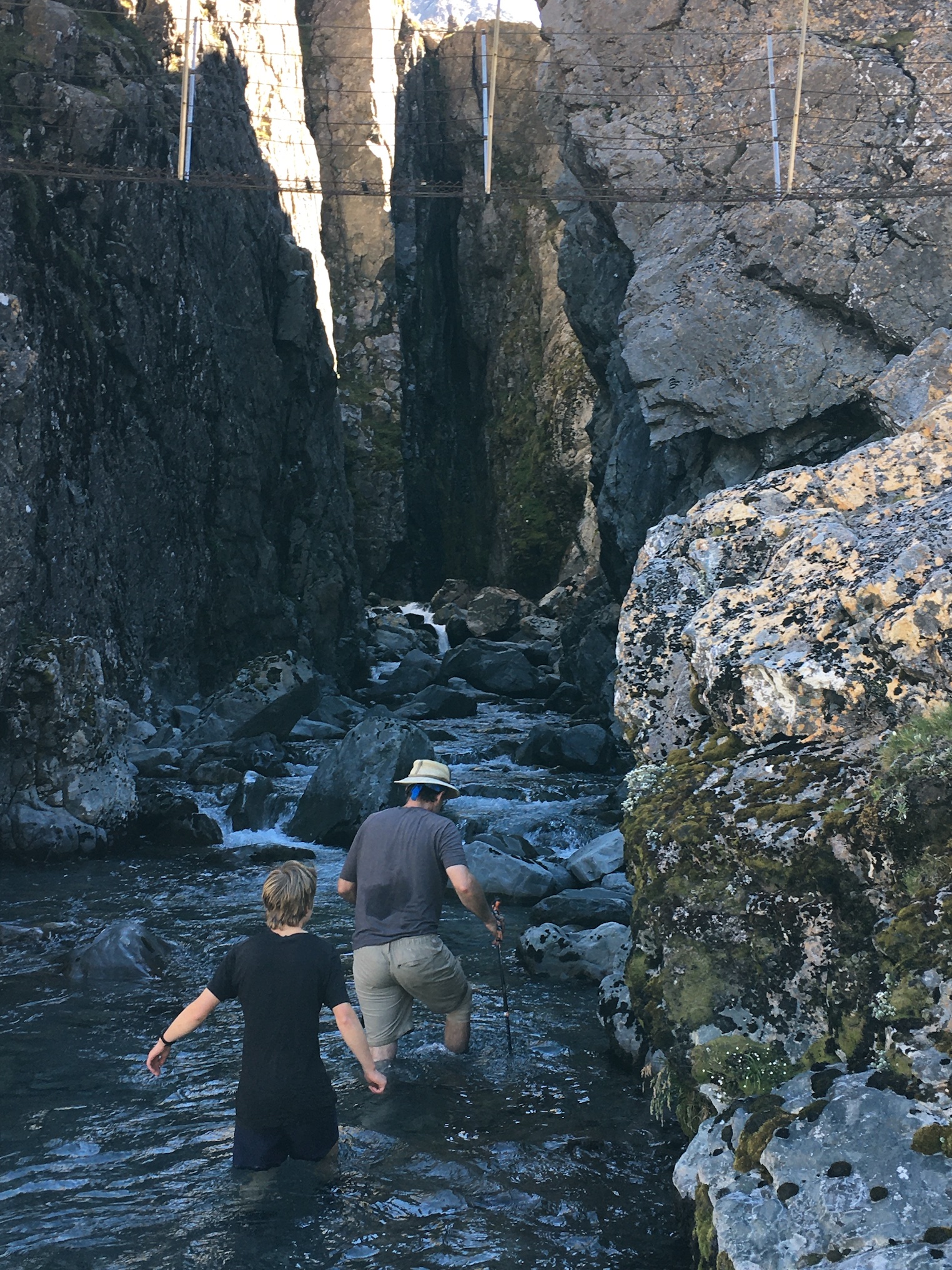
Wading in to see Waimakariri Falls.
The upper falls, just below the hut, are hidden in a deep, narrow fissure in the rock. Waist deep in icy water is the only way to see the water roaring down—great fun, but not something you’d want to do on a cold day.
Above the falls, the river is narrow enough to jump across with dry feet, and flows through a fabulous alpine landscape. We didn’t hike all the way to the snowfield where the river actually begins, but we were close.
The fuzzy flower of a South Island edelweiss
My favourite two things on the hike were the South Island edelweiss (Leucogenes grandiceps), which looks like it was made out of felt by someone named Aunty Flo, and the river water itself. The water was crystal clear, yet colourful (the gorgeous turquoise of glacier-fed rivers) and full of substance. I could have watched it flow over the rocks for hours (come to think, I did watch it flow over the rocks for hours).
Waimakariri Falls Hut. The snowfield visible to the right of the hut is the source of the Waimakariri River.
Least favourite part of the hike was Carrington Hut. It’s a great hut in a stunning location, but last weekend, it felt as though everyone from Christchurch was there. Carrington Hut has 36 bunks, but only 1 toilet and 1 sink. With about 40 people in the hut and another 20 or so tenting nearby, it was way over its capacity. As usual, everyone was considerate and did their best to make it work, but it was still unpleasant.
All in all, a lovely weekend getaway, and an easy hike, as long as you’re comfortable with river crossings.
Our pre-Christmas tramp this year took us to Kahurangi National Park to walk the Heaphy Track. The trip was simultaneously spectacular and miserable.
The Heaphy Track follows the path of a proposed road, and as such is gently graded—it’s a technically easy walk. So easy it’s almost boring. But it passes through some spectacular landscapes teeming with remarkable flora and fauna.
Day 1 began for us at 5.30 am when we awoke in the Collingwood Campground to our tent being blown flat by the wind and rain. We quickly decamped and retreated to a shelter to wait for the rain to let up before starting our hike.
Unfortunately, the rain outlasted our patience, so we started out under a heavy fall that had us soaked within minutes. The steady climb was largely unremarkable. The rain eventually cleared and we reached Perry Saddle Hut under a sunny sky.
Day 2 was more eventful, with two endangered species sightings by 7 am. The first was a takahe browsing the grasses just outside the hut as we finished breakfast. This critically endangered bird, the world’s largest rail, was presumed extinct for 50 years. Its population now numbers just 445.
Minutes down the track, with rain setting in again, we nearly stepped on our second endangered species of the day—a Powelliphanta snail—a fist-sized carnivorous snail. Without the rain, we never would have seen these nocturnal, moisture-loving animals. We counted ourselves lucky.
Under increasing rainfall, we made our soggy way across Gouland Downs and then the weird and wonderful Mackay Downs. We explored caves and admired huge glacial erratics tossed like giant bowling balls over the landscape. Weka (another endemic rail) with chicks in tow scurried around our legs every time we stopped for a break, waiting for us to let down our guard so they could make off with a snack.
We reached Mackay Hut drenched, but the worst of the rain was yet to come. Half an hour later, the sky opened up and the wind rose. The torrent sheeted down, spilling off the hut roof like someone was tossing buckets of water over the edge. It didn’t let up until nearly 4 am the following day.
Again we set out in the rain, this time into a landscape scoured and still gushing water. But again the rain held delights—another giant snail, sundews lining the track, enormous 700-year-old southern rata trees, waterfalls in all directions, sprays of flowering bamboo orchids dripping from tree trunks, a mistletoe with scarlet flowers … That evening—Christmas eve—drying out in Heaphy Hut, we composed a New Zealand tramping ballad as a family:
T’was the night before Christmas, and all ‘round the hut I sure wasn’t stirring; I was sitting on my butt. A cup of tea nestled warm in my hand. I ate lots of scroggin, expanding my waistband. Out on the porch, the weka did play, Hauling our shoes and our stockings away.
When up on the roof there arose such a clatter I limped from my bench to see what was the matter. The sun on the roof of the dunny nearby Made me shade my eyes as I peered up to the sky. And what to my wondering eyes did appear But a trio of cheeky, mischievous kea. With can opener beaks and curious minds The birds tore apart everything they could find. When done on the roof they moved on to our packs Eating their fill of our Christmas Day snacks.
With our stockings all gone and no snacks to eat, We still had a Christmas that couldn’t be beat.
Christmas morning dawned and the last ragged storm clouds blew away, leaving brilliant blue skies and blooming rata trees for our last leg along the coast under dense stands of nikau palms.
We ended with a quick dip in the Kohaihai River (very quick—it was ice water) and the long drive home. A most enjoyable Christmas!
Before Christmas, the family spent five days tramping in Nelson Lakes National Park. We have tried several times to plan a trip to the area around Angelus Hut, but something has always happened to cancel it—once it was bad weather, another time it was a gastrointestinal bug at Angelus Hut that laid 30 hikers low, another time it was the Kaikoura earthquake. But this year, we managed, with only a 24-hour postponement due to the weather.
We rolled in late on day one. With only a two-hour hike to the first hut and pouring rain forecast to clear late in the day, there was no reason to start early. We lucked out, and the last raindrops fell as we were getting out of the car. The climb to Bushline Hut on Paddy’s Track was a bit of a monotonous uphill, but with nice views. If I were doing it again though, I’d give Bushline Hut a miss. The place is overrun by mice—if the noise of them nibbling into everyone’s packs didn’t keep you awake all night, their pattering feet over your bed or down your neck did. It was less than pleasant.
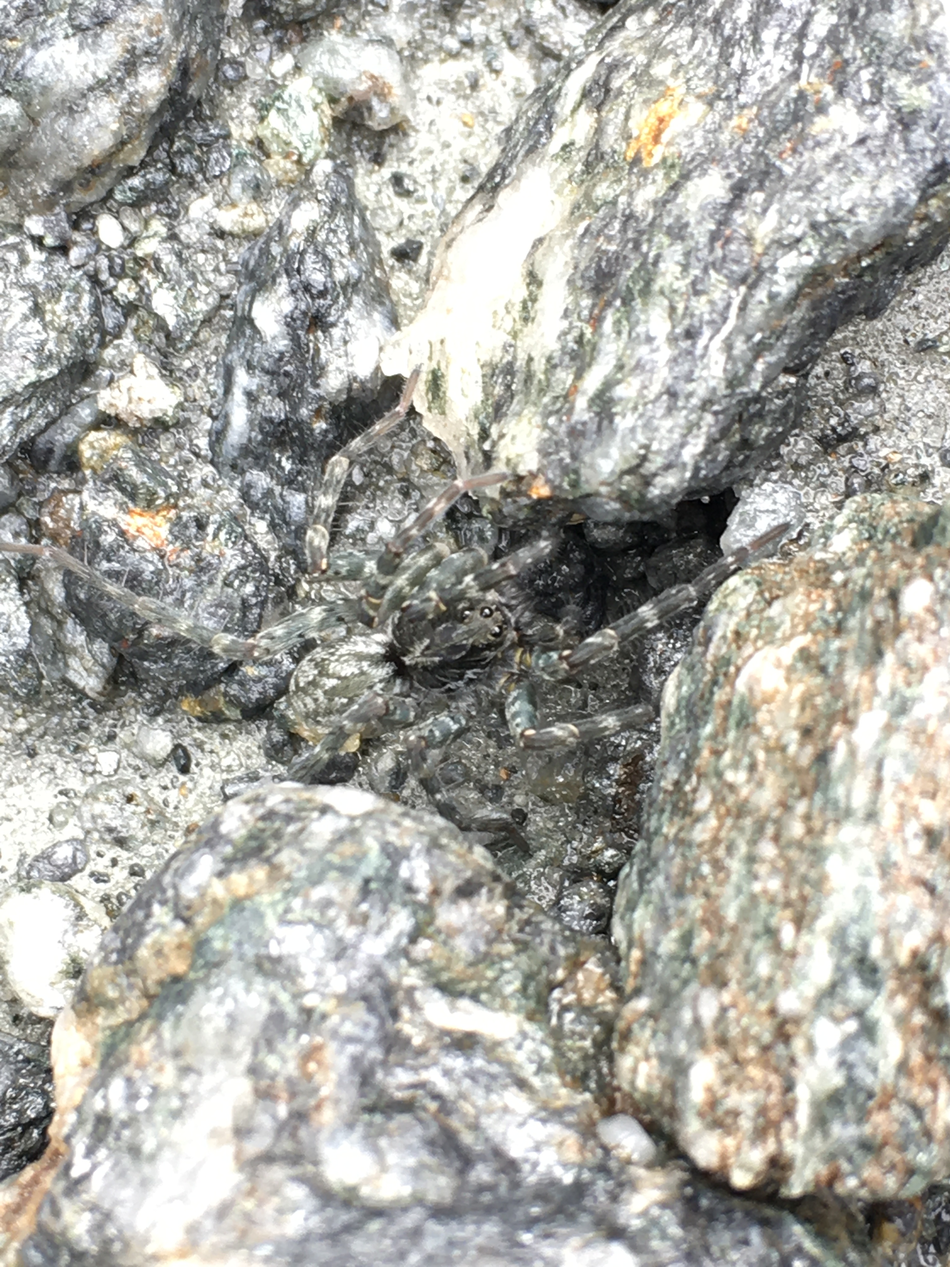
Vegetable sheep (Raoulia spp)
Leaving the mice behind in sparkling sunshine the next morning, we followed Robert Ridge to Angelus Hut. Well above tree line, the ridge is one continuous spectacular view of the mountains and lakes in and around the park. We were prepared for wind and cold (it had snowed on the ridge the day before), but enjoyed sun all day with very little wind. My favourite part of the ridge was the profusion of vegetable sheep—some of the most spectacular specimens I’ve ever seen.
Angelus hut dwarfed by the surrounding landscape.
We made good time and enjoyed lunch overlooking a mountain tarn just a few minutes before reaching Angelus Hut, in its dramatic location at the edge of Lake Rotomaninitua. That left us all afternoon to explore the stunning tarns, streams and rocks around the hut. Rain from the preceding days had left all the tarns and streams overflowing, and the sound of flowing water was a constant—trickling through rocks underfoot or rushing in torrents down the mountainsides.
Mt. Cedric Route
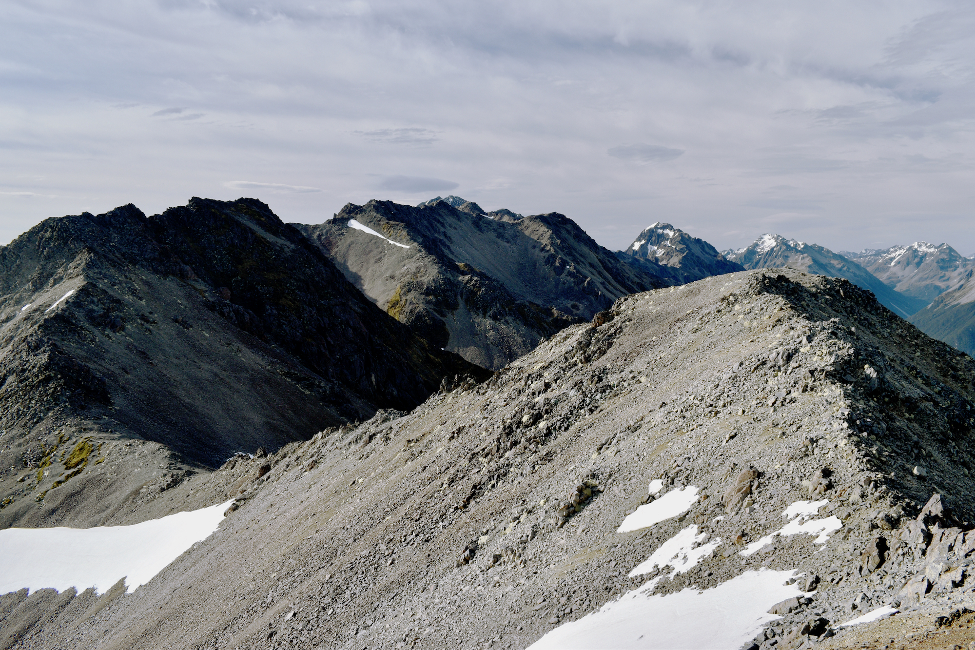
The following day was the hardest and most spectacular, following the Mt. Cedric Route to Sabine Hut. I thought Robert Ridge was spectacular, but the Mt. Cedric Route blew Robert Ridge out of the water! Again, we had fabulous weather and enjoyed the views. The route skirts around an unnamed 1880-metre peak, which we summited—an easy scramble without packs, and well worth it for the views. From that high point, the rest of the track is downhill. Fourteen hundred metres vertically, to be exact, most of which happens in the incredibly steep final 1.5 km. While the ridges and scree slopes of the majority of the route are visually and mentally daunting, they’re relatively easy to traverse. But the drop through the forest, on slick wet leaves, was basically one long ungainly fall.
We were rewarded at the end by Sabine Hut on the shore of Lake Rotoroa. A nice swim in the lake and a gentle walk to the Sabine River made for a relaxing afternoon.
Day four was a long uphill, which was actually welcome after so much downhill the previous day, ending at Speargrass Hut. Unlike the previous two days, the Sabine-Speargrass Track is entirely in the forest. And it is a magical forest—lush and wet, but it gives the impression of perching on nothing but great blocks of rock. The track regularly traverses roots with deep holes between them, and you could hear water gurgling underfoot in many locations.
The most magical spot along this section of track was an open bog not far from Speargrass Hut. A long boardwalk climbs to a platform perched in the bog. Benches provide a nice place to sit and take in the view. Coming out of the forest into a landscape so rich in colour felt like entering a painting—colours just a little too saturated, bog falling away a little too perfectly to reveal distant peaks a little too sharp and dramatic to be quite real.
Day five was a quick, relatively unremarkable jaunt out to the carpark along Speargrass Track, and then a long drive home.
Quite possibly one of the most spectacular pre-Christmas tramps we’ve done. It was definitely worth waiting for.
The hut nestles amidst scrubby sub-alpine vegetation. As you emerge from the trees onto a rocky hillside, you see it across the valley. Dark beech forest laps at the hut on one side, and cliffs rise on the other. A kea calls. A stream rushes far below. You are not the first at the hut—a thin wisp of smoke rises from the chimney. You smile and look forward to warming your hands and drying your socks by the fire.
As each hiker arrives at the hut, they are greeted by those already resident.
“G’day. Did you come of from Sharplin Falls this morning?”
“Going to Woolshed Hut tomorrow, or all the way out?”
“Where are you from?”
“Oh, you’re from Southbridge. My mother lives there. Do you know her?”
“Is this your first visit to New Zealand?”
“Do you do much tramping?”
As afternoon wears on, the hut fills up. Locals, tourists, couples, solo hikers, and families with kids. A dozen or more strangers bunking together, cooking and eating together. There are no cell phones to divide you. You are all present in this place together. You share matches, hot water, chocolate, and reading material. As the evening wears on, a bottle of scotch might be passed around. You talk about your homes, previous travels, and your current aches and injuries. You tell stories. You laugh. You wish each other good night.
In the morning, some carry on downhill while you toil up Others, you know you will see again at the next hut. You bid them all a cheerful farewell, feeling like old friends.
When I first came to New Zealand, I found the idea of backcountry huts a bit odd. I didn’t have to hike with a tent? I’d just bunk with other hikers in a hut provided at just the right spot? I was used to hiking in the US, and for me backpacking (tramping) meant getting away from other people and setting up my tent in a place of complete solitude. I was dubious.
Twelve years and many backcountry huts later, I’m sold on the hut system. Not only is it lovely to not have to carry a tent, I’ve come to enjoy the social aspect of the hut experience.
That’s not to say I enjoy listening to half a dozen strangers snore next to me all night, or that I don’t sometimes wish my hut mates were less talkative, but on the whole, the people I’ve met and the things I’ve learned—about other places, other cultures, and sometimes even about my own neighbours—far outweigh the negatives.
I picked up the food for a backpacking trip today. All I can say is BLECH, and HOLY COW THAT STUFF’S EXPENSIVE! And we don’t go for the “backpacker” food—we just buy the instant meals available in the grocery store.
To buy over-salted, over-sugared, freeze-dried, highly processed food when there is fresh produce pouring out of the garden is physically painful.
I suppose we should plan in advance. As vegetables come into season, we should dry enough for our trips, make up our own highly-processed, over-salted backpacking food. Once upon a time—before children—we did some of that.
But it’s actually a lot of work…to change a delicious vegetable into something we would only consider eating if it were the only option. I just can’t get excited about that.
So, we’ll probably just keep buying those icky instant meals. It’s backpacking, after all—you don’t do it for the food.